Norsk

Storehornet – an area of mountain fissures, route 54c

Vanylven

The trail at a glance

This scenic trail is perfect for those who are looking for some excitement and spectacular views. The excitement part begins with a 150-metre walk along the edge of the mountain and relatively easy mountain climbing up a 6-metre long groove in the rock face. The rest of the hike covers gentle and dry terrain, and you can explore the nature outside of the marked path. This trail is graded red both because there are sections of hiking along the mountain edge and relatively easy climbing and also because this mountain area has fissures and you really need to know where you are going. About a kilometre after the steep climbing, once you have passed the first mountaintop on your way, you will reach a small pond with a brook that flows down into a depression in the ground and then disappears down an underground river. This underground river flows for a minimum of 60 km before coming out into the open air towards the Saurdalen Valley, but it probably follows the fissures further down the mountain. If there had not been any fissures in the mountain, the entire area would have been a lake with the size of 5 football pitches and the maximum depth of 5 metres. We recommend taking a detour from the marked path to a cairn on Storehornet or studying the mountain fissure area that stretches towards Saurdalen.

Route description

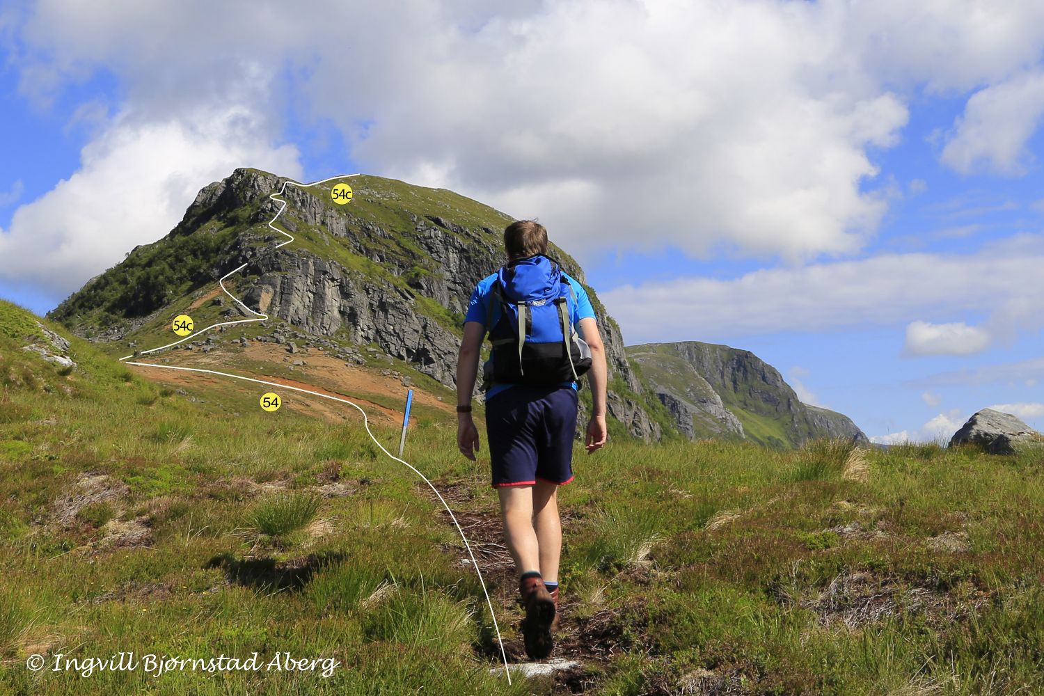
This trail has the same starting point as route 54 from Øverberg via Blåfelden to Syvde: https://mrfylke.no/Morotur/Turar/Blaafelden-Fuglehovudet-OEverberg-rute-54 After 950 metres, route 54 c branches off route 54 in an area of red sand. The intersection of paths is signposted, and both routes are marked with blue paint on stones and blue sticks. The red sand contains olivine with a very high pH value, which is the reason why there is very little vegetation in this sand area. 
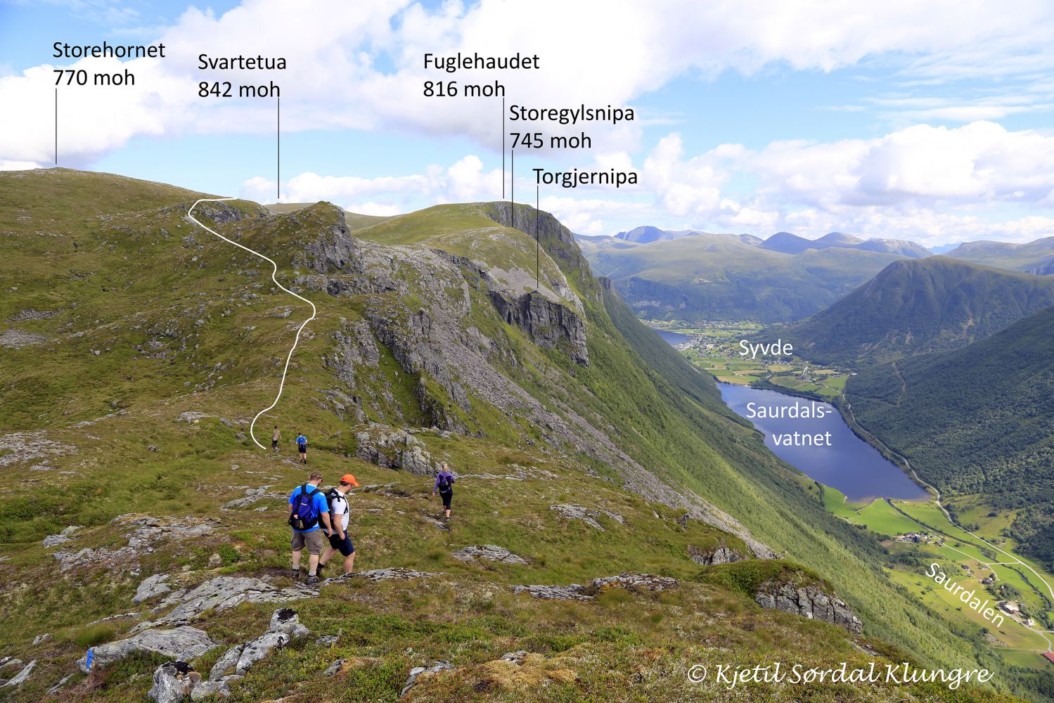
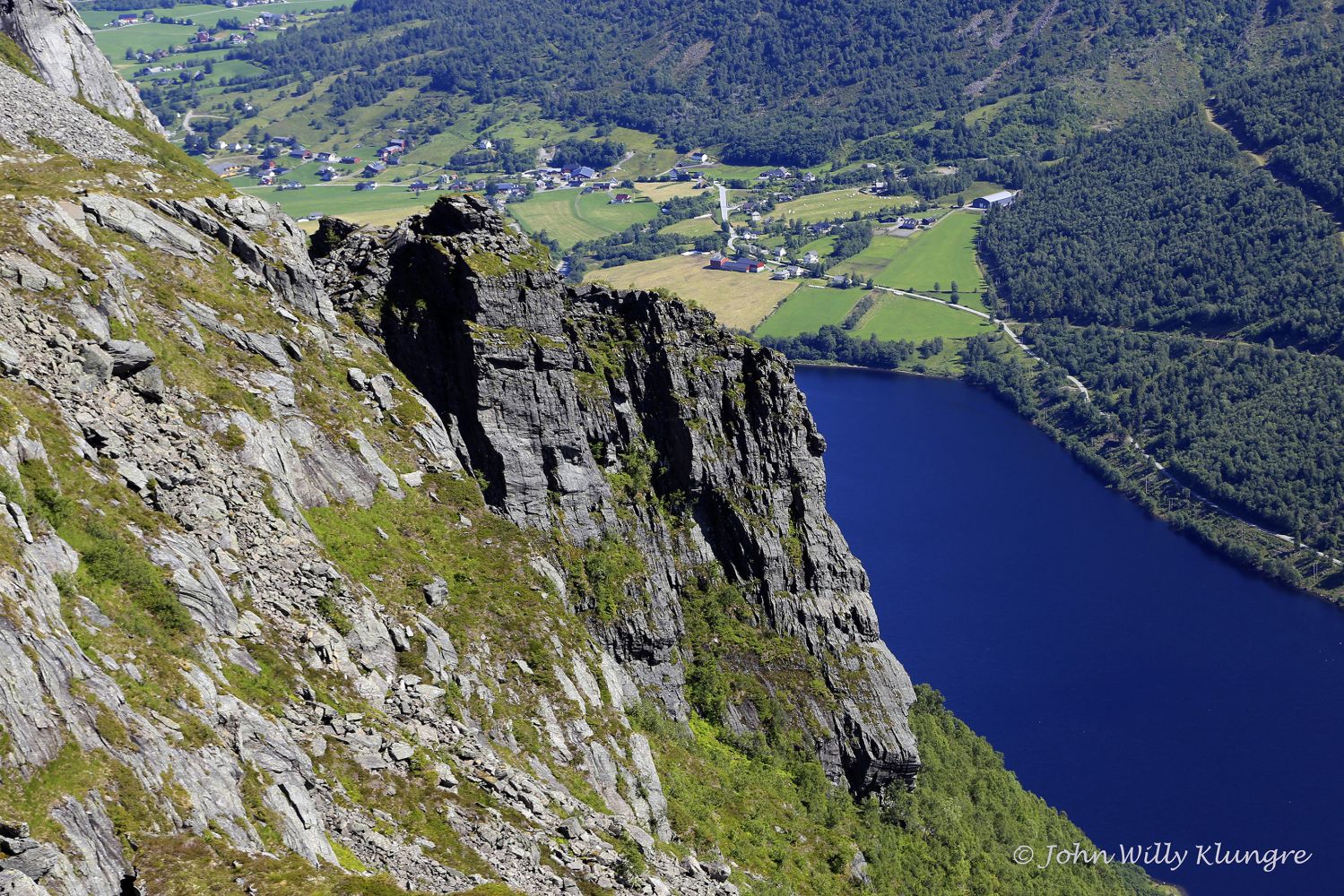
Already 75 metres after the intersection of paths in the first sharp turn of the marked route, pay attention to both the great view over the Saurdalen Valley and a heavily fissured rock face. Such fissures are found in a greater or lesser degree throughout the entire area that stretches past Storehornet. 
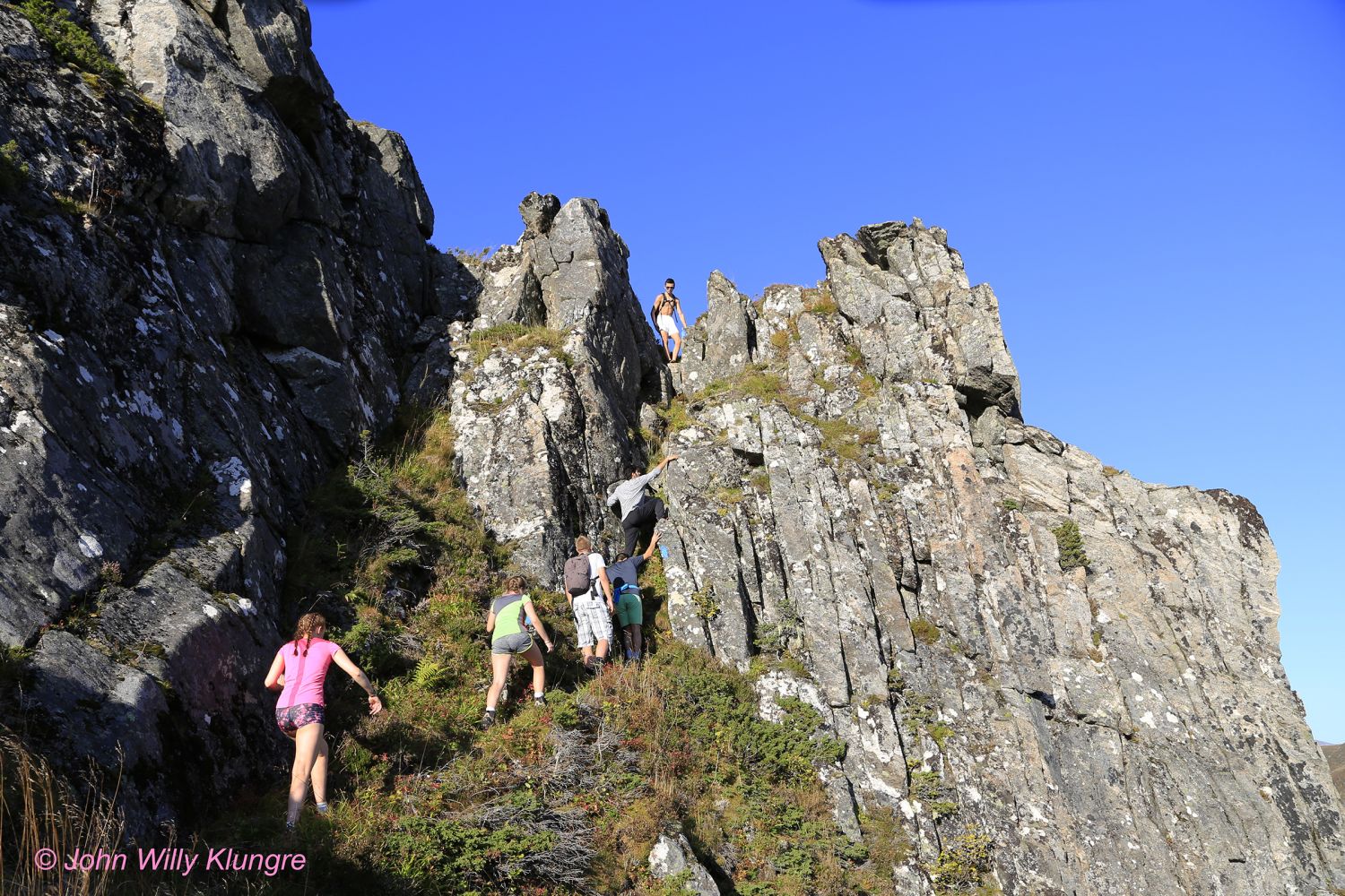
150 metres after this viewing point, you will start walking along the edge of the mountain and then do some relatively easy mountain climbing up a groove. There are 2 grooves in the rock face, and both are suitable for climbing, but only the one to the right is marked. The left groove is believed to be more suitable for people who are relatively small and thin. As you climb the groove on the right, you can do a little manoeuvre to the right to avoid climbing all the way up. 
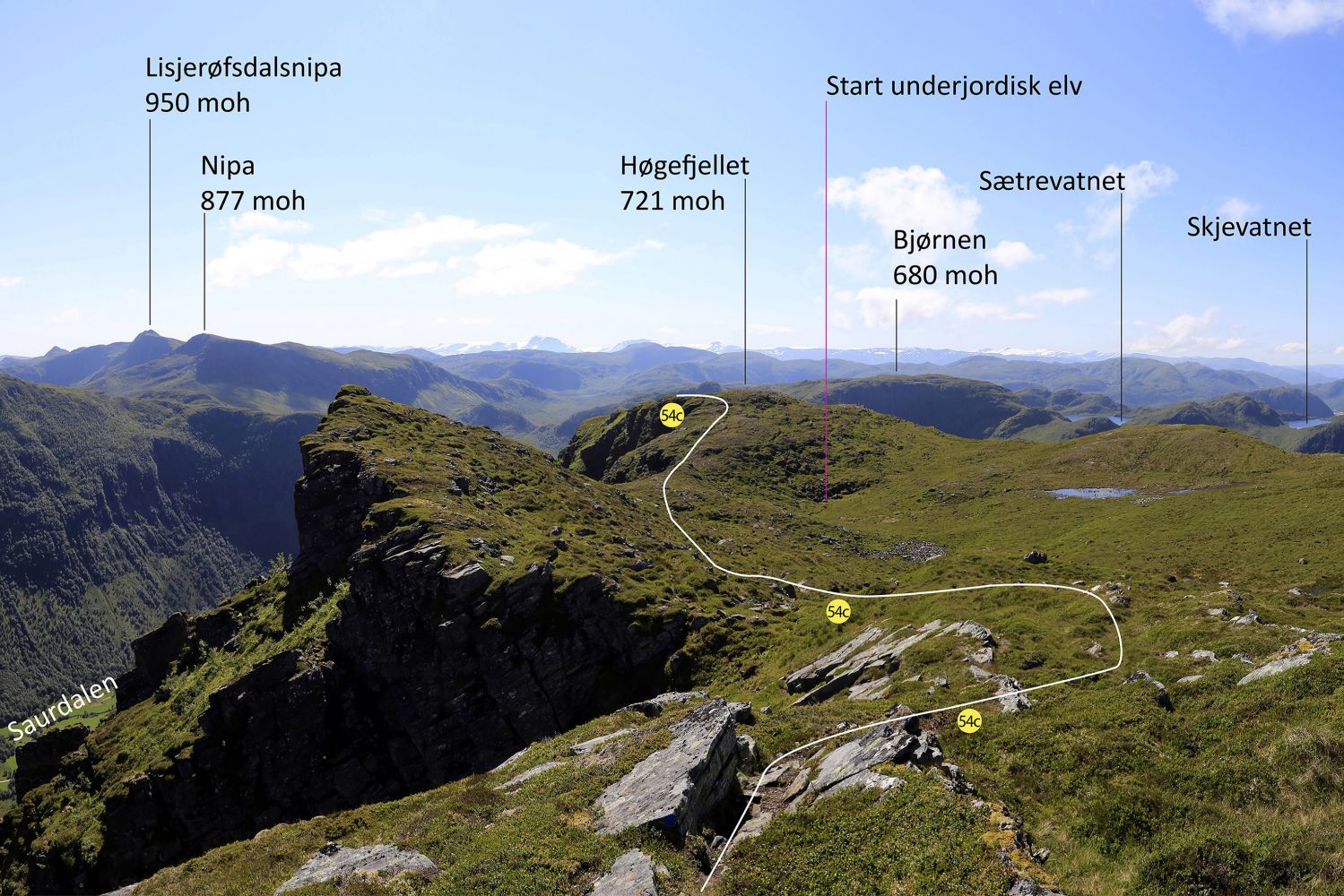
After the climbing, you will follow gentle and dry terrain the entire time until you come across route 54 near the mouth of the river at Lake Lisjehornvatnet. The attached GPS file shows how to get to route 54 both near the river mouth at Lake Lisjehornvatnet and via a shortcut that leads to Lake Støylsmannsvatnet. If you want to walk further to Fuglehaudet, Blåfelden, and Syvde, we recommend going to the intersection with route 54 near the river mount at Lisjehornvatnet. However, if you want to go back to the starting point in Øverberg via route 54, taking the unmarked shortcut towards Støylsmannsvatnet is recommended. If you do that, please study the map carefully before hiking, preferably on your computer screen at home.

Access and parking

You can drive to the starting point of the trail from Syvde via Saurdalen. Alternatively, if you are coming from Åheim or Fiskå, you can first drive to Sylte, then continue up Syltedalen and drive further up to Kilebrekka and Øverberg. It is usually okay to park at the starting point of the trail in Øverberg, Syvde.
Hiking route
Red
Distance
8,67 km one way
Elevation
399 m
Duration
3 t. 10 min.
Highest Point
747 masl

Map route

Surface type Distance
Sti 8

Map

Vanylven hiking map can be purchased at local shops and petrol stations in Vanylven Municipality.
Driving directions

API endpoints

Route data GeoJSON