Sandfjelltua from Kvanndalen in Nordalen – Route 49d
Vanylven
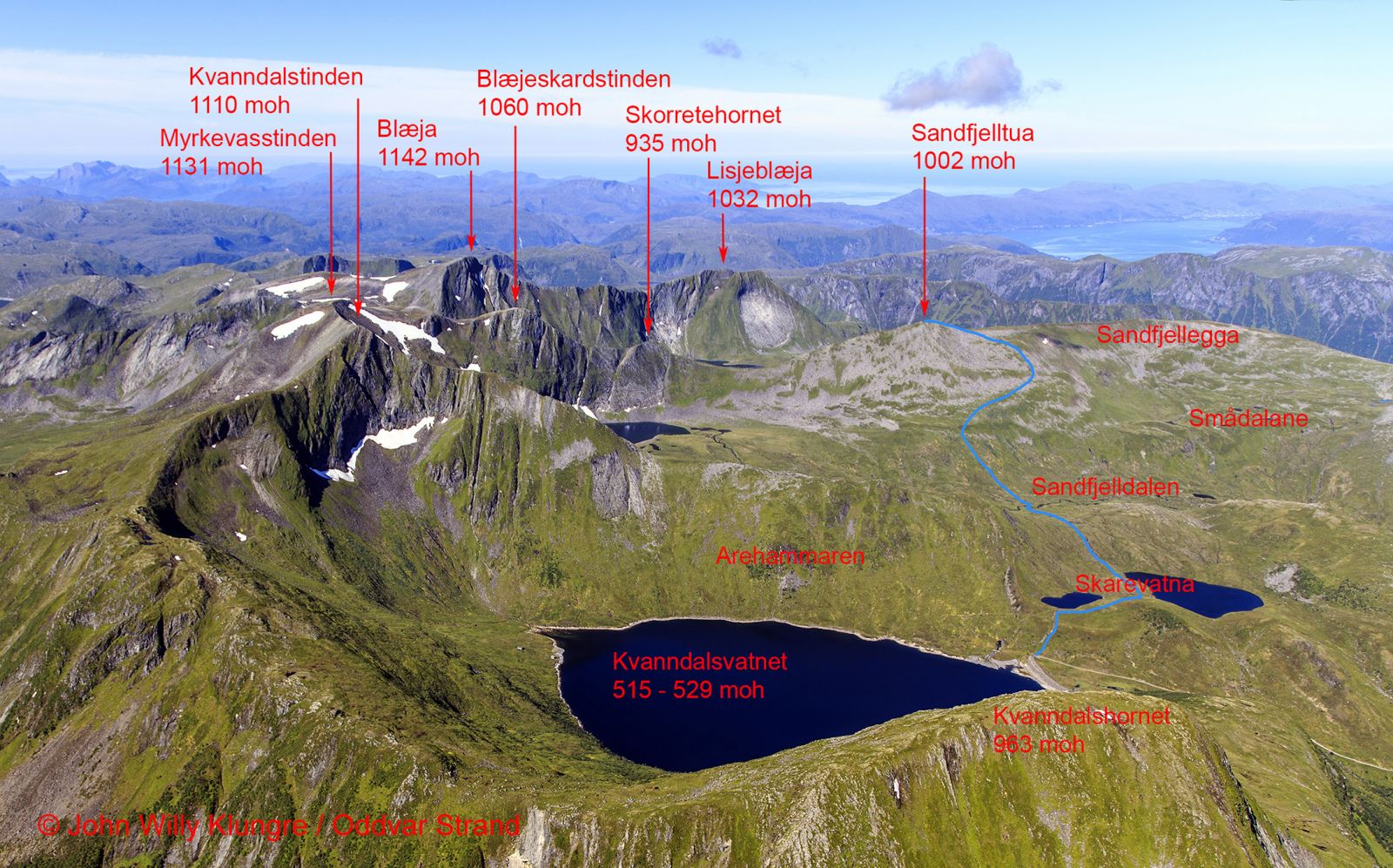
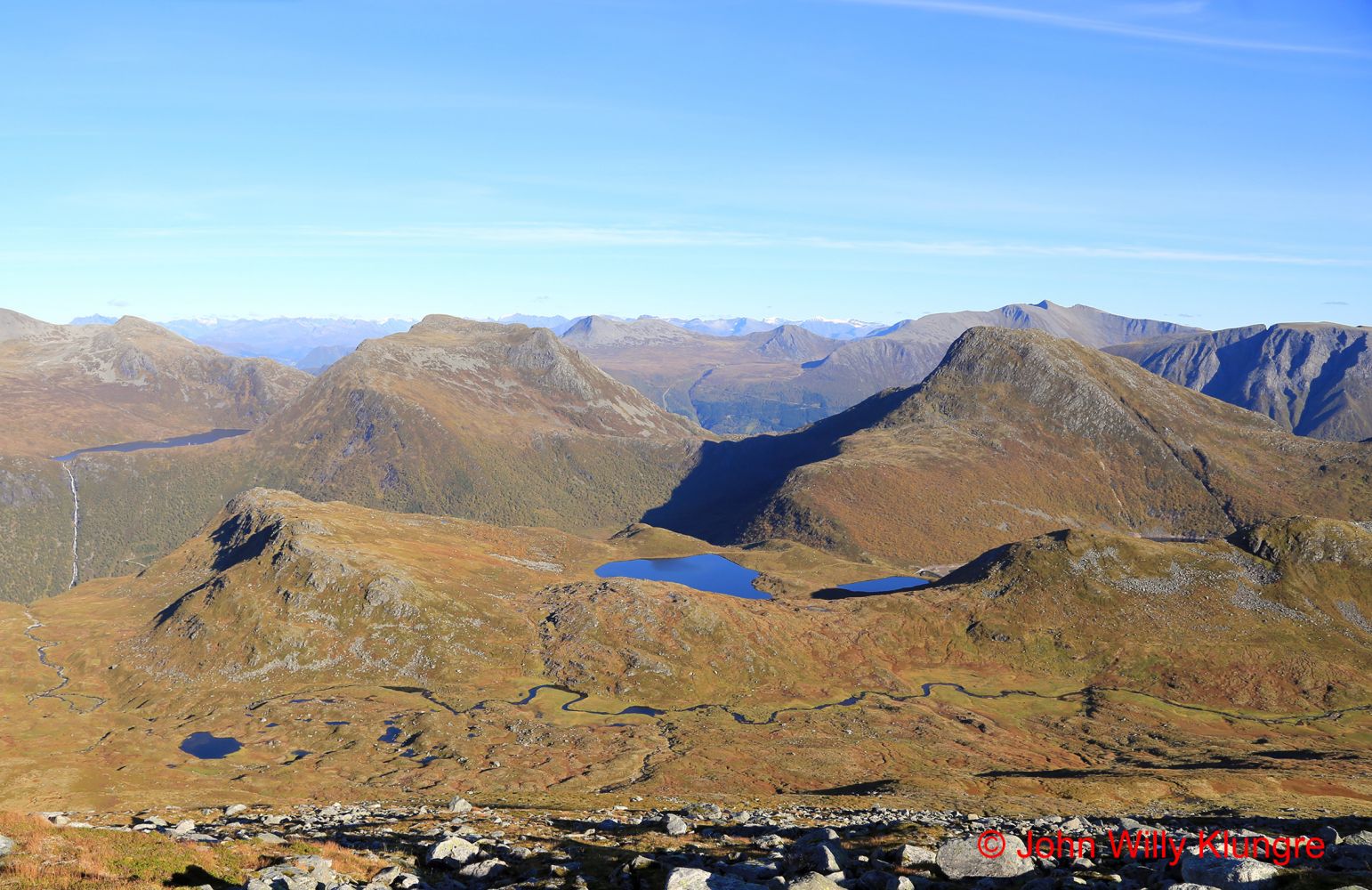
Sandfjelltua rises to 1002 metres above sea level and is the lowest of the 1000-metre-high peaks of Syvde and Vanylven. You will get an amazing view of both the highest mountains in Vanylven and the ocean. The route from Kvanndalen to Sandfjelltua is a popular ski trail, especially in late winter and spring, when the road up to Kvanndalen is open after the winter. The starting point of this trail is the dam in Kvanndalen at 530 m a.s.l., which is above the tree line, so you do not have to walk through the thicket or other vegetation.
The starting point of the trail is signposted, and so is the intersection of paths at the top of the first uphill climb. The entire trail is marked. After you pass the two Skarevatna lakes and Skaregarden at the top between Kvanndalen and Sandfjelldalen, the path follows a rocky mountain ridge down to the river. It is usually easy to cross the river by walking over the marked rocks. Once you pass the river, follow another rocky ridge with a thin layer of humus soil at the top. You will then come up to a grassy slope that is heavy to walk up, but nice and pleasant to walk down. As you continue further up, the trail starts to follow a sheep track. Follow this marked route to avoid having to walk up a rocky mountainside.
Drive from Syvde to Norddalen to get to the starting point of the trail in Kvanndalen. You will see the sign for Norddalen 300 metres northwest of the church in Syvde. Drive along the Norddalen Valley until it ends. Then drive along the mountain road that begins at the end of the valley until the road ends by the dam at the Kvanndalen power station. There is a spacious car park by the dam.
Duration
2 t. 35 min.

Signage
Both signed and marked
| Surface type |
Distance |
| Sti |
2,7 |
Hiking map: På tur i Vanylven (Eng. Hiking in Vanylven) – can be purchased at local shops and petrol stations in Vanylven Municipality.
 Driving directions
 Route data
GeoJSON
Route data
GeoJSON