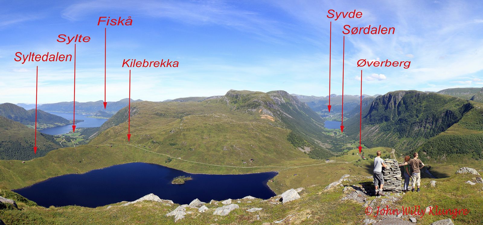
Nørdsjø Trail over Kilebrekka
Vanylven
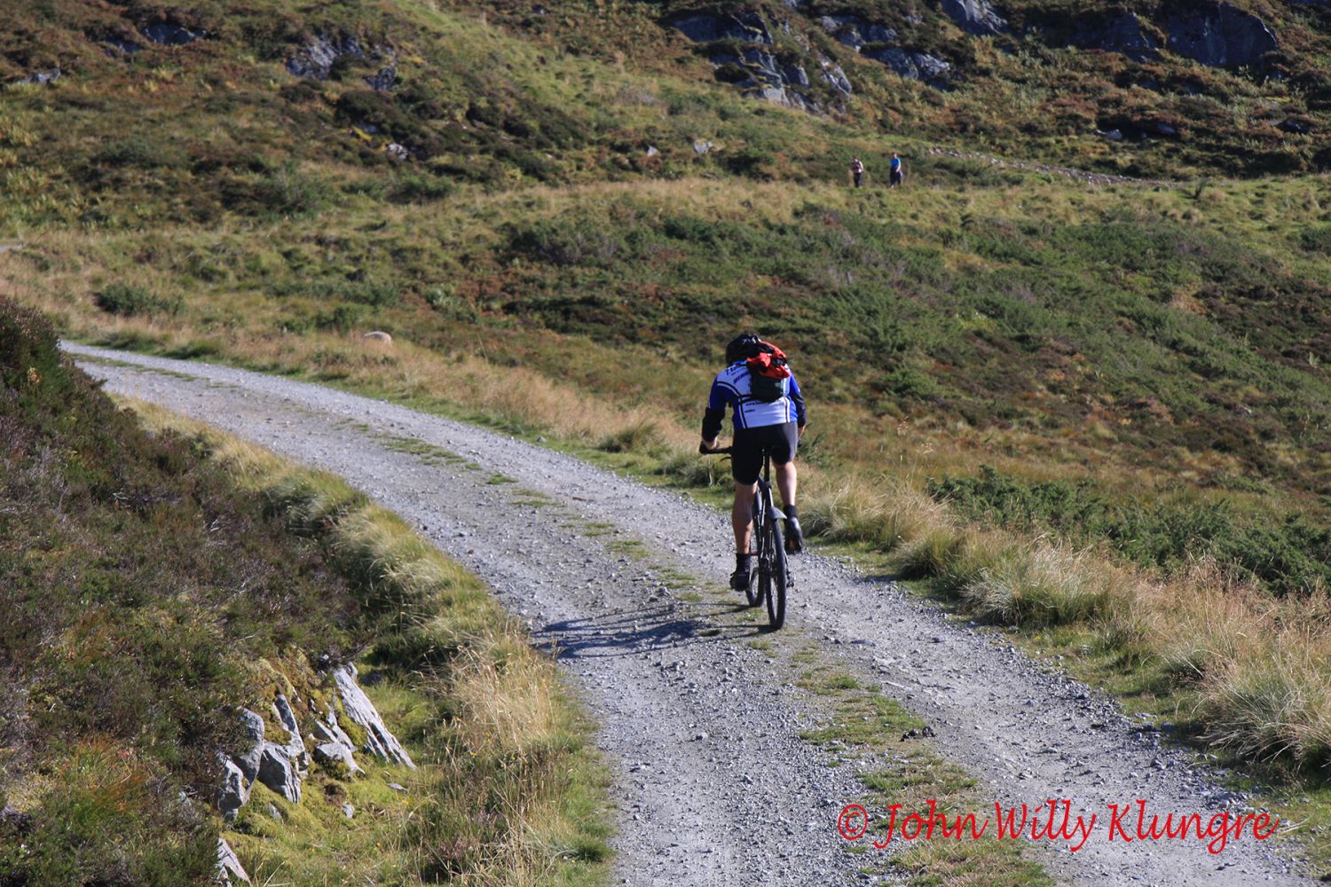
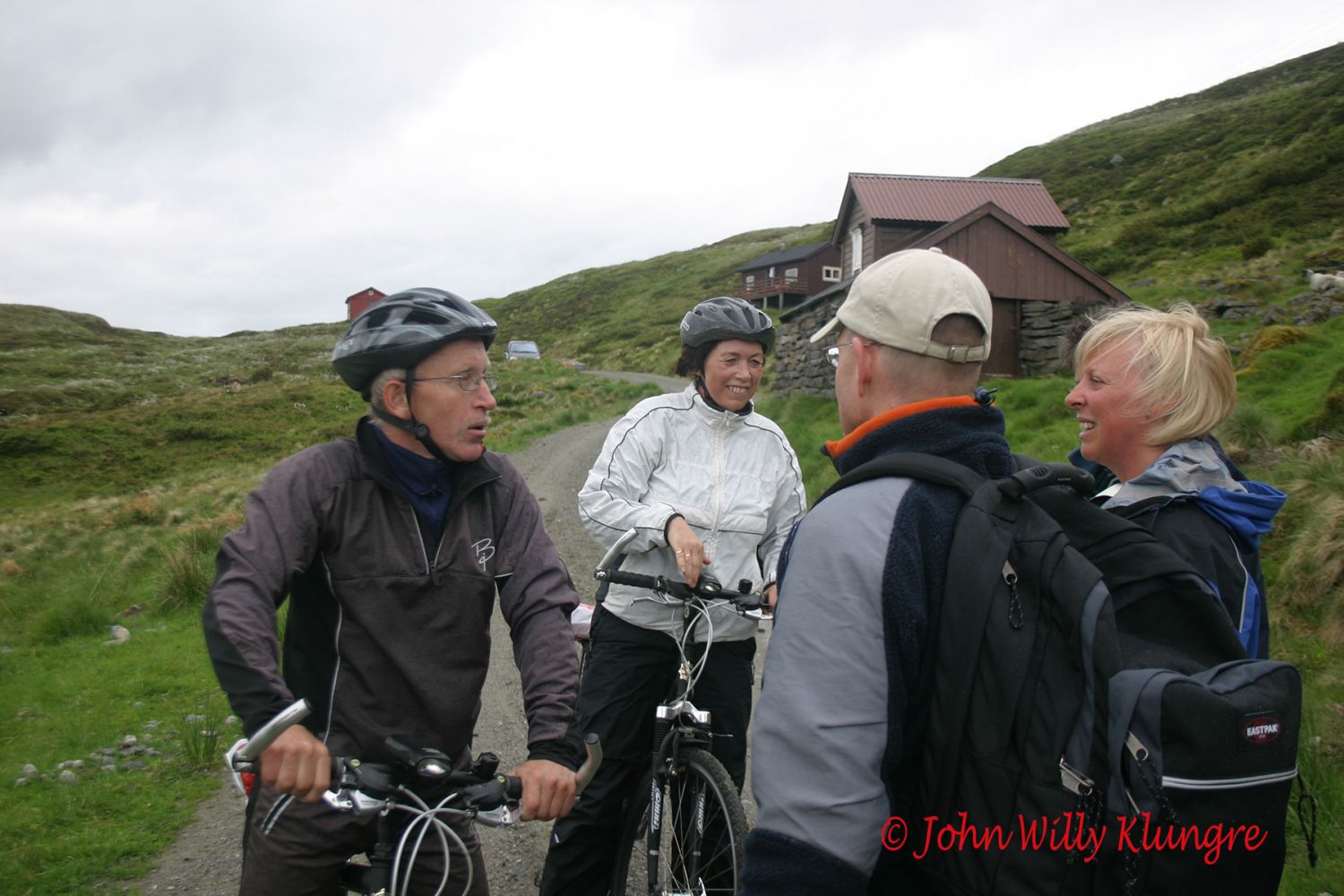
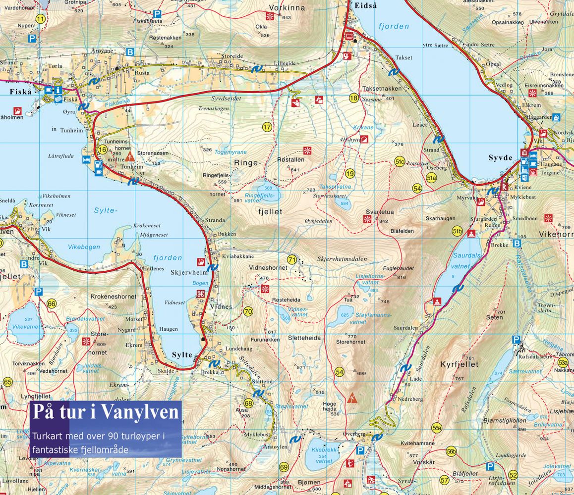
This is one of the two Nørdsjø Trails (North Sea Trails) in Vanylven. The stretch of just under 32 km offers beautiful nature and well-preserved cultural landscapes. The trail goes via the villages of Eidså, Fiskå, Sylte, and Syvde, and you will get to enjoy the view of two fjords, two valleys, and two lakes. The largest part of the trail is a low-traffic asphalt road. Some sections follow a busier asphalt road, and some a gravel road. For those who want to take it slow, there are numerous picnic areas along the route, making for comfortable pit stops. In Leitebakkane about 1 km south of Eidså, there is a picnic area with a panoramic view of Eidså and the mountains of Breiteig. You can stop by the area with tables and benches by the old school building at the beginning of the Sørdalen Valley. And if you would like to enjoy a great view, stop by the hilltop either in Kilebrekka or Øverberg. In summer and early autumn, the mountain café in Øverberg is open on Sundays.
The uphill section from Syltedalen to Kilebrekka is steeper than from Sørdalen to Øverberg, and many people prefer to cycle or walk up the steep slopes from Syltedalen and then slide down less steep hills towards Sørdalen. The asphalt road from the beginning of the Sørdalen Valley all the way to Eidså has little traffic. Follow the county road through Sørdalen and the “old road” that mainly follows the marine border from Syvde to Eidså. From Eidså, you will have to cycle along the main road for a few hundred metres before turning off to the “old road” in the direction of Fiskå. You can follow this road all the way to Tunheim. There is a slightly narrow and busy section of the road between Tunheim and Sylte before you can enjoy the peace of a low-traffic road to Syltedalen.
This is a circular route, so you can start and finish it where you want. If you bring your bike in a car, there are many car parks along the trail.
Biking route
Blue landevei
Duration
5 t. 45 min.

Sesong
Spring, Summer, Autumn
| Surface type |
Distance |
| Asfalt |
26 |
| Grus |
5 |
Hiking map: På tur i Vanylven (Eng. Hiking in Vanylven) – can be purchased at local shops and petrol stations in Vanylven Municipality.
 Driving directions
 Route data
GeoJSON
Route data
GeoJSON