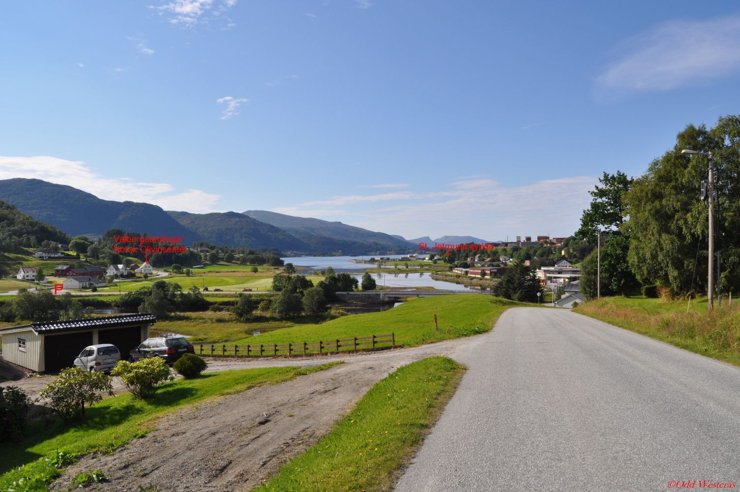
“Around the Village” is one of the 22 hiking trails known as Vanylvsturen. The Vanylvsturen trail network was established as the result of collaboration between the Department of Culture, the Bulyst Project, and the Norwegian Institute of Public Health. It was launched in 2009, which was the Norwegian Year of Cultural Heritage. Generally accessible hiking trails were set up in most of the villages so that as many people as possible could participate. The idea is to allow people to experience culture by learning about human activity of the past as well as myths, legends, memories, i.e. something that gives them a sense of meaningfulness and strengthens their identity. At the same time, the initiative promotes outdoor activity, which improves health. The Vanylvsturen trails are marked with special signs and arrows. This trail is a nice walk from the centre of the village. It follows the rural road along the southern side of the Åheimselva River and then becomes a path until it reaches the bridge over the river near Lake Gusdalsvatnet. From there, you will walk along the county road back to the starting point. The hike will take about 1 hour. From the junction in the centre of the village, you can follow the river for 800 m in the direction of Vanylvsfjorden to see Saint Jetmund Church from 1155.200 m away from the car park by the religious centre Misjonshuset, you will find Valborgsamlinga (Eng. the Valborg Collection) and Norsk Olivinsenter (Eng. Norwegian Olivine Centre) which are both located in the old Thue school building.
Route description
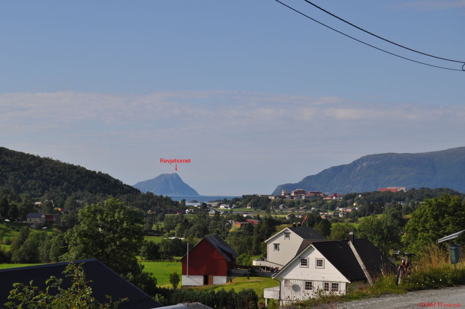
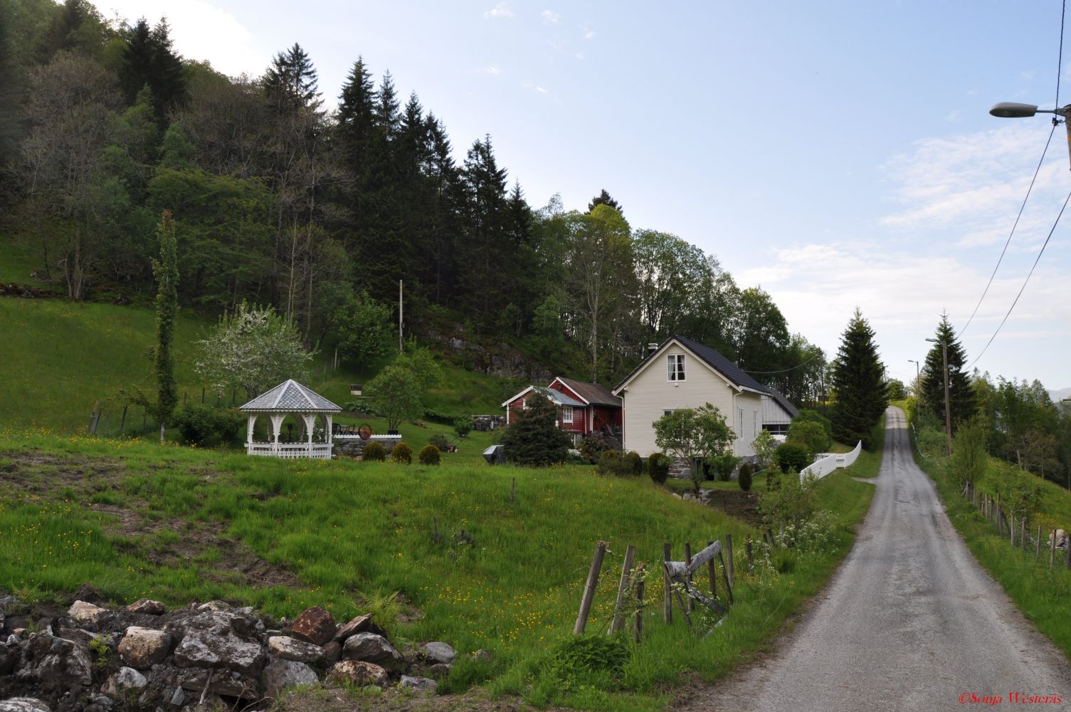
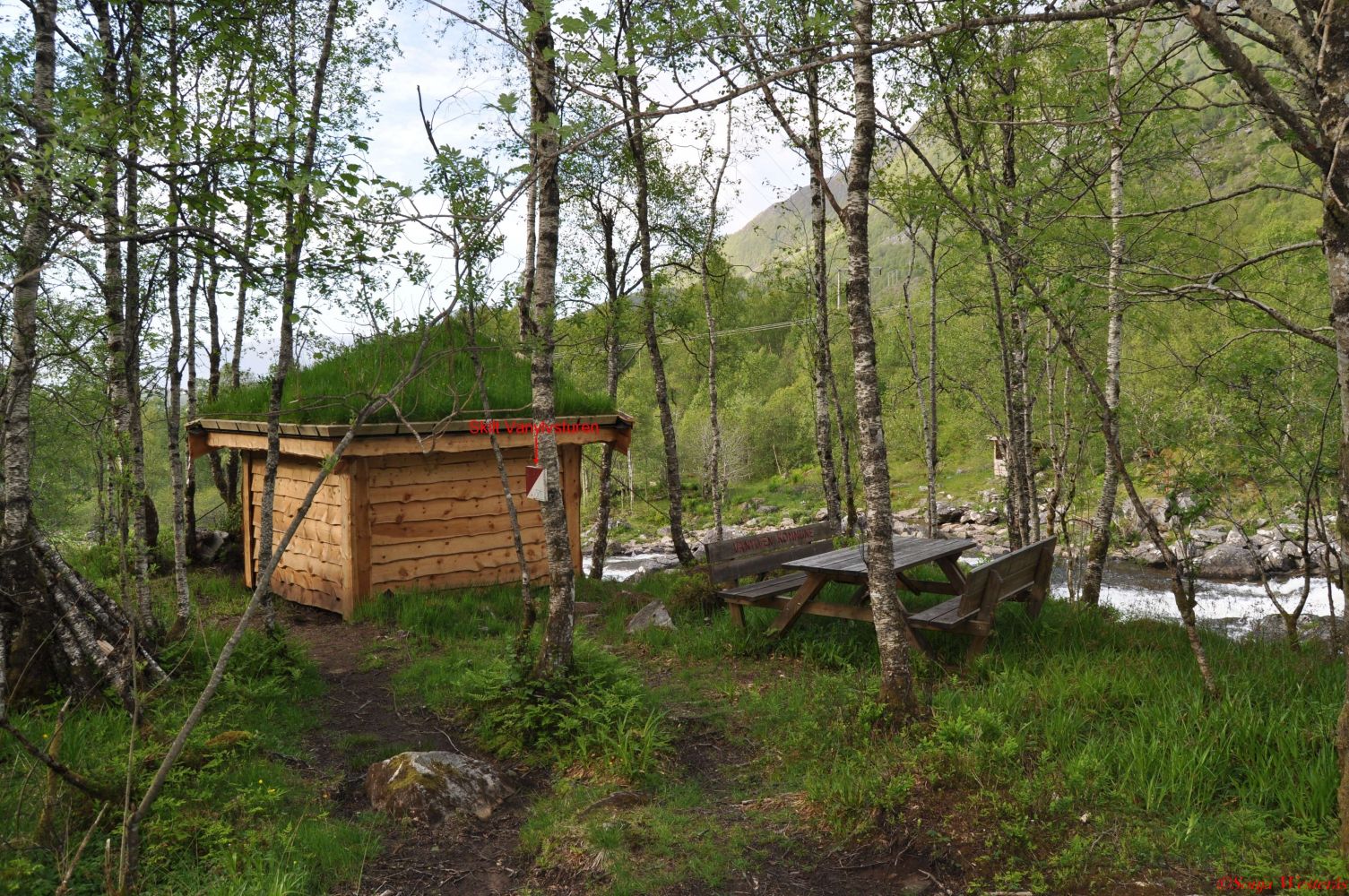
Park your car by the religious centre at the junction with the exit road to Selje/Stadlandet. Walk south along the road (FV61) until you reach the first entry road on your left (Laksegata Street). You will see the first arrow attached to the post here. Walk further to Birkedalen and Holmen. Birkedalen is an old farm from the 1800s that was populated until 1960. The white masonry house was built in 1920. The 4H Elvablikk club uses the farm and the house in Birkedalen as a food station under their yearly fitness trail “Around the Village”. Follow the road past Birkedal, find the arrow that points up a small grassy hill and follow the path. To the right of the Veiradalselva River, you will see an old mill from the middle of the 1800s where all furnishings are intact. The mill was last used during the war. The bridge over the river is built by the 4H Elvablikk club. Members of the club have a journal there, and you are encouraged to write in it. Åheimselva has always been a good salmon river. From the bridge, you can see Rundesteinen which is a particularly good fishing spot. The path along the Åheimselva River is equipped with a nice bridge and sitting areas. Once you reach the end of the path, follow the road over a bridge to get to the main road that will take you back to the centre of Åheim. From here, you will get a beautiful view of the sea in the direction of Stad and Revjehornet. The view is especially nice during the sunset in good weather. On your way to the centre, you will pass the Åheim Stadium. Down from the area of Holen just before the junction in the centre, you can see the sports hall Olivinhallen up on your right. Turn left over the bridge at the junction and return to the starting point by Misjonshuset.This trail is well suited for walking. If you are cycling, there is a short section along the river where you will have to walk, pushing your bike.
Access and parking
The starting point of the trail is at the religious centre Misjonshuset by the junction with the exit road to Selje/Stadlandet. Since this is a loop trail, you can obviously start at any point and walk in both directions. Alternative starting points could be the junction in the centre of the village or the stadium in Løvold.
Park your car next to Misjonshuset by the junction with the exit road to Selje/Stadlandet. Alternatively, you can park by the COOP/Spar shop or the stadium in Løvold. No parking fee applies.
Hiking route
Green
Distance
4,94 km one way
Elevation
95 m
Duration
1 t. 35 min.
Sesong
Winter, Spring, Summer, Autumn
Highest Point
81 masl
Signage
Signed
Map route
Surface type
Distance
Asfalt
4,5
Sti
0,5
Map
Hiking map: På tur i Vanylven (Eng. Hiking in Vanylven) – can be purchased at local shops and petrol stations in Vanylven Municipality.