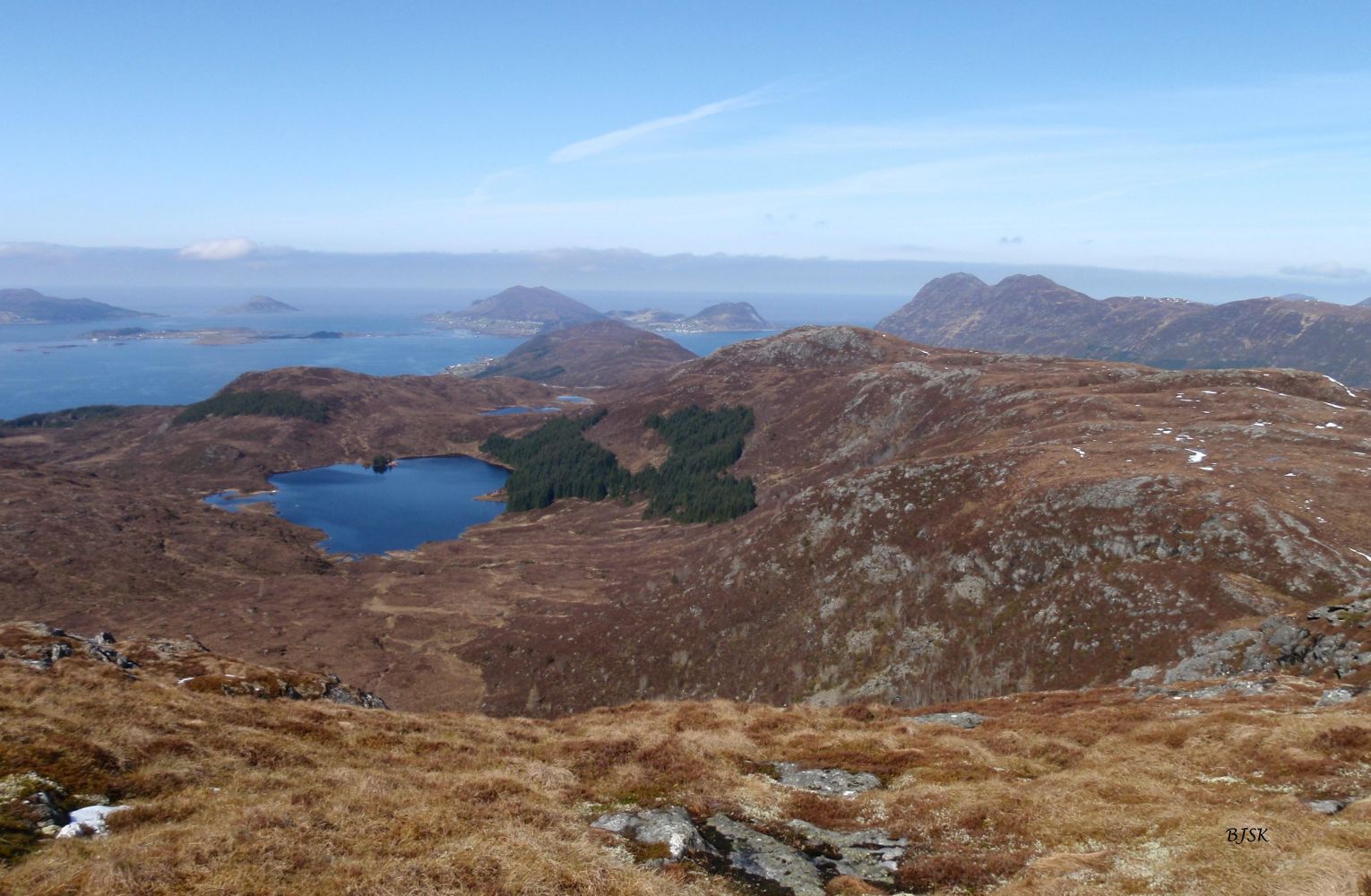
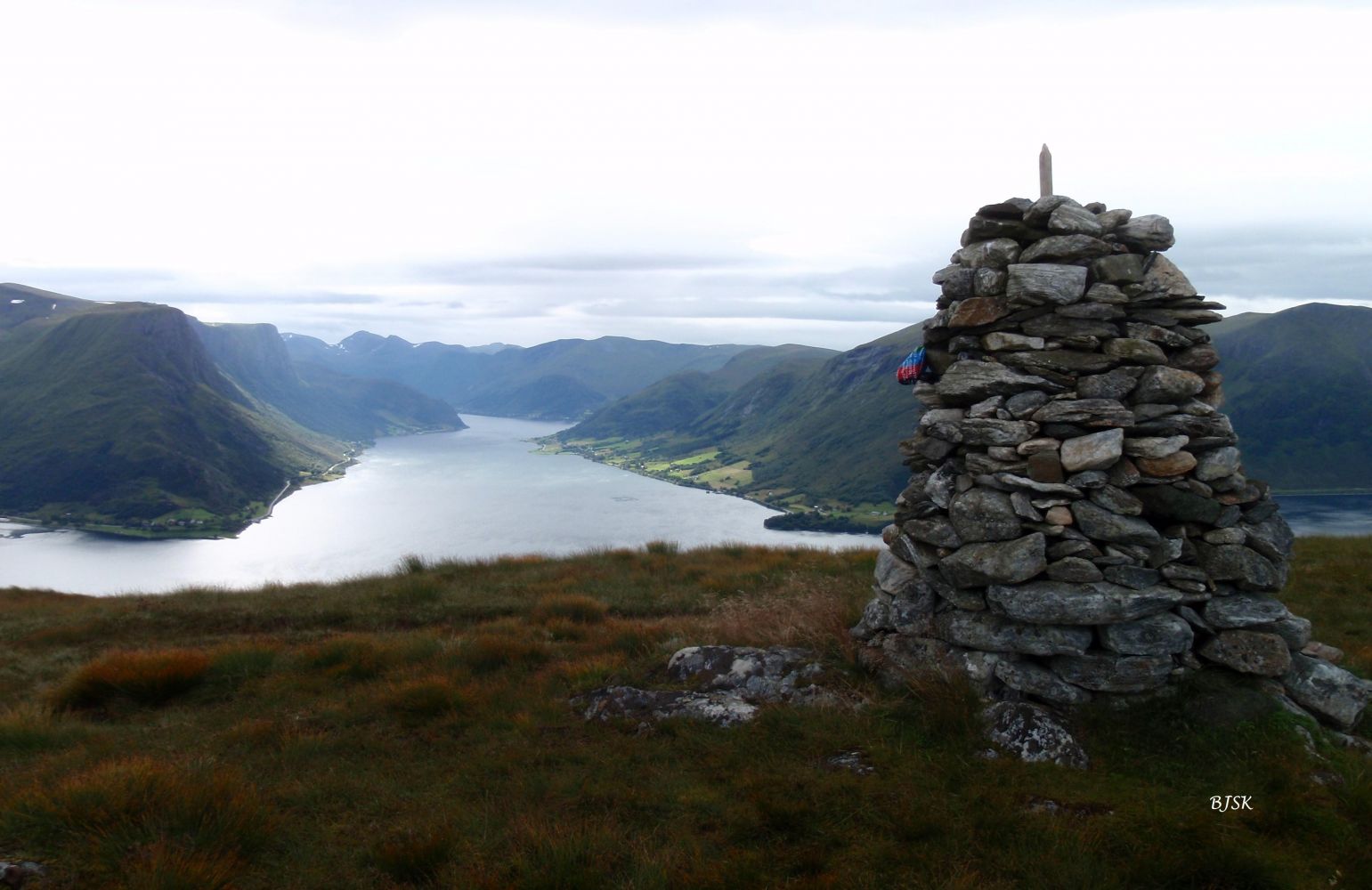
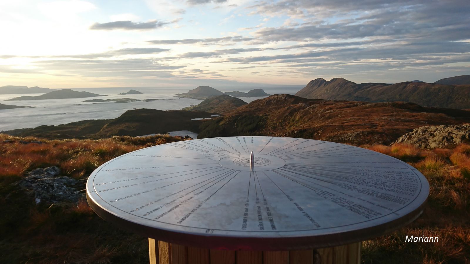
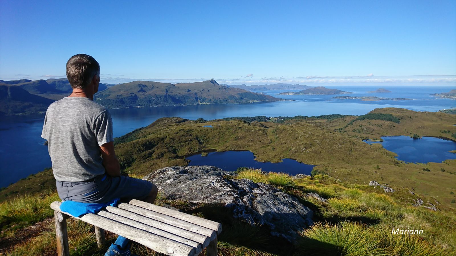
Veten rises above Lake Nyksvatnet and offers a great view to the west as well as a view of the mountains in Sande and Vanylven. The name of the mountain comes from the Norwegian word for beacon fire, as the mountaintop was part of the old signalling system along the coast. The Larsnes Sports Association (Larsnes IL) has a trail post on the peak. On the summit of Veten, you will also find a board with the names of the surrounding mountains.
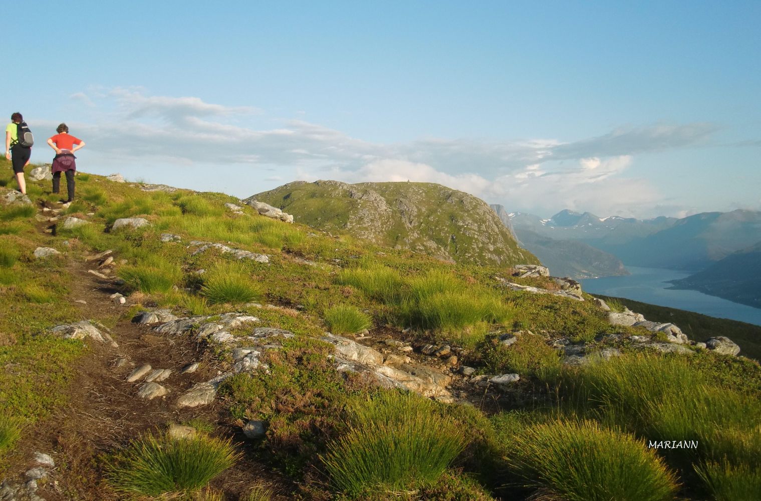
The trail starts from the car park at the highest point of Drageskaret. Follow the Langhamrane mountain ridge past Kvilesteinen and between Knottahornet and Svedehornet. Continue walking through the mountain terrain until you see the signs for Keipen and Veten. Turn right. Follow the path as it takes you past the west end of Lake Langevetevatnet and climb up a steep slope to the top of Veten. From Veten, you can follow a path that leads to Torsethornet and continues to Keipen. This can be an alternative return route. You will return to the main path at the sign for Keipen and Veten. All these paths are well marked. From Veten, it is also possible to follow a path to Skredestranda.
Park your car along County Road 61 (FV61), at the highest point of Drageskaret, between Gursken and Larsnes.
Duration
2 t. 35 min.

Sesong
Spring, Summer, Autumn
Signage
Both signed and marked
| Surface type |
Distance |
| Sti |
3,3 |
Hiking map of Ytre Søre Sunnmøre, M 711 1119 III, Sunnmorskart.no
 Driving directions
 Route data
GeoJSON
Route data
GeoJSON