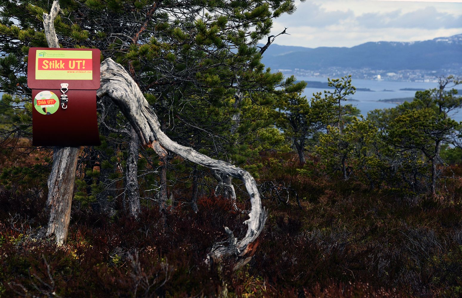
Mount Vassura got its name from a scree slope (“ura”) located near Lake Sollibøvatnet. The name is used referring to the top which is almost as high as Tranhaugen which used to be a Stikk Ut trail checkpoint. Vassura is 295 m a.s.l. high, and it offers a fantastic view over the town and the area around it. The walk up and down the hill is also full of exciting views, and the trail takes you through a wonderful forest terrain.
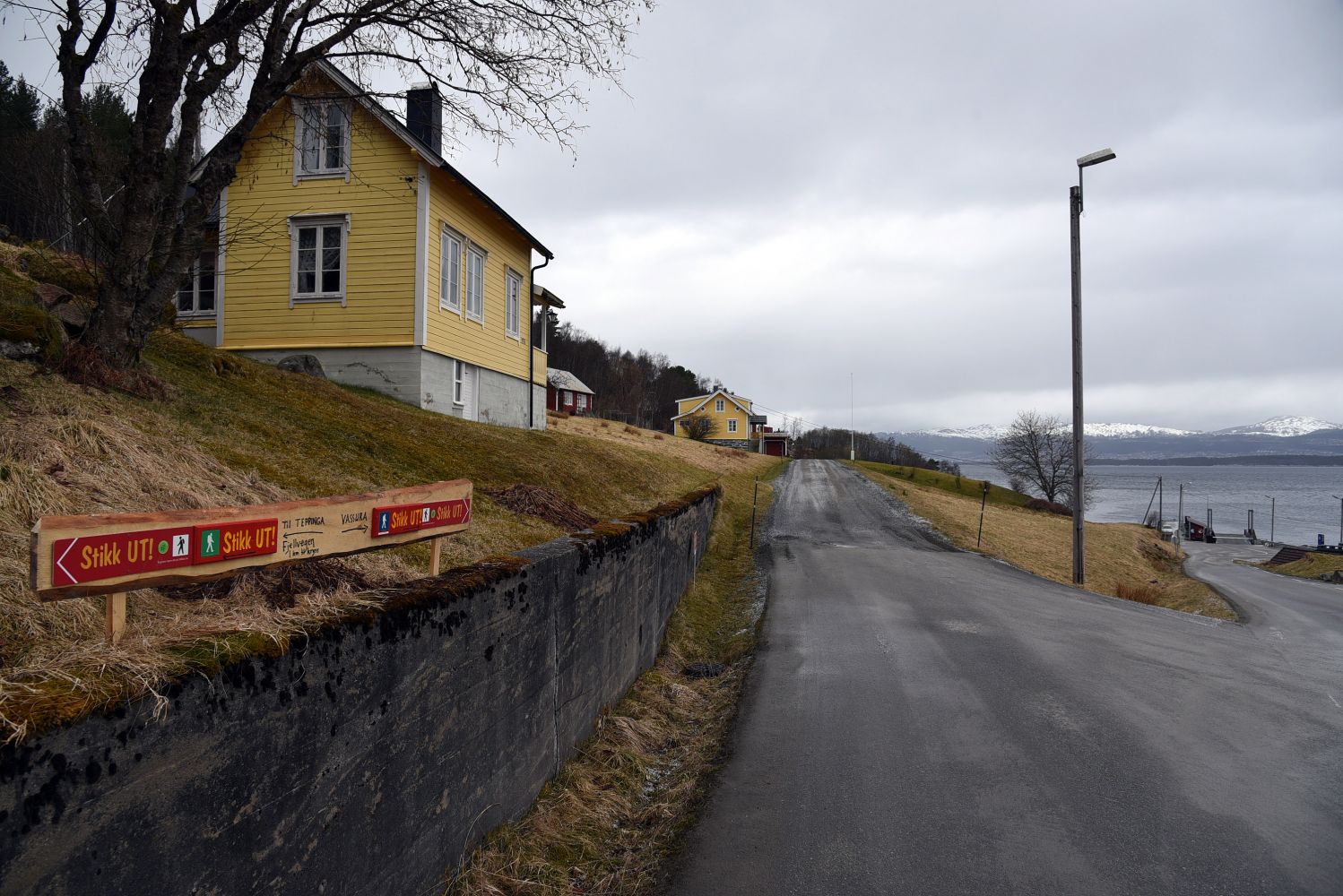
If you get to Sekken Island by ferry, walk for a couple of hundred metres to a junction. Take the turn to the right and follow the country road for about four hundred metres until you see a Stikk Ut sign which will lead you up the motor road. Follow the motor road and the tractor road for about 2 kilometres until you start approaching Lake Sollibøvatnet. At that point you will come to a sign that points to the left. Follow the serpentine and partly steep path up to the top of Vassura from there. This path has been widely used for the mountain walk in the memory of King Haakon Herdebrei (“Herdebreimarsjen”) for many years, and you can clearly see it in the terrain. You can expect to walk for about an hour from the ferry terminal to the trail postbox. The walk from Vassura down to Sollibøen will take about half an hour. Once you are in Sollibøen, you will easily find a way down to the ferry terminal.
If you are a visitor to the island, the most convenient starting point is the ferry terminal. Start by following the description of the trail up to Vassura. This will also allow you to register at both Stikk Ut trail checkpoints on Sekken Island on the same day. There is a bus connection between the ferry terminal and Vestadstranda that fits most of the ferry arrivals until 4.40 p.m. This can be helpful if you want to start your trail from the southern side of the island or take a bus on your way back to the ferry terminal. If you have any questions while planning this trail or when you are on Sekken Island, please call us at 975 91 319.
A nice way to start this trail if you want to reach both trail postboxes on Sekken Island is to start walking from the ferry terminal. If you have a car and want to park it on the northern side of the island, you can do so directly at the ferry terminal. If it is full there, you can park at the junction a couple of hundred metres up from the quay (by the road safety stones). You can also drive up to the shooting range and park your car by the shooting cabin. DO NOT park on the street that goes up to Lake Sollibøvatnet. You can easily block the way for those who live or work in the area.
Duration
2 t. 5 min

From Vassura, it is also possible to walk to Teppinga. You will need to walk for a couple of hundred metres further down past Sollibøen. Then follow the sign and path to the shooting range and you will reach Fjellvegen (“the Mountain Way”). It is about one kilometre to Teppinga from there.
 Driving directions
 Route data
GeoJSON
Route data
GeoJSON