Vardehornet in Volda
Volda
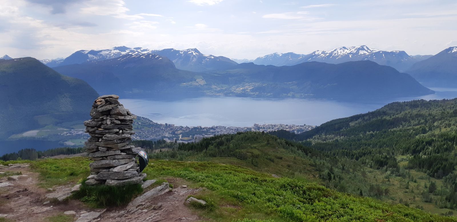
The trail destination, Vardehornet, lies in a popular hiking area north of Volda. There are many routes to the hilltop. The trail described here starts from Håmyra and follows a path almost all the way up. The hilltop offers a great view of Volda and the Folkestad ferry route. This could be a fitness trail or a relaxing after-work hike.
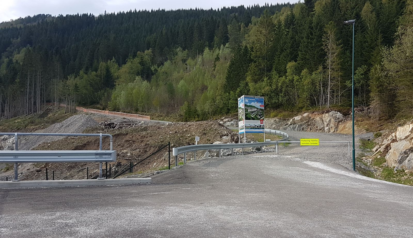
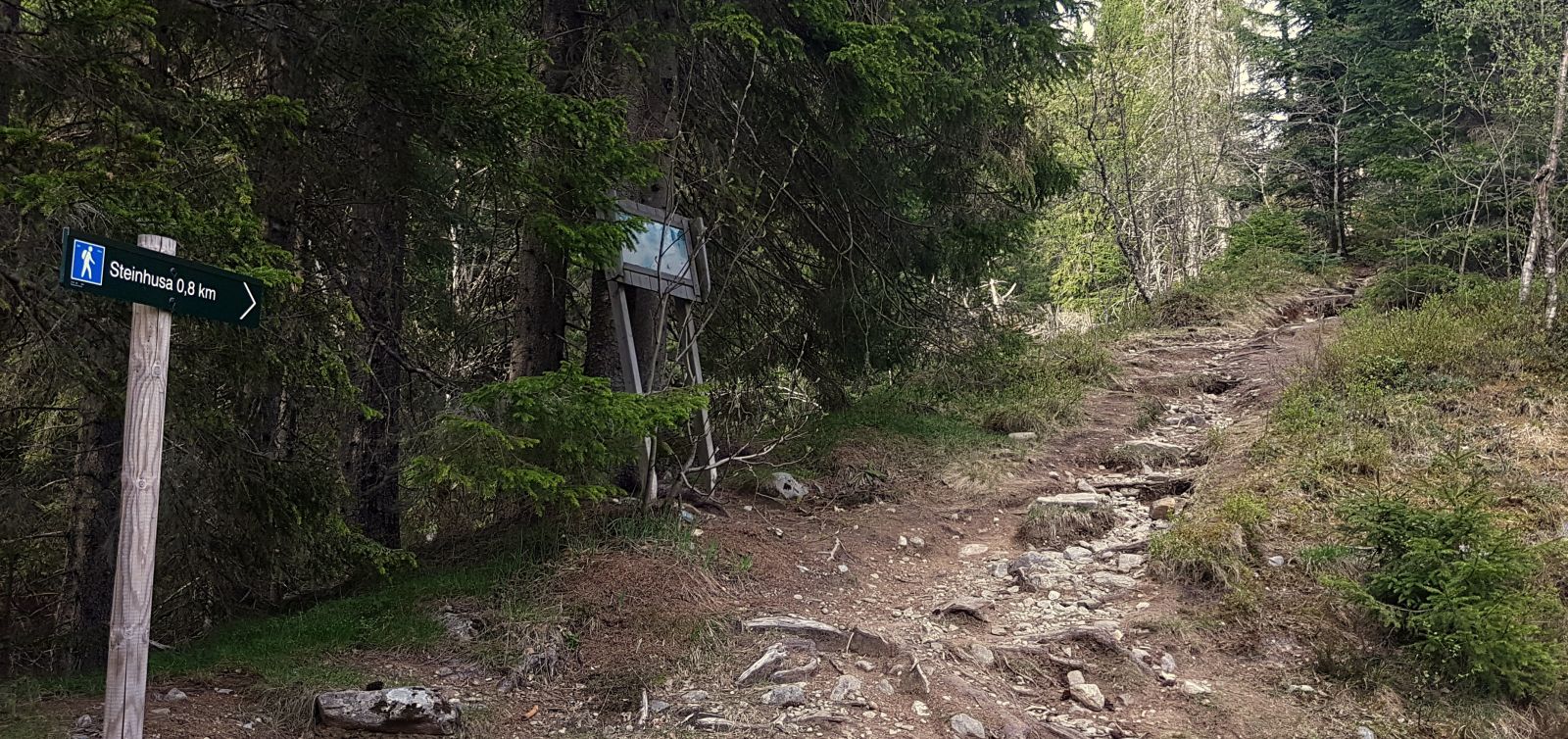
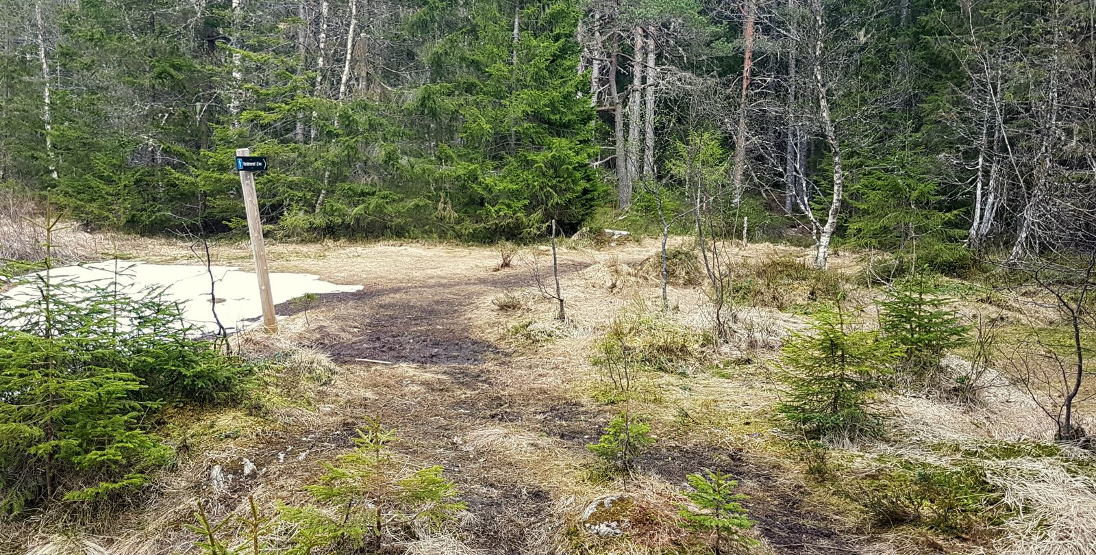
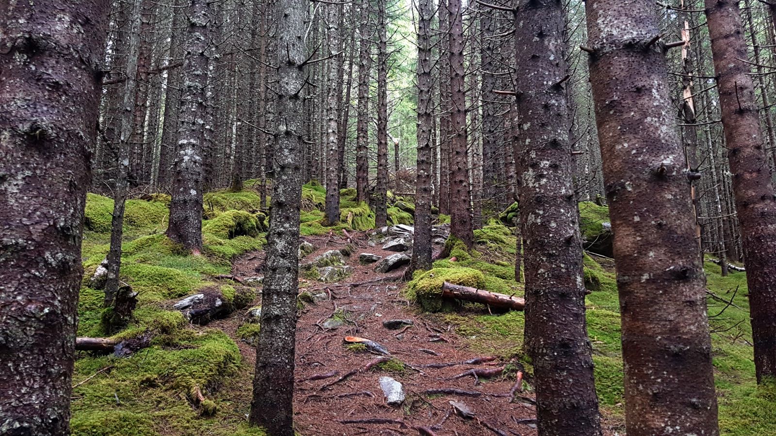
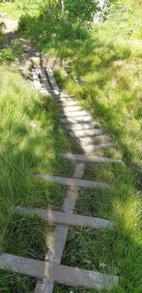
Start by walking from the car park at the end of Raudemyrvegen Road near Håmyra, a new residential area. Follow the gravel road (Prestesætrevegen) for about 250 m until you reach the first turn. Turn off to the path and follow the ridge along the right side of the Håmyrelva River. You will see a sign for Steinhusa. Follow the path until you reach an older forest road. Turn right and follow the forest road for just under 150 m until you see a sign that points to Vardehornet. Follow the well-defined path as it gradually ascends through the forest. When you reach a fork in the path with a sign for Røyshytta, do not follow that sign and instead take the path straight ahead following the arrow. The path will now take you through a beautiful spruce forest and become slightly steeper than before the fork. This is a nice spot to look for mushrooms. Once you come out of the spruce forest, walk through the marshy area which is partially covered with wooden footpaths. Follow the path further into a deciduous forest as it takes you along the ridge of the hill. You will walk out of the forest at the end of the ridge. Here, you will see the trail destination. Walk over a small marshy area before you start following a clear good-quality path further up to the hilltop. You will first reach a cairn with a trail journal where you can write your name. If you walk further, you will find yourself at the back of Vardehornet.
From Vardehornet, you can continue hiking east and follow the path to Lake Dinglavatnet and then the gravel road down to the starting point (Prestesætrevegen Road). You can also continue west and take a walk further towards Ring/Niven/Tverrberget. There are many alternative routes to choose from.
In this description, we took the same route back to the older forest road with the sign for Vardehornet. From there, turn off to the left and follow the road until you reach Prestesætrevegen Road. Turn right and follow the road down to the mountain farm Prestesætra. Here, you will find a nice gapahuk shelter built by The Rotary Club. On the western side of the plain near the gapahuk, there is a path that will take you back to Prestesætrevegen Road which you can follow down to the starting point. Alternatively, you can follow the road that goes down right from Prestesætra.
From the centre of Volda by car: Drive along E39 in the direction of Stryn. Drive straight ahead (Vikebygdvegen Road) at the roundabout near Volda University College. Take the first left turn and follow Heltnevegen Road. Then drive along Raudemyrvegen Road until it ends. The distance is about 3 km in total.
You can also walk to the starting point of the hike from the centre of Volda.
Duration
2 t

Sesong
Spring, Summer, Autumn
| Surface type |
Distance |
| Grus |
1 |
| Sti |
3 |
Take the circular bus route, Ringruta, in Volda – frammr.no
Local hiking map of Volda
 Driving directions
 Route data
GeoJSON
Route data
GeoJSON