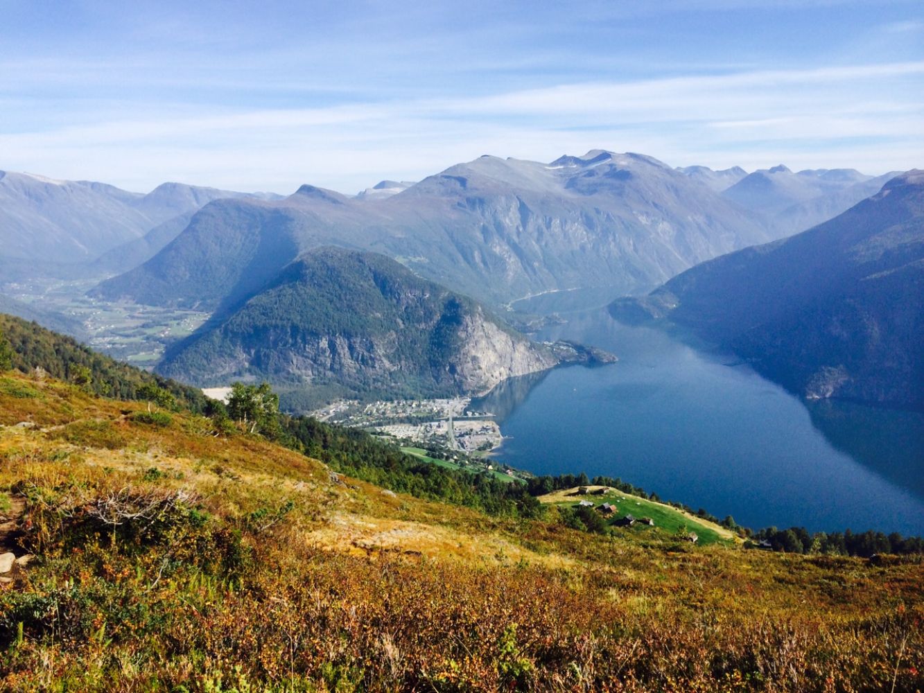
Mount Vardefjellet lies at 893 m a.s.l. on the tip of a peninsula facing Norddalsfjorden. This is a relatively easy mountain trail that offers a beautiful view of large parts of Norddal municipality and some parts of Stranda municipality, as well as many of the highest mountain peaks in the area. One of the highest mountains in Norddal municipality, Mount Torvløysa (1850 m a.s.l.), lies in the south. Pyttegga (1999 m a.s.l.), which is one of the peaks in the Tafjordfjella mountain range, is the highest. You can see Stranda municipality in the west, and you can also catch a glimpse of the famous tourist destination Mount Slogen (1564 m a.s.l.) in Ørsta municipality. Mount Blåtinden (1338 m a.s.l.), which is located on the border between Norddal, Stordal and Stranda municipalities, is visible in the north. Hogsetdalen (750 m a.s.l.), the other summer mountain farm for the villages of Linge and Lingås, lies just to the north of Mount Vardefjellet. Several farmhouses and cabins that had previously been on the verge of collapsing are now renovated. The path leading from Mount Vardefjellet down to Hogsetdalen is partly waymarked.The name “Vardefjellet” dates back to the time of the Vikings when the mountain was used as a beacon or a cairn (“varde” means “cairn” in Norwegian). A signal fire was lit up at the top of the mountain to warn others about unrest or an attack from the enemies. Where nothing blocked the view from one mountain to the other, a whole system of signal mountains was developed throughout the country. It was therefore important that such signal mountains were clearly visible both from the neighbouring mountain tops and the settlements in the area, so that people could be warned in time.
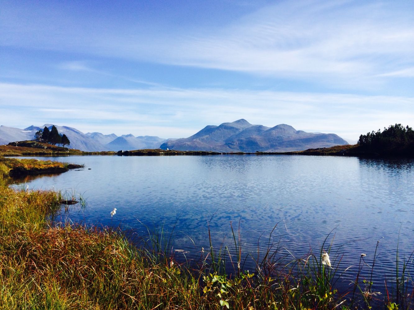
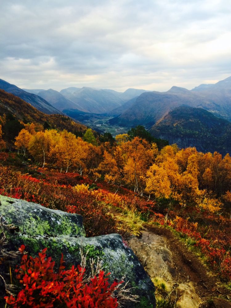
The trail starts from Klovset (549 m a.s.l.), the summer mountain farm for the residents of Linge and Lingås. There is a large car park here and an information board with aerial photos showing various hiking routes in the area. Walk along the tractor road for the first 100 metres from the car park. Follow the sign to the right onto a path. The path climbs steeply uphill at first. As you walk further uphill, the path will split in two directions — towards Mount Vardefjellet and towards Hogsetdalen. The path continues further up and westwards through open and easily accessible mountain terrain with a great view of the fjord and mountains. Before you reach the top, you will walk past the idyllic Lake Vardevatnet that lies at 850 m a.s.l. It is possible to take a dip in the lake. A privately-owned cabin called Vardebu is located by the lake. The trail is marked with red “V” letters, poles with red tops and signs where the path splits in two. The expected time for this trail is about one hour of walking with a normal walking speed.
When you drive past Muri in Valldal (just before the centre of Valldal, if you are coming from the west/Ålesund), you will see a sign to Lingås. Follow the road as it goes up all the way to the last farm in Lingås, about 200 m a.s.l. Drive past the barn and park your car at the designated car park. Alternatively, you can drive further to Klovset for 2.4 km along the toll road. NB! The final section of the toll road is steep, but manageable.
Toll fee of 50 NOK Lingås – Klovset
Duration
1 t. 55 min.

Signage
Both signed and marked
| Surface type |
Distance |
| Sti |
2,1 |
There is a bus connection between Valldal and Ålesund
http://www.frammr.no/Ruter/Buss/145
In summer there is an additional bus connection between Valldal and Åndalsnes with three departures a day.
Norddal municipality tourist map 1:50 000 Stranda municipality tourist map 1:50 000
 Driving directions
 Route data
GeoJSON
Route data
GeoJSON