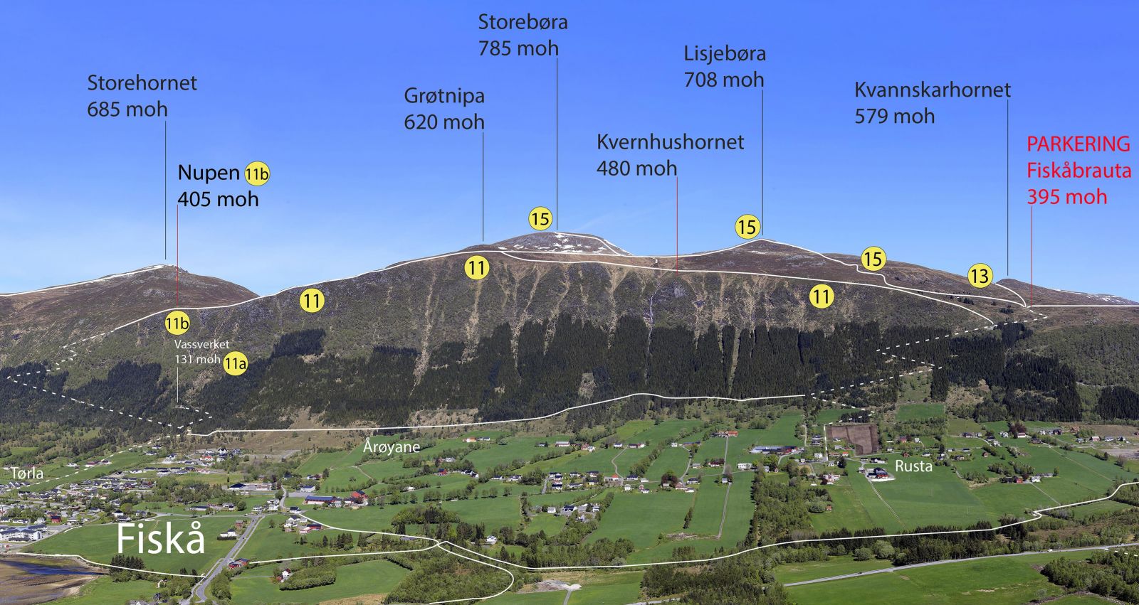
Utsikta – panoramic trail along the mountain edge between Nupen and Fiskåbrauta in Fiskå
Vanylven
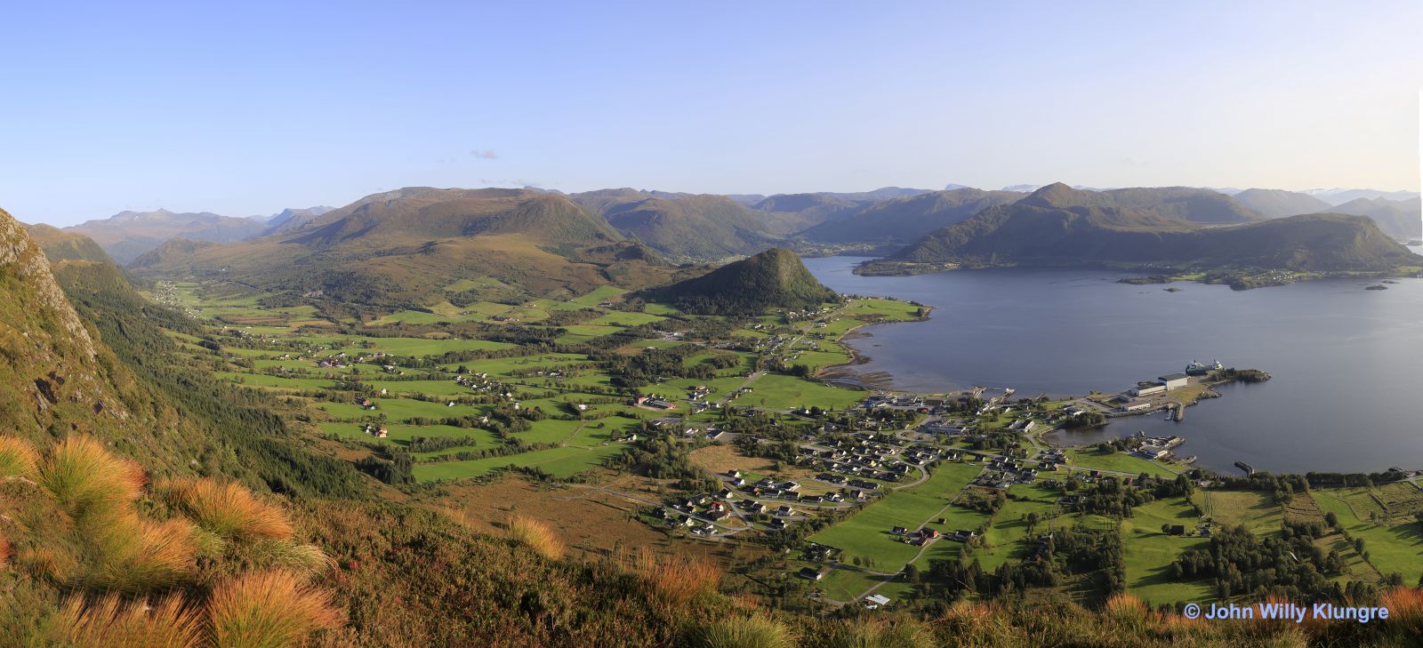
This trail is all about the view. You will walk along the mountain edge above Fiskå and enjoy a panoramic view of Fiskå and the surrounding area.
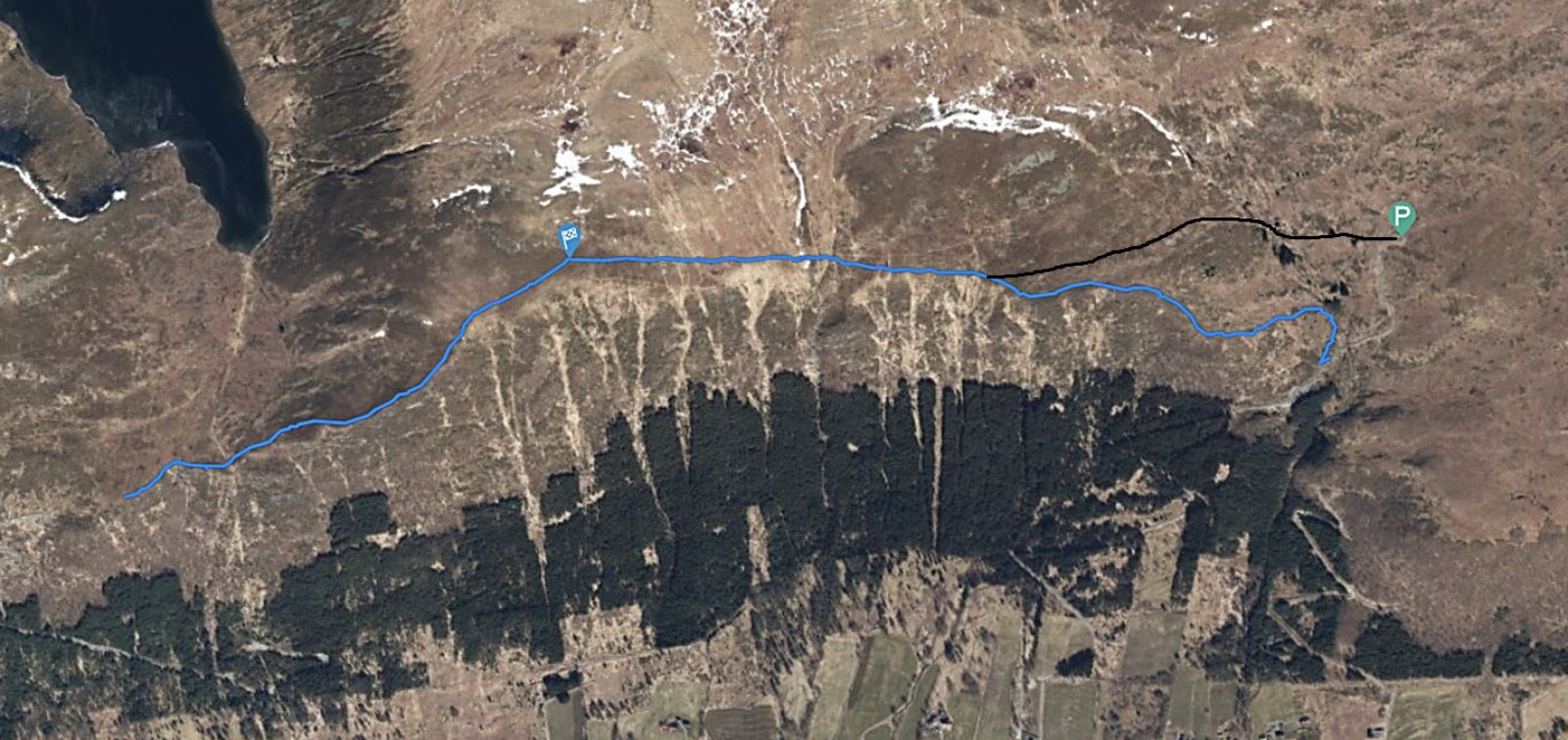
The map below shows a route with the starting point slightly below the car park on Fiskåbrauta and the end point on Nupen. The GPS file which you can download has the same starting and end points. You can choose to walk either from Nupen or Fiskåbrauta, and you can also take a circular route by combining it with other trails. If you choose to take a circular route from the centre of Fiskå, a road will take you over the steepest sections of the trail. The road to Nupen is steeper than the road to Fiskåbrauta, and many people prefer a steep climb to a steep descent.
The typical landscape in Vanylven is U-shaped valleys formed by glaciers during the ice age. These valleys have steep mountain walls on both sides that become more moderate as they go further up. Around Fiskå, these moderate mountain areas begin at a height of between 400 and 600 metres above sea level. The area between the steep and moderate terrain offers the best view, and the Utsikta trail is set up in this transition area.
You can park your car along the road to Fiskåbrauta, or at the fenced-in car park on Fiskåbrauta. If you walk in the opposite direction, you can park by Combisenteret in the centre of Fiskå.
Duration
2 t. 15 min.

Sesong
Spring, Summer, Autumn
Signage
Both signed and marked
| Surface type |
Distance |
| Sti |
6 |
Vanylven hiking map is sold at local shops and petrol stations in Vanylven Municipality.
 Driving directions
 Route data
GeoJSON
Route data
GeoJSON