Norsk

Tusentrinnstrappa – Gorgehornet, route 60

Vanylven

The trail at a glance

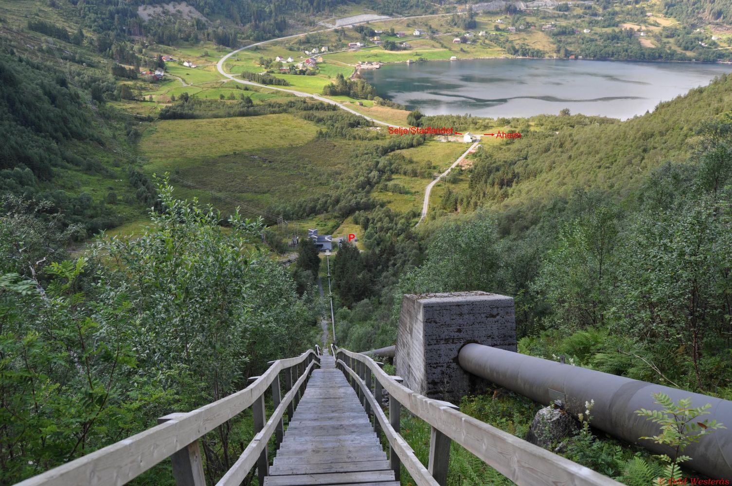
This spectacular trail takes you up a steep staircase with one thousand steps. If you have a fear of height, you might feel uncomfortable on this hike. The stairs begin below the power station in Kjødepollen (built in 1938) and climb steeply up along the pipeline from Lake Storevatnet (also called Skorgevatnet, but we are using the names in accordance with Vanylven Hiking Map). Some locals use the stairs for a workout. You can make this exercise very intense if you want. Follow the link below to see nice pictures of the stairs. http://westcoastpeaks.com/Peaks/heidane1.html 
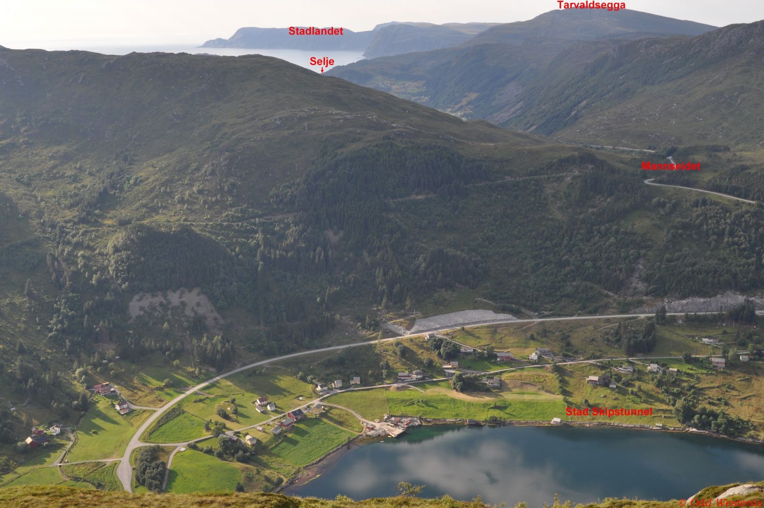
The stairs end at the height of about 340 m a.s.l. Continue walking up along a clear path to about 390 m a.s.l. where Lake Storevatnet becomes visible. From there, it is fairly easy to follow the marked path up to the top of Gorgehornet (517 m a.s.l.) where you will be rewarded with a beautiful view over Vanylvsfjorden and Stadlandet. You will also see the innermost area of the fjord where a part of the Stad Ship Tunnel is planned to be constructed. http://www.skipstunnel.no/

Route description

The trail starts at the power station in Kjødepollen, the innermost part of Vanylvsfjorden. The starting point of the trail is clearly signposted. You will first walk on a loose gravel/stone surface before reaching the stairs that are marked as solid gravel in the description of the surface. There are exactly 1000 steps, but they are not continuous. You will have to walk on a path between the sets of stairs, which is fairly easy. Once the stairs end, continue walking along a clearly defined path. There are ropes to help you overcome a couple of rocky outcrops which can be slippery. Once you leave the steep section behind you, you will see Storevatnet right in front of you. It is also signposted there. Follow the sign that points left toward Gorgehornet. The renaming section of the trail up to the top is marked and easy to follow. Once you are at the top, you will get a spectacular view over Vanylvsfjorden and Stadlandet. Follow the same route back. Alternatively, you can continue following the marked path to Lisjevatnet and further down to Skorge. This trail is also part of the Åheim Sports Association’s network of marked routes that continue toward Kyrnosa and down to Beksle, with the optional route from Kyrnosa toward Vaulsnipa, Nyken, Tusshornet and down to Åheim.The entire trail is within the county of Sogn og Fjordane, but it is described here on Morotur since Gorgehornet is one of the Åheim Sports Association’s trail destinations. If you walk down to Skorge, the endpoint of your hike will be on the Møre og Romsdal side of the county border.

Access and parking

In Åheim, turn off to FV620 in the direction of Stadlandet/Selje. You will reach Kjødepollen Bay in the innermost part of Vanylvsfjorden after 5.9 km. Turn left and drive up to the power station. You will see a sign for Tusentrinnstrappa by the county road. After 300 m, you will reach the power station with plenty of parking space. The trail is signposted from the car park, and you will start climbing toward Tusentrinnstrappa straight away. The car park at the start of the trail by the power station is well-maintained and free to use.
Hiking route
Red
Distance
3 km both ways
Elevation
460 m
Duration
1 t. 55 min.

Map route

Surface type Distance
Sti 2,1

Map

Hiking map: På tur i Vanylven (Eng. Hiking in Vanylven) – can be purchased at local shops and petrol stations in Vanylven Municipality.
Driving directions

API endpoints

Route data GeoJSON