Tusenårsvarden through Moldedalen
Molde
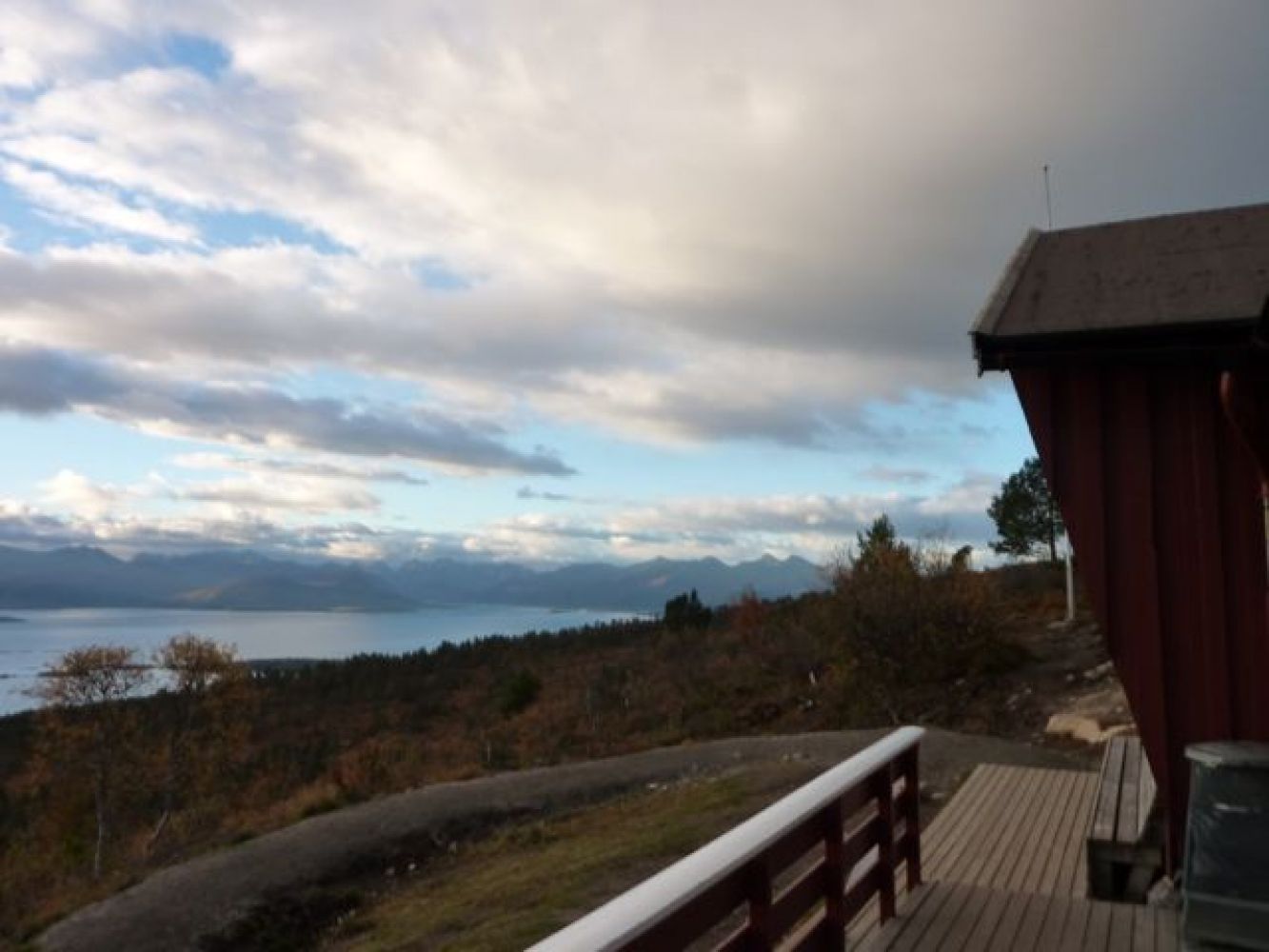
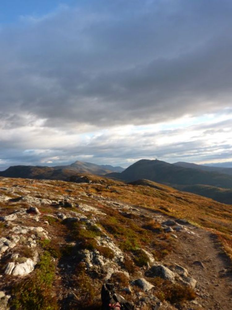
When you reach the Skihytta cabin, you should stop for a rest. You will have just crossed the tree line and can enjoy the view. Just before you reach Audunstjønna pond, you will be crossing a creek/river. This is the perfect place to stop for a sip of refreshing mountain water. If the weather is really warm, we recommend a dip in Auduntjønna. Once you've managed to climb all the way up to Tusenårsvarvden, you will have stupendous views of both land and sea. From here there is a superb trail winding eastward along the ridge. As a starting point
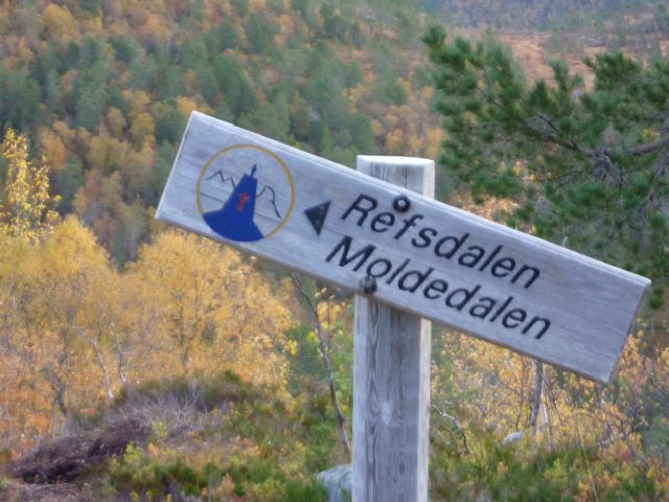
Follow the road up towards Varden until you reach Damefallet (parking area in this junction). From Damefallet, follow the trail and signs up to Skihytta (you can follow either the new or old trail). From Skihytta, follow the path to the northeast towards Auduntjønna. From here, you can see the Tusenårsvarden cairn to the east. Follow the path along the ridge on the south side of Auduntjønna until you come up to Tusenårsvarden. The last stretch is steep. Here the route continues eastward along the ridge. Once you get below the tree line, turn left at the sign Refsdalen/ Moldedalen. Follow the path to the marsh until you come down to the trail in Moldedalen. Follow this in a southwest direction until you get back to the starting point.
By Fjellbrudammen - free parking
Duration
4 t. 50 min.

| Surface type |
Distance |
| Sti |
2,5 |
If there has been a lot of rain, the path may be slippery. Hiking is best when the weather is dry.
Route map Molde and Fræna - Topographic map series - M711 Blad 1220 I Hustad
 Driving directions
 Route data
GeoJSON
Route data
GeoJSON