Torvika – Lyngfjellhola – Løvollsnipa – Løvold, route 65
Vanylven
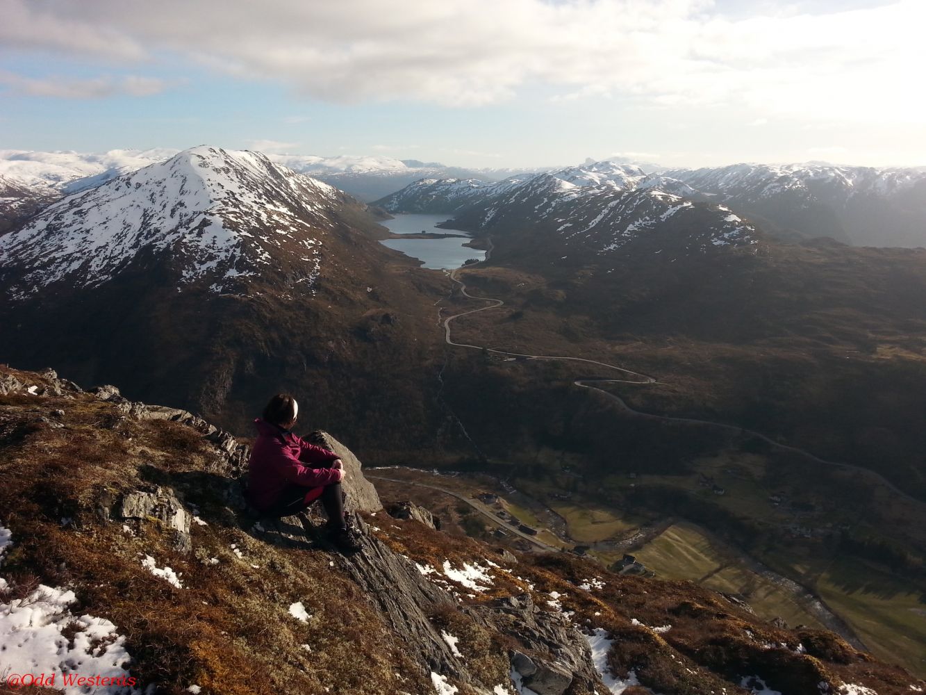
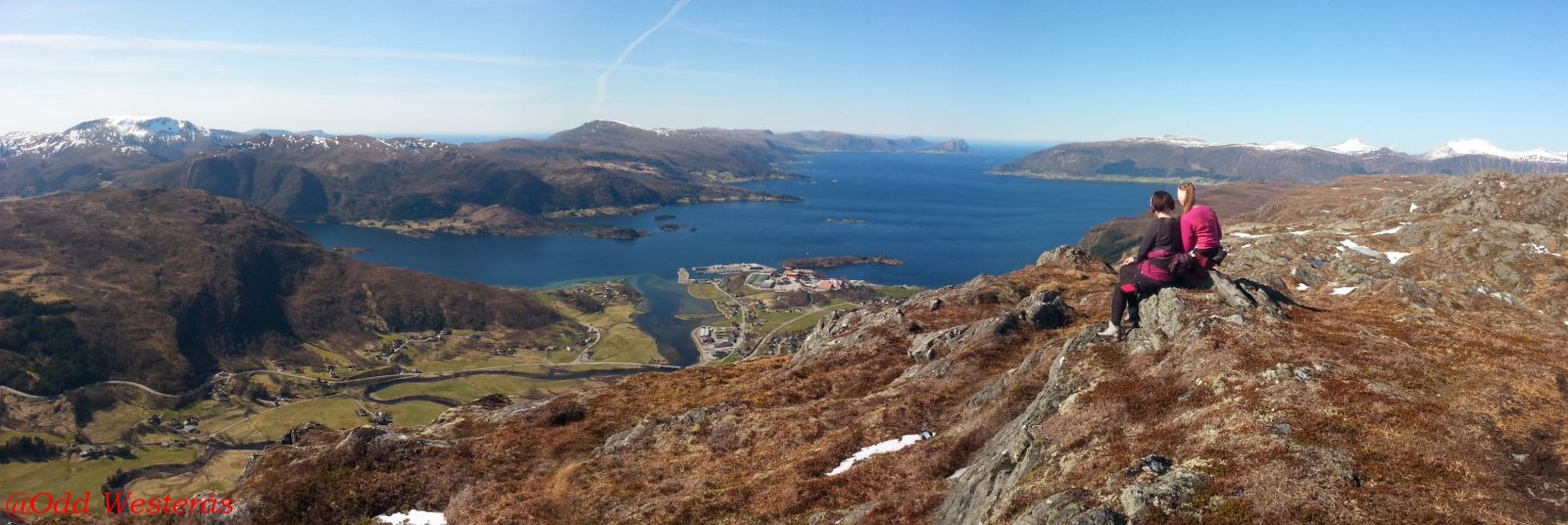
Løvollsnipa is an amazing viewing point which you can reach by walking from both Løvold (100 m past the Åheim Stadium) or the Torvik residential area in Åheim via Lyngfjellhola. This description is for the trail with the start at the residential area in Åheim, via Lyngfjellhola to Løvollsnipa, and down to Løvold/the Åheim Stadium. You will enjoy a spectacular view both south, west toward Stadt, and over Vanylvsfjorden almost the entire time. We also recommend taking a detour down to Røvehammaren.
You will come down to the county road between Åheim and Gusdalen 100 metres south of the Åheim Stadium. You can use the car park by the football pitch, which is well-maintained and free of charge, if you want to walk up to Løvollsnipa from there or leave your car until you come back down after having completed the entire trail.
The trail at the top of the residential area in Åheim. Walk up the temporary road toward the large water storage tank which supplies water to the residential area. Alternatively, you can drive for 200 m up this road and park there. The path begins after about 600 m of walking on a gravel surface. There is a signposted intersection of paths there. Take the path to the right which is signposted to Løvollsnipa. The entire trail is marked so it should be relatively easy to find the route. Begin by walking north before turning south and going up toward the plateau called Lyngfjellhola. The path runs along the mountain edge with an amazing view. About 1.5 km from the starting point, you will reach the Åheim Sports Association’s fitness trail destination. The path continues southeast and turns north up a small plateau after about 2 km. From there, it goes right up toward Mount Lyngfjellet. You will come up to Lyngfjellet between two large cairns which are clearly visible from the village. There is a signposted intersection of paths there. At this point, you are about 2.3 km away from the start. Turn right at the intersection and walk over a small river/brook that runs from Lake Lomvatnet. The trail continues south along the edge where you can enjoy a beautiful view and fairly easy terrain. Cross a small river after 2.6 km and keep slightly to the east while walking toward Lake Lisjesvartevatnet which is about 2.9 km away from the starting point. Walk over the river and begin the final ascent to the hilltop. You will reach the top of Løvollsnipa Hill after 3.6 km. The Åheim Sports Association set up their fitness trail post here as well. There are two routes from Løvollsnipa in addition to the one that runs from Lyngfjellhola. One of the routes goes east around Lake Nipevatna and along the eastern side of Lake Svartevatnet. Here, you can walk north toward Storehornet or east toward Syltehornet/Skjevatnet. To walk down to Løvold/the Åheim Stadium, follow the route south. You will cross a brook about 700 m after the hilltop and pass the Røyrneselva (Røraneselva) River after another 200 m. If you turn east here, you will see a stone that looks like it is balancing on top of another stone. Continue walking down to the road between Åheim and Gusdalen. The distance from Løvollsnipa down to the road is about 2 km. The entire trail is about 5.6 km long.There are stones on some sections of the trail which may become slippery especially in wet weather.
The trail starts at the top of Torvikfeltet, the residential area in Åheim, along the temporary road that goes up to the water storage tank. The beginning of that road is signposted. You can also drive for a couple of hundred metres up this road and park your car there. From the junction in Åheim, drive north along FV61 for 1.1 km before turning right up to the residential area. After 400–500 m, you can either turn left, drive for 100 m and park there or continue straight ahead for another 200–300 m, turn left onto the temporary road and park your car 200 m further up the road.
At the starting point of the trail, you can park your car either 200 m up the temporary road or at the car park furthest in Torvikfeltet. Free parking.
There is also a well-maintained free car park by the Åheim Stadium if you want to start walking from there or leave your car there until you come back down.
Duration
4 t. 10 min.

Sesong
Spring, Summer, Autumn
Signage
Both signed and marked
| Surface type |
Distance |
| Sti |
9,6 |
Hiking map: På tur i Vanylven (Eng. Hiking in Vanylven) – can be purchased at local shops and petrol stations in Vanylven Municipality.
 Driving directions
 Route data
GeoJSON
Route data
GeoJSON