This is a nice hike that everyone can enjoy. The path is both bike- and stroller-friendly.
Route description
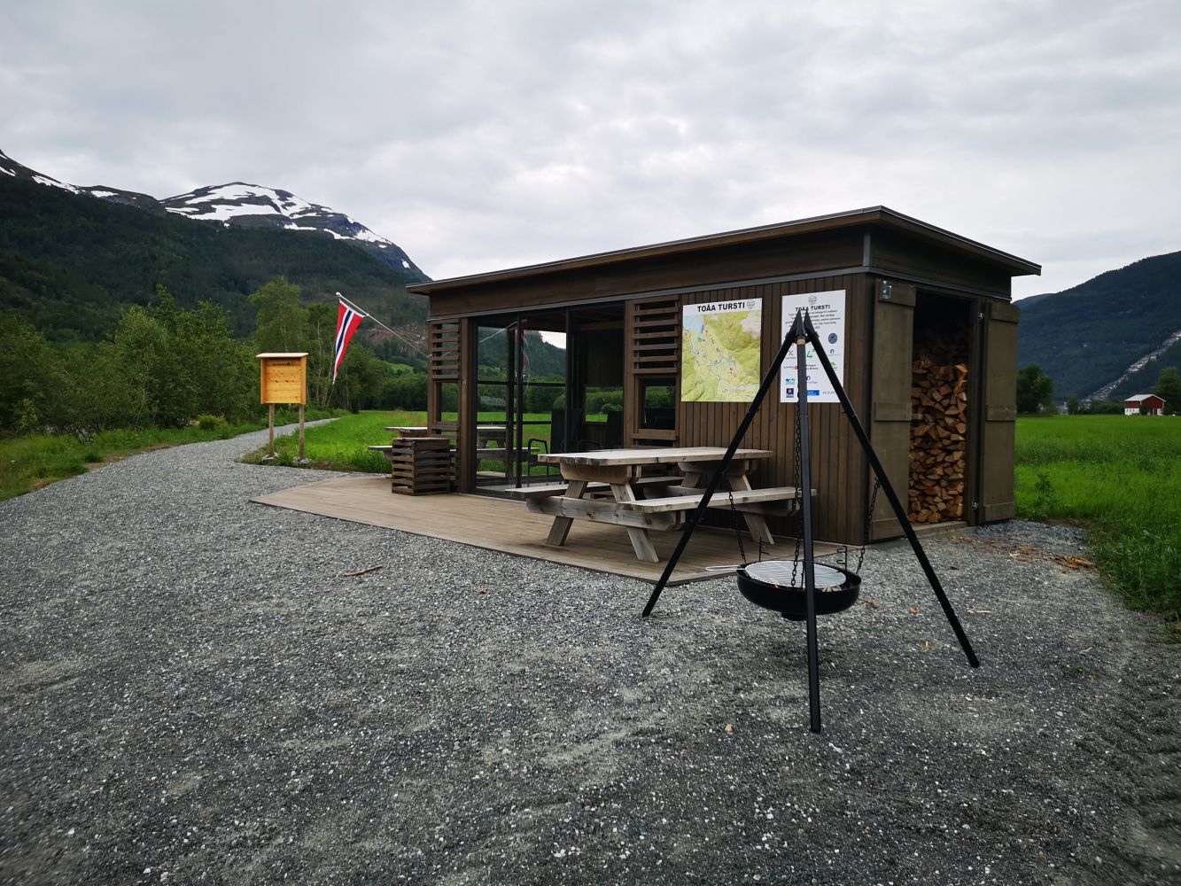
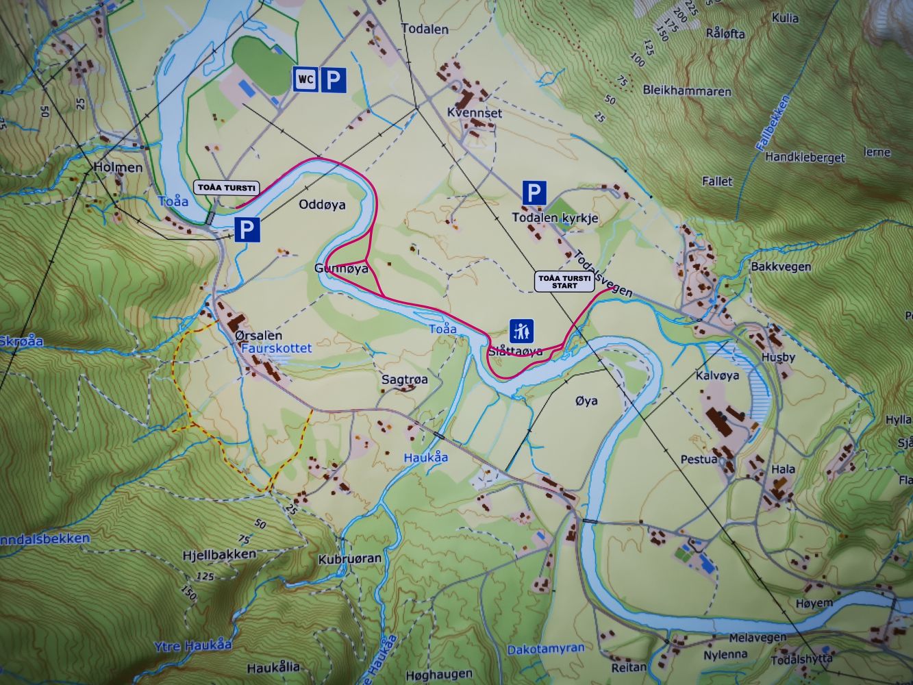
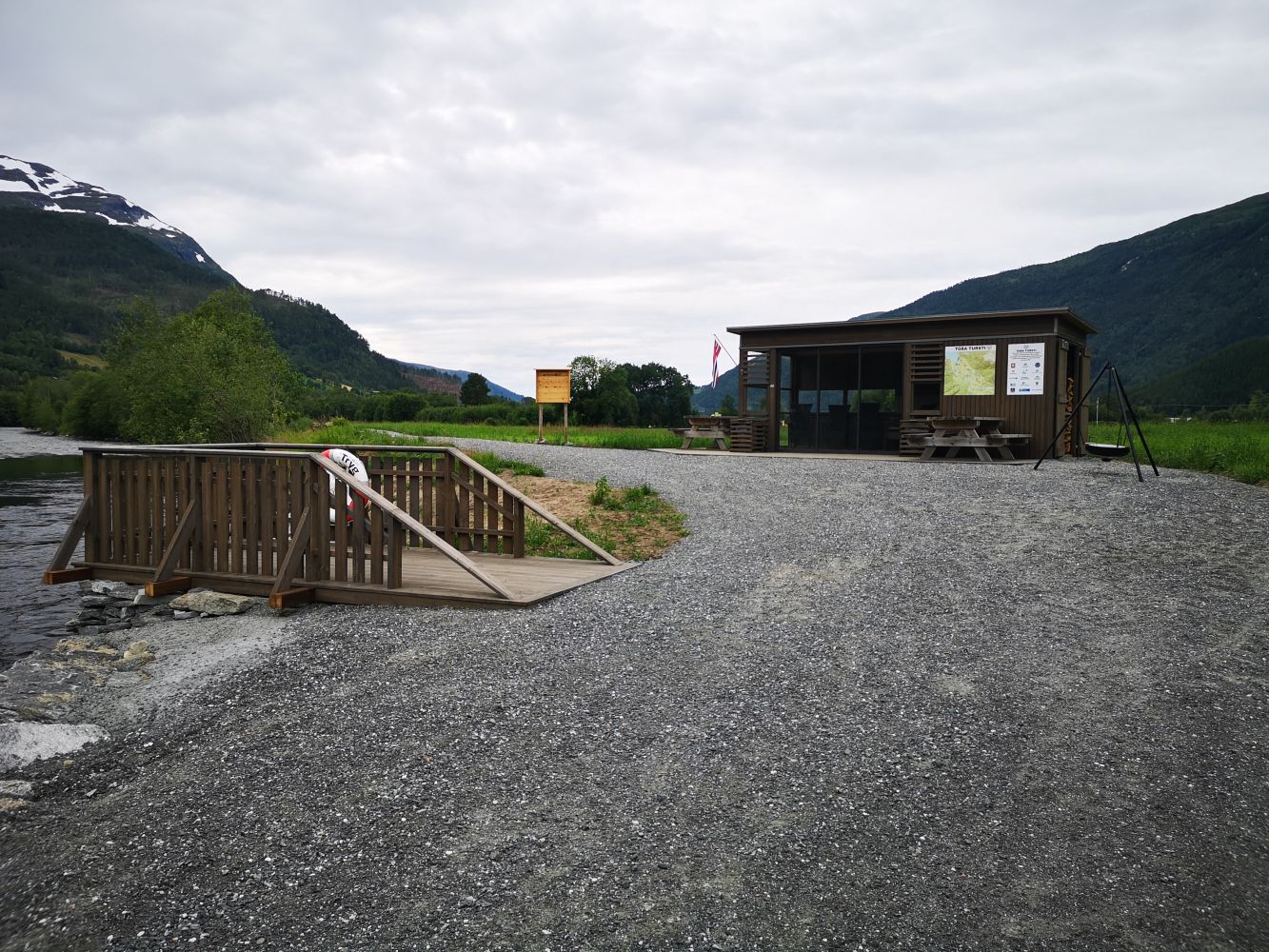
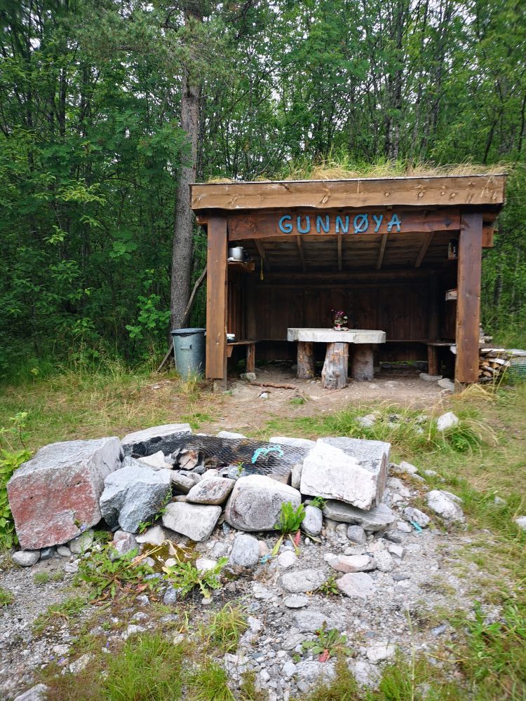
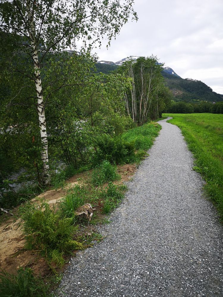
Follow the wide gravel path from the car park. You will first come across a new gapahuk shelter and a wheelchair accessible fishing ramp. There is also a sitting area and a barbecue place here. Gunnøya with the trail postbox is to be found further along the path. You will see a small path that branches off towards the river and leads you to Gunnøya. The trail postbox is inside the gapahuk shelter. To follow the rest of the hiking trail, return to the main path and walk westwards in the direction of the Todalsfjorden. The path ends by the bridge on Bordholmvegen Road. From here, you can follow the same route back to the car park.
Arrival and parking
Drive from Matkroken in Todalen in the direction of Kårvatn. Park your car a couple of hundred metres after passing Todalen Church (please see the map).
Hiking route
Green
Distance
1,60 km one way
Elevation
20 m
Duration
50 min.
Sesong
Winter, Spring, Summer, Autumn
Highest Point
16 masl
Signage
Signed
Map route
Surface type
Distance
Sti
1,60
Map
The Toåa Hiking Trail has a Facebook page.
The Todalen Sports Association (Todalen IL) set up a postbox with a trail journal in Gunnøya.