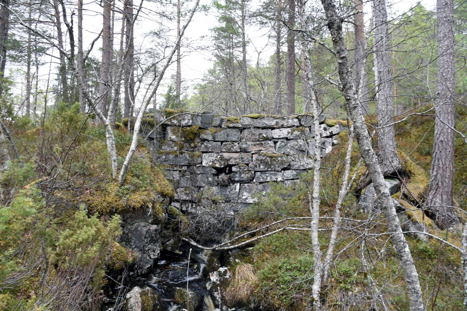
The trail postbox is placed along “Fjellvegen” (“the Mountain Way”) which is a gravel hiking trail that goes across the island of Sekken. Teppinga is an old dam located around midway between the residential area on the northern side of the island (where the ferry terminal is) and the southern side where you will find the Samsen convenience store, Bygdetunet Museum and Sekken Education Centre. There is not much of a fjord or mountain view on this trail, but you will walk across a wonderful forest terrain which is also a great experience. You can also take a detour to “Utsikten” to the west of Oppsalen. A 700-metre walk will take you there from the forest road which goes down to the village.
If you get to Sekken Island by ferry, just follow the road straight ahead for one kilometre until you come to a junction. From there, walk up Sollibøvegen Road towards Sekkesetra, follow the sign pointing to the shooting range, and you will find a hiking trail there. Follow this trail for about one kilometre to Teppinga. There are rest areas with benches near Teppinga. From there, you can walk the same way back. It is also possible to continue walking following the hiking trail down to the village on the southern side of the island. But keep in mind that you need to arrange the transportation back to the ferry terminal.
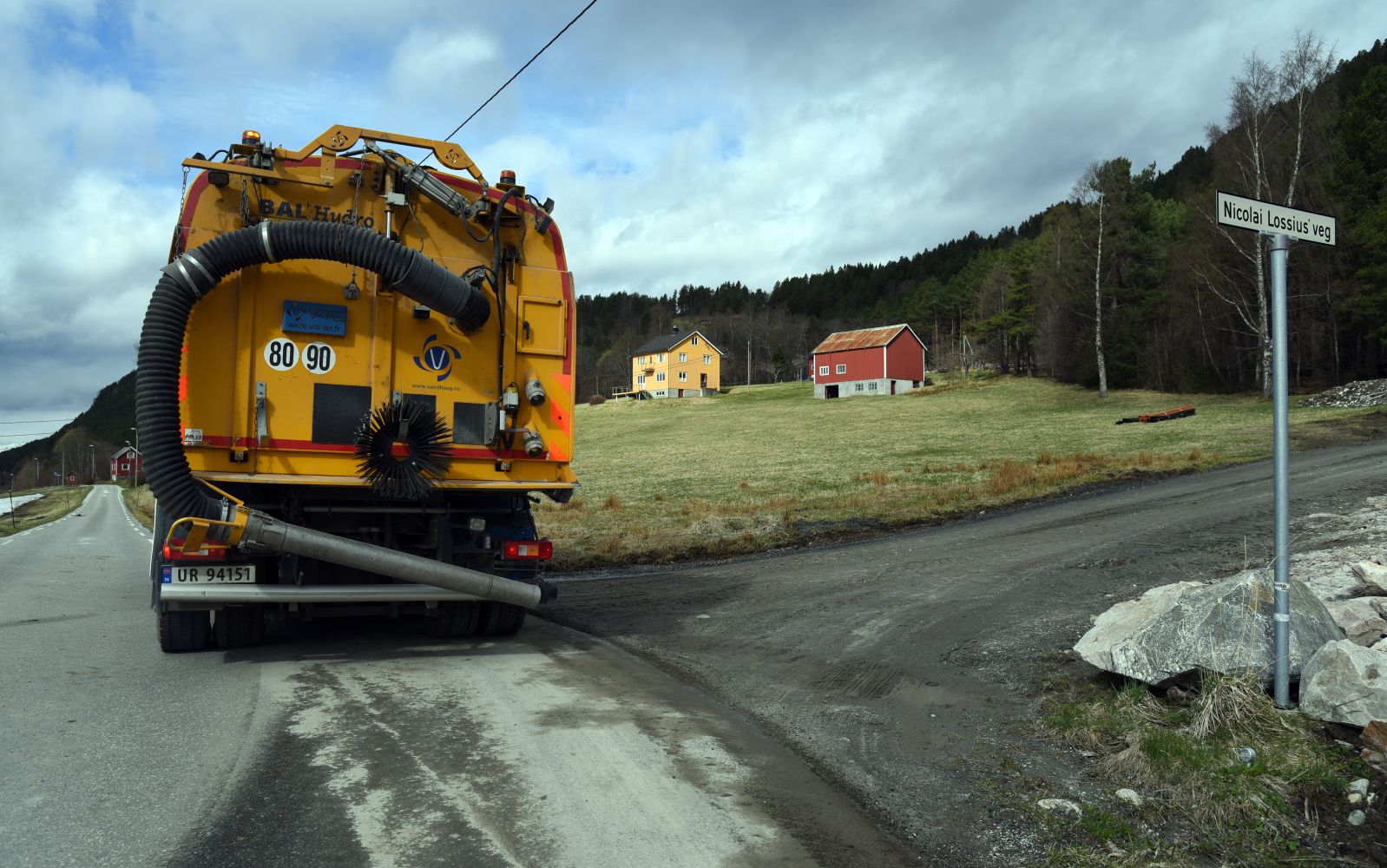
The trail starts either from the ferry terminal or from the junction of Håkon Herdebreis Road and Nicolai Lossius Road. If you have any questions while planning this trail or when you are on Sekken Island, please call us at 975 91 319.
You will easily get to the starting point of the trail if you walk from the ferry terminal. If you go by car and are ready to drive for a little while, you will find the car park near the shooting range on the northern side of the island or next to the county road on the southern side. There is a bus connection between the ferry terminal and Vestadstranda that fits most of the ferry arrivals until 4.40 p.m. If you walk from the ferry terminal and end up on the southern side of the island, you can take a bus back to the ferry terminal from there. Alternatively, you can start your trail from Vestad and walk up Nicolai Lossius Road.
Duration
3 t. 0 min

Sesong
Spring, Summer, Autumn
Signage
No signage or markings
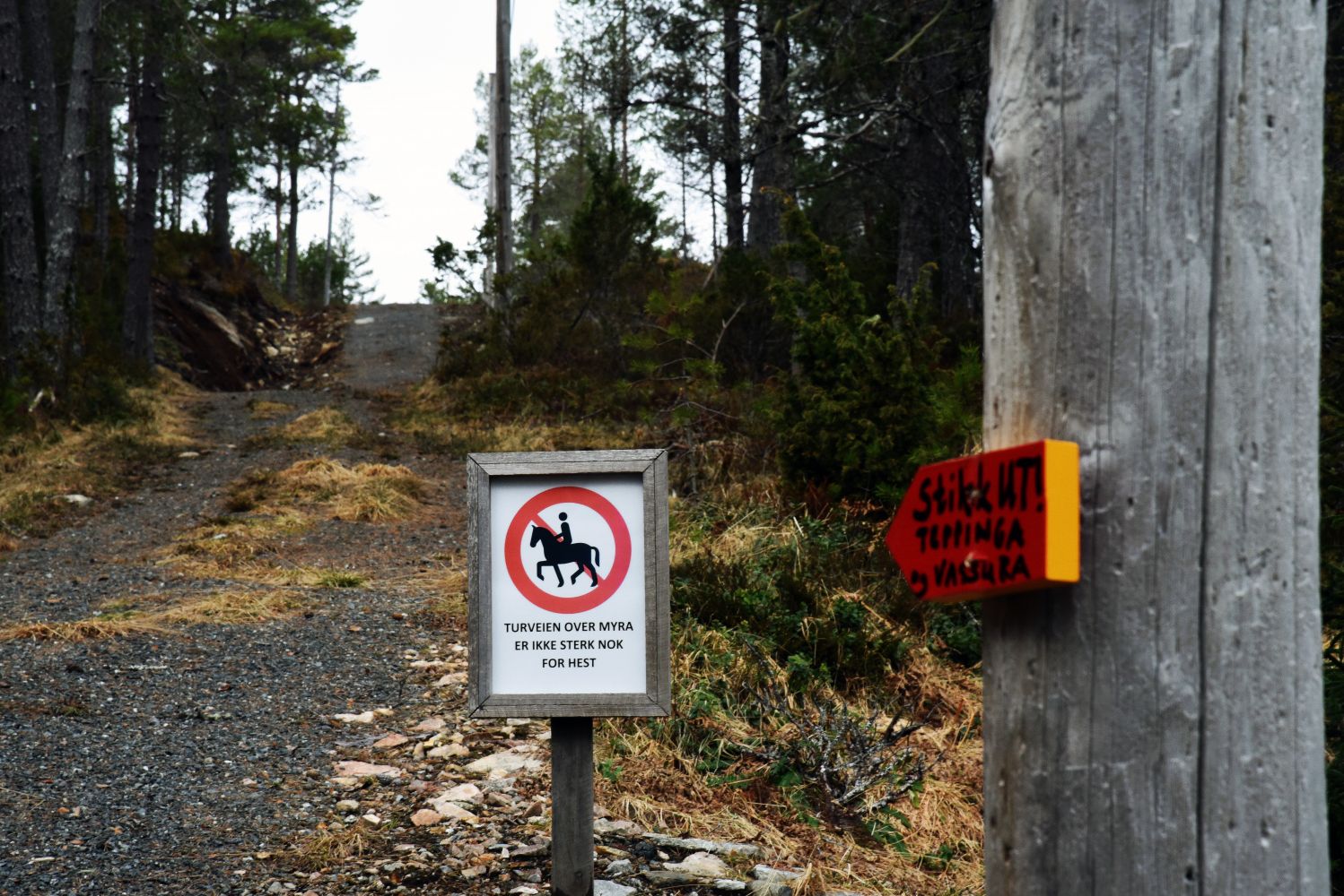
If you are in a mood for a longer walk, you can follow the path towards the trail postbox at the top of Vassura. Go back to the shooting range, follow the path and then take the country road to Sollibøen. From there, the path is waymarked up to Vassura. Have a look at the Vassura trail description and follow that trail in the opposite direction.
 Driving directions
 Route data
GeoJSON
Route data
GeoJSON