Tennevatnet – Norddalen in Syvde – Route 47
Vanylven
The trail to Lake Tennevatnet can be used for both a short and relaxed afternoon walk or as a fitness trail for those who want to challenge themselves with a steep uphill climb. The trail follows a well-prepared but steep tractor road.
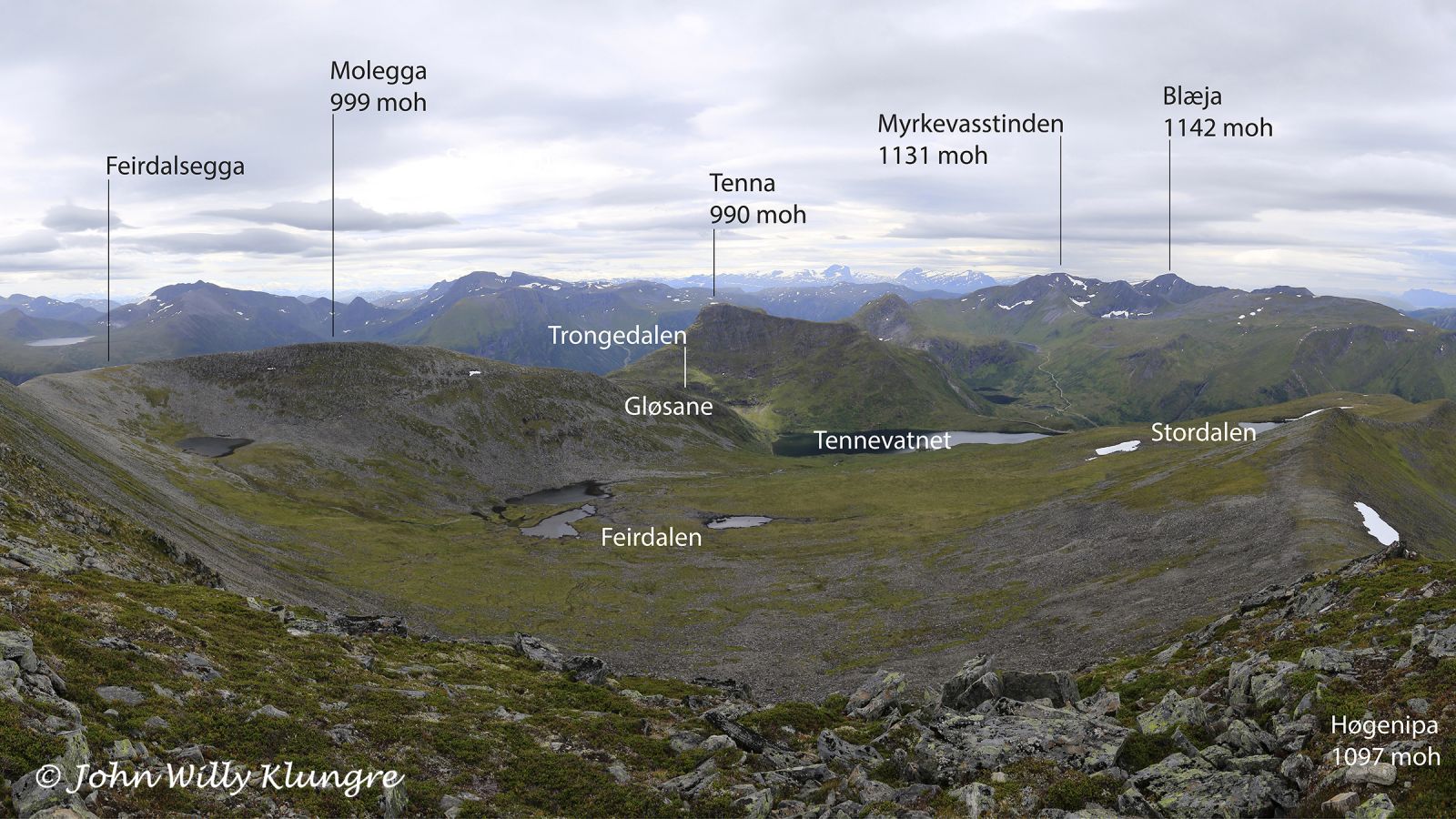
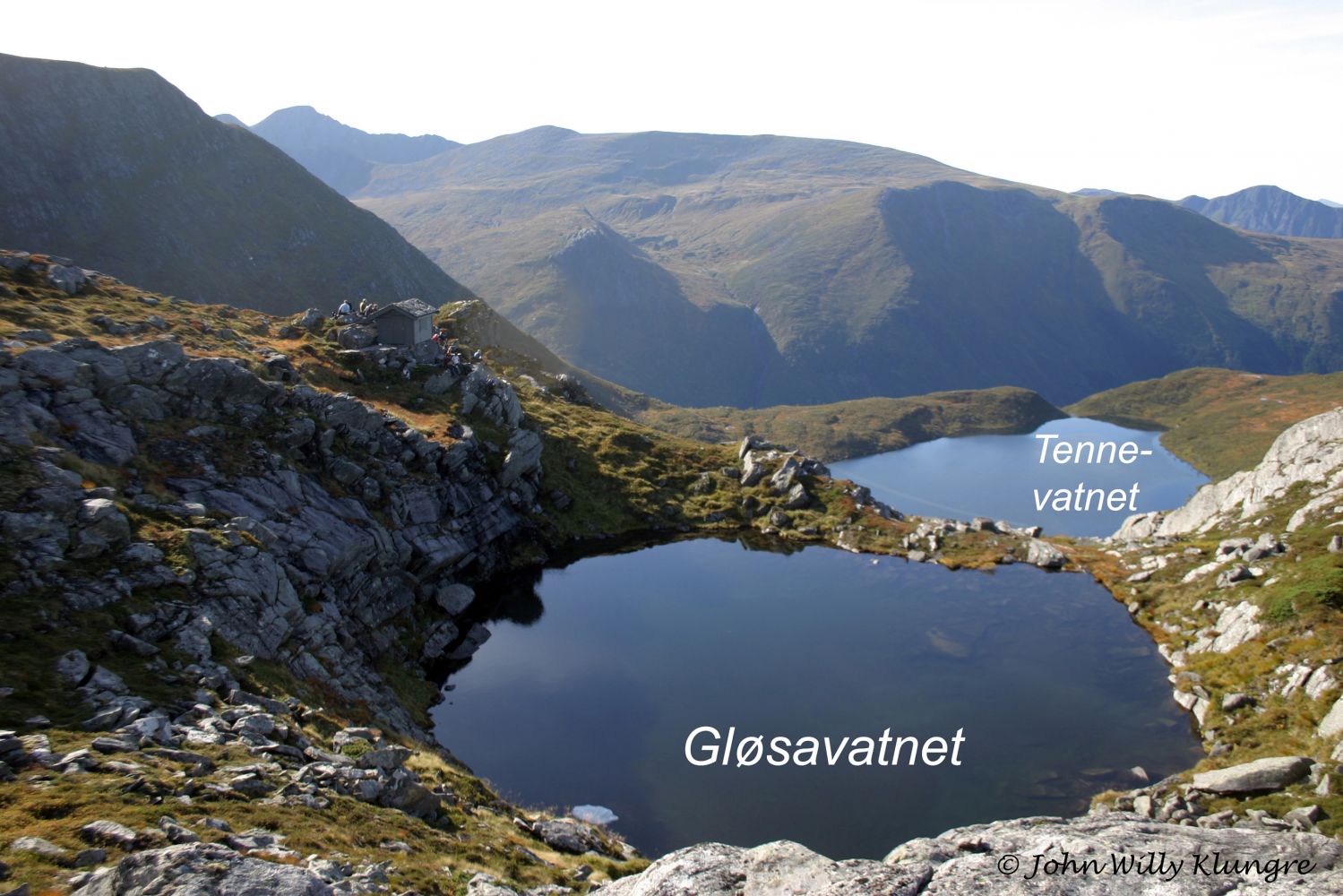
The way this route is placed in the terrain makes it possible to enjoy the evening sun longer than in the surrounding areas, so it can be a nice evening hike in both spring and autumn. Lake Tennevatnet is also a good starting point for other hikes, including a circular route via Høgenipa. The GPS track ends at the highest point of the road. This is where a trail postbox is located. From here, you can walk further. A clearly defined path will take you from the end of the tractor road up to the boathouse on the north side of the river mouth at Lake Tennevatnet where the Nordal Krins association has a trail postbox. The highest point of the road is about 550 m a.s.l.
The road to Lake Tennevatnet climbs in hairpin turns through the steep terrain, which provides for a good workout. The distance from the starting point to the highest point of the road is about 1300 metres, and from there to the boathouse on the northwest side of the lake about 400 metres. The road is steep all the way to the top, where it flattens out. You will see the signs for Molegga, Hovlida, and Høgenipa at the top of the tractor road. There are no marked routes from Lake Tennevatnet, but we can recommend a circular walk via Høgenipa. You can follow a well-defined path from the river mouth at Lake Tennevatnet as it takes you along the top of Store Blåfjellet. This can be a good starting point for the hike to Høgenipa. The easiest way to find a path to Trongdalen and further towards Molegga is to walk from the direction of Trongedalen.
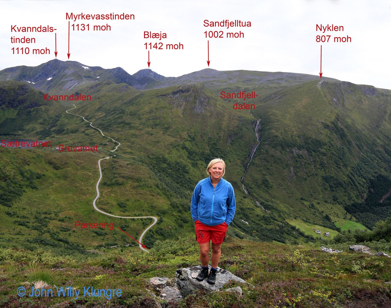
Drive from Syvde to Norddalen to get to the starting point of the trail in Kvanndalen. You will see the sign for Norddalen 300 metres northwest of the church in Syvde. Drive along the Norddalen Valley until it ends. Continue along the mountain road that begins at the end of the valley. After the start of the gravel road, park your car just before bridge no. 2. There is enough space to both turn and park here. The starting point of the trail is marked with a sign.
There is plenty of parking space at the beginning of the trail.
Duration
1 t. 15 min.

Sesong
Spring, Summer, Autumn
| Surface type |
Distance |
| Grus |
1,3 |
The main road from the valley up the mountain was built in connection with the development of the electric power industry in the 1970s. The road is maintained by the developer, and there is no toll fee. At the very end of the road, you will find the Kvanndalen Valley and Lake Kvanndalsvatnet. The level of water in this lake is regulated. The neighbouring valley in the west is regulated in a far more gentle way. Far down in the valley, the water is collected and directed into a tunnel to Kvanndalen. The mountain area around Lake Tennevatnet and the area surrounding Nordalsfjellet are used as a pasture for grazing animals.
Hiking map: På tur i Vanylven (Eng. Hiking in Vanylven) – can be purchased at local shops and petrol stations in Vanylven Municipality.
 Driving directions
 Route data
GeoJSON
Route data
GeoJSON