Sukkertoppen (314 m a.s.l.) from Osane
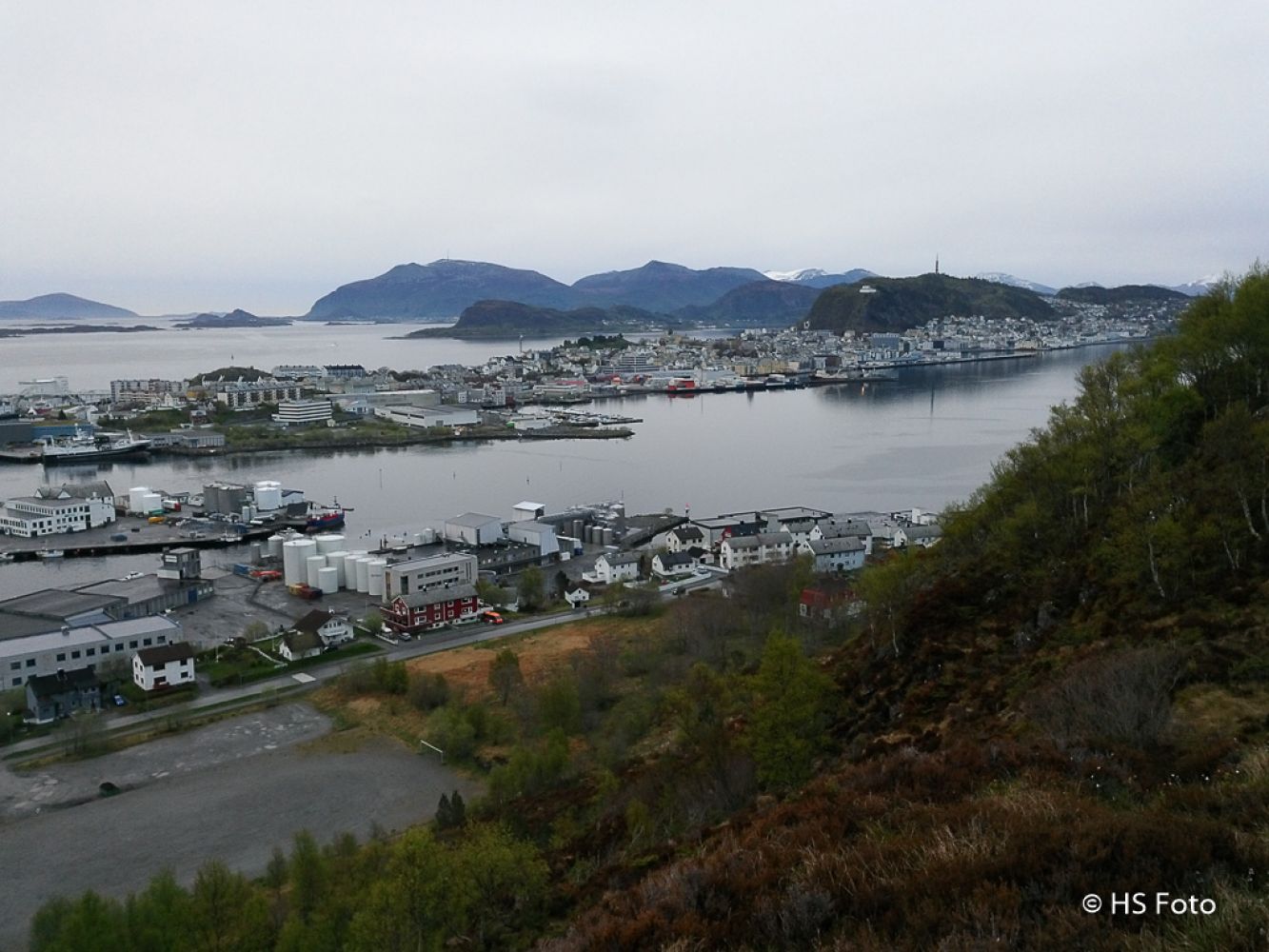
Ålesund
This trail is relatively dry compared to the routes from Hessa.There is only one wet section on a rock ledge at a height of about 90 metres above sea level. Otherwise, there are only occasional damp areas along this trail.
In the old days, everyone on the island of Aspøya had their own route to Sukkertoppen. This trail follows one of these routes. People are said to have rowed across the strait and walked from the seashore right up the mountain.
If you walk up to Sukkertoppen along the ridge from the roundabout in Hessaskaret, you can spot several paths which run north and down towards Kleivane and Osane.Some are animal tracks while others are some old paths trodden by people.
This hike may be a little hard because you will walk over moss and heathland. Not everyone is used to this type of surface and it can be tiring.You will get to see Skarbøvika from an unusual angle and enjoy the view north the entire time because there are no particular forest sections on this route.
This trail meets the northernmost of the two main paths, which run westwards along the ridge of Sukkertoppen, 100–150 metres east from where you come up from the Hessa school.
The starting point and destination are the same in the description and the GPS file.
The hike starts from the gravel area in Osane.About half way through this area, you can clearly see a “gateway” that heads south towards the steep mountain. Follow this “road” up to the mountainside. Turn right at a height of about 60 metres. Here, you will see a large stone which marks the fork in the path.
Follow the mountainside, continue along the northern side for a couple of metres, and you will soon reach a small mountain ridge. Head south and keep walking further up along a stream.
You will soon reach a rock ledge at about 90 m a.s.l. which offers a scenic view.You can choose between several alternative routes from here. You can walk eastwards and up along the forest until you reach the path at the top. In that case, you will meet the main path approximately where the path from Hessa climbs up to the ridge.
The route I chose goes to the right, westwards, towards a “ridge” that looks a little easier and covers open terrain.The surface here may be a little wet, but I kept my feet dry in low hiking shoes.
Once you come up to the “ridge”, just follow it for as long as you can see past a small cleft further up the mountain. Keep to the right after this cleft and aim for a large stone that lies further to the southwest. This stone lies just next to the path you should take.
You are now on one of the most common paths to Sukkertoppen. Follow this path all the way to the cairn at the top.
There is no need to stop here. I recommend taking a walk further along the ridge. After a couple of hundred metres, you will see “Olavs-støtta”, a stone that, according to local folklore, was erected in the memory of Saint Olaf (995-1030) after his visit to Skarbøvika in 1027, before he rowed towards Valldal and passed over the mountain to Sweden, over the Baltic Sea, and to Russia. He and his Viking army had military exercises here. They returned in 1030, and he died in the Battle of Stiklestad.
Another legend is that scouts were sent to Olsfjellet/Berntfjellet in Skarbøvika because the view in the directions where the enemies could come from is at least as good as from Sukkertoppen.
Back to our hike:
Follow the same route back but turn north down a path called Rayaråsa after the radio mast. This path leads you to Osane. Here, there are driveway markers with reflectors along the trail as well as reflectors on the trees in the forest further down the mountainside. The upper section of the trail from the mast to the forest can be damp. The final section of the path after you come out of the forest can also be a little damp.
The trail follows a gravel road for the last couple of metres down to the gravel area in Osane.
The trail starts at the gravel area in Osane, Skarbøvika.
Drive from Ålesund over the Steinvåg Bridge. Follow the sign that reads “Atlanterhavsparken” from the town.
Follow the main road after the Steinvåg Bridge until you reach Skarbøvik Secondary School, which will be on your right-hand side within a 90-degree turn at the end of Skarbøvikgata Street.
40 metres after this turn, you will see a large open area on your right, with a small driveway.
Drive in here.
The car park is marked with a sign that reads “P Osane” in the GPX file that you can download.
Park your car at the large gravel area in Osane, Skarbøvika marked as “P Osane” in the GPX file.
Duration
1 t. 30 min.

Signage
No signage or markings
| Surface type |
Distance |
| Sti |
1,9 |
There is a bus stop next to the gravel area as well as by Skarbøvik Secondary School.
Please check
http://www.177mr.no/
At the time of writing, the trail to Sukkertoppen is not marked. The route is easy to find, but the hike can be demanding.
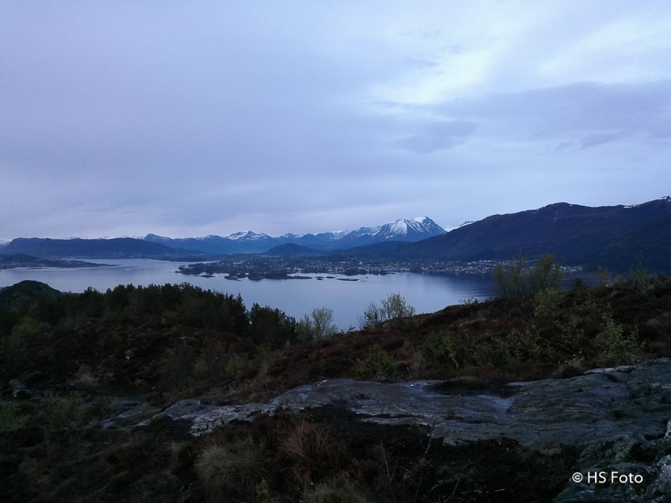
You will have a great view the entire time until you come down to the forest by following Rayaråsa (the path from the mast down to Osane).
Ålesund map series M711 Sheet 1119 I and Ålesund hiking map series
 Driving directions
 Route data
GeoJSON
Route data
GeoJSON