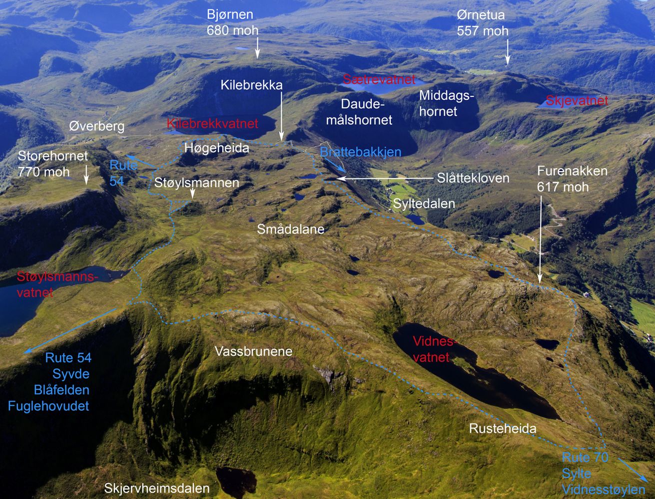
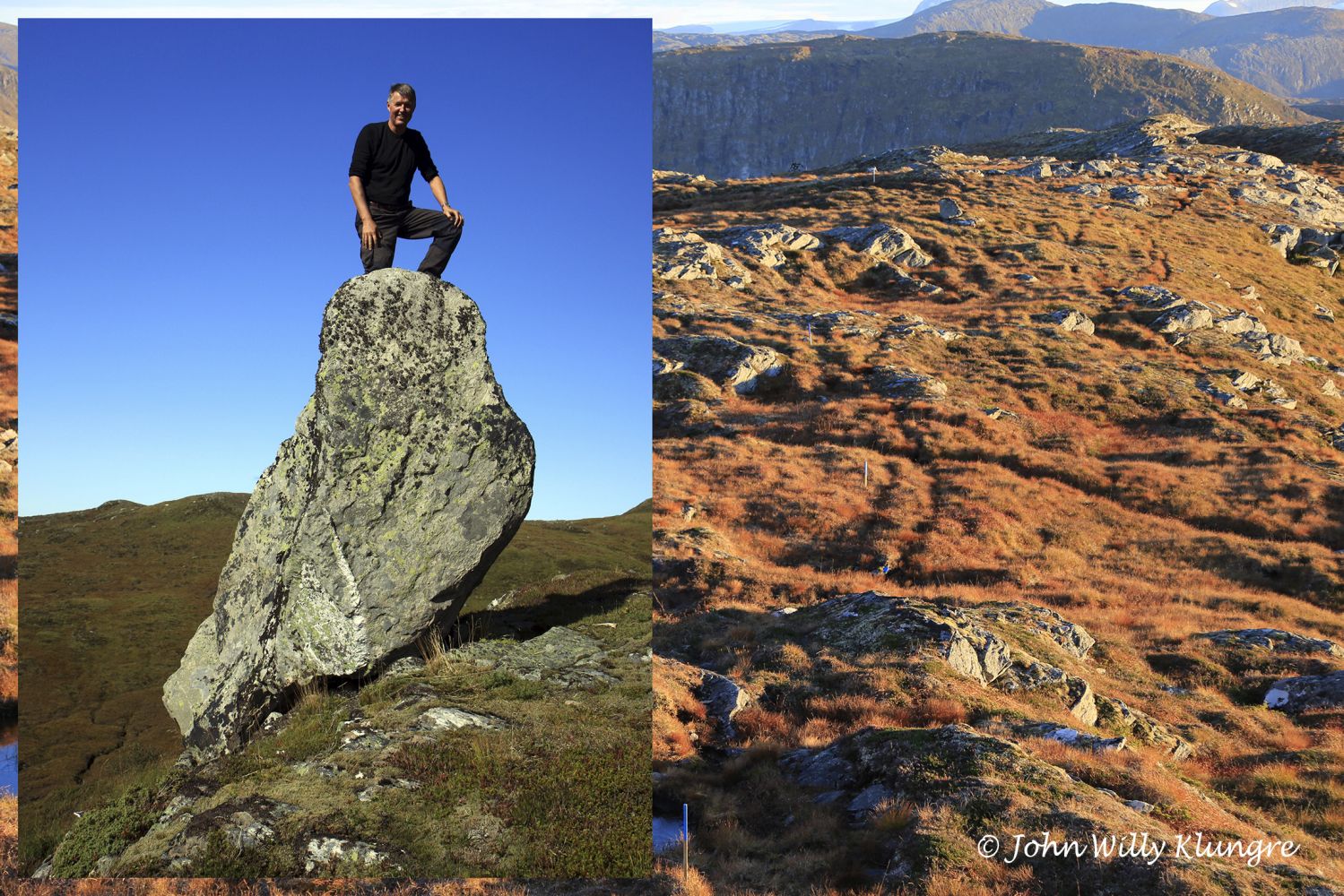
From the starting point in Kilebrekka, the surface is solid and easy to walk all the way to Høgeheida. Continue walking from Høgeheida until you reach the junction on Route 54 (
http://mrfylke.no/Morotur/Turar/Syvde-OEverberg-rute-54). Turn left at the junction and walk past Lake Raudegrødvatnet. About 100 metres after the lake, you will see a tree root with a hole in it. Many people like to take pictures here with their faces framed by the tree root. 400 metres after the root, you will come to Støylsmannen, a rock left behind by glaciers in the Ice Age. The rock is believed to have fallen from a mountain and stayed on the ice. When the ice melted at the end of the Ice Age, the rock was accidentally placed vertically on the edge of a small cliff where it is standing safe and stable today, 10–12 thousand years later. Støylsmannen stands on a small ridge away from the marked route, but it should be easy to find. The route on the map and the GPS track below go via Støylsmannen. Just after passing the river mouth at Lake Støylsmannsvatnet, you will reach the highest point of the trail by the cairn on Støylsmannsheida at 659 m a.s.l. From here, turn left down to Lake Vidnesvatnet and continue via Furenakken back to Kilebrekka. You will get scenic views from both Furenakken and Slåttekloven where you can look almost vertically down to the Syltedalen Valley.