Slagneshornet from Slagnes, route 80
Vanylven
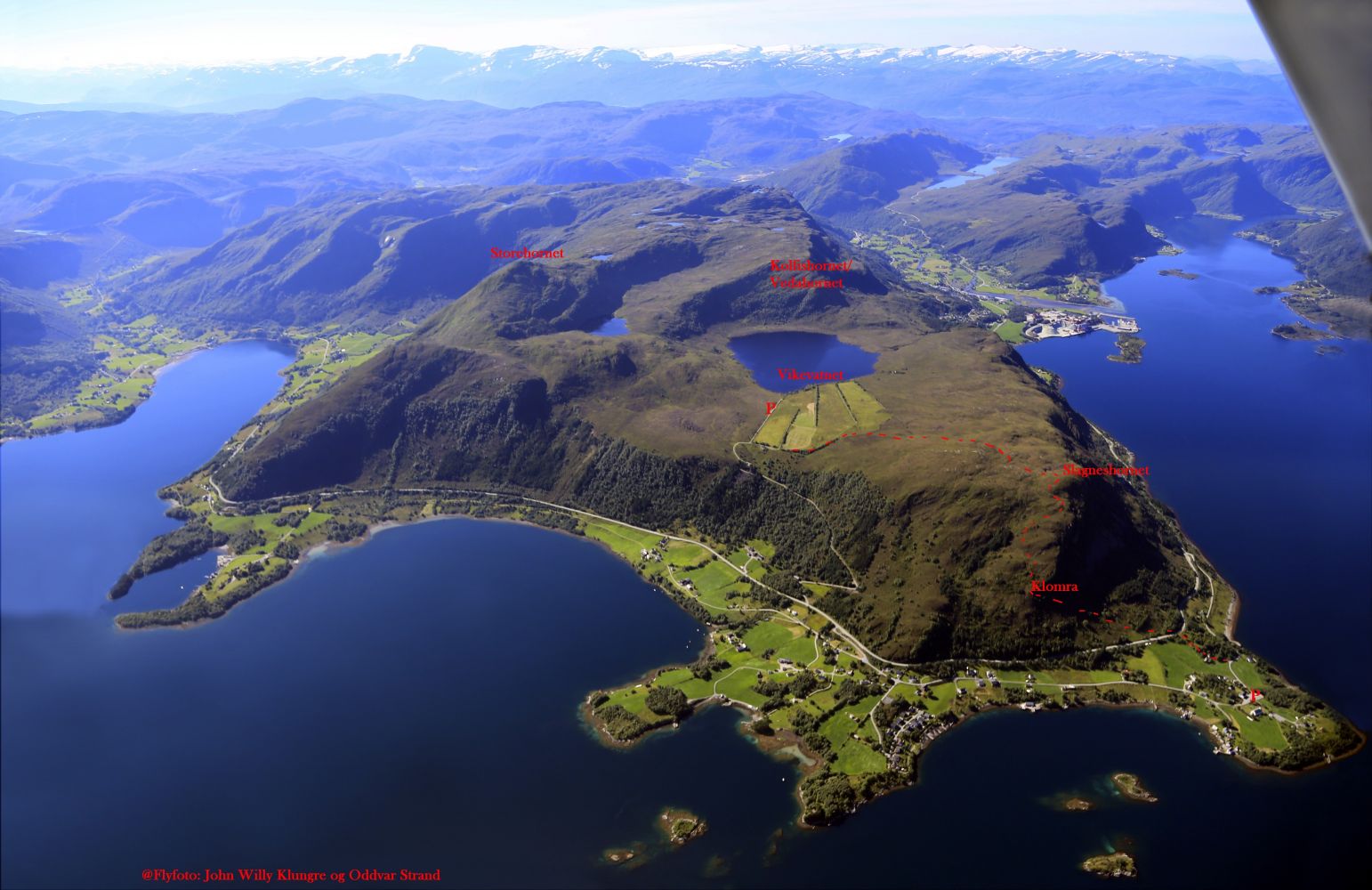
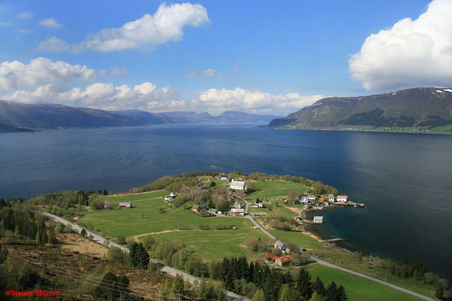
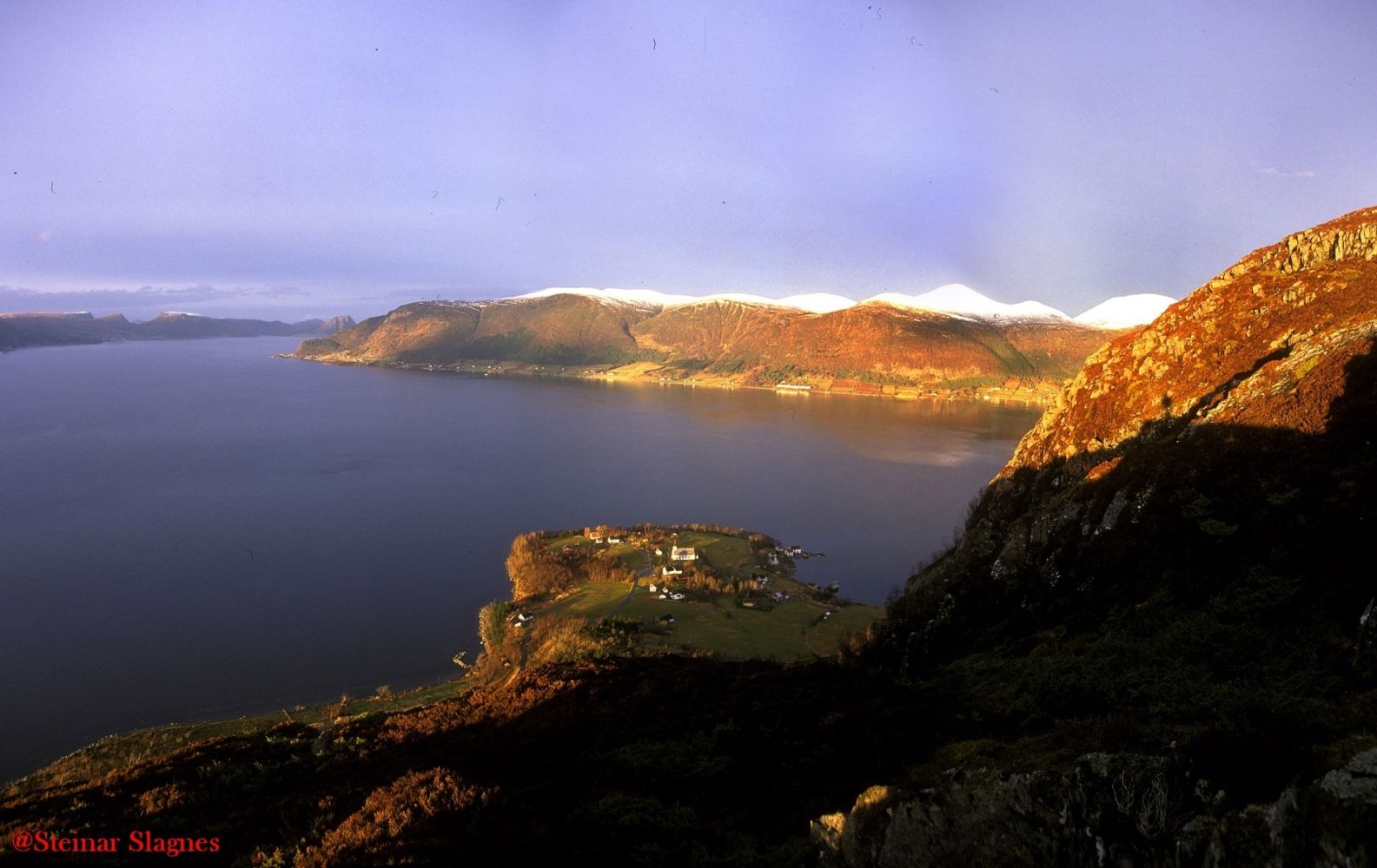
This scenic loop trail runs from the church in Slagnes up to Slagneshornet, a viewing point where you will get a panoramic view over Vanylvsfjorden. You will then walk through fairly easy terrain towards a mountain road that will take you back down.
From the car park by Vanylven Church, walk south for 200 m before turning off to the left up to a group of old farms. Walk along the edge of the forest up to County Road 61 (FV61). Cross the road. Be careful because the place is close to a bend in the road. Walk east once you are on the other side of FV61. From here, the path is marked all the way up to the mountain road near Lake Vikevatnet. After about 400 m, you will reach a small cliff called Klomra. Here, the path turns further south in the direction of Slagneshornet. The distance from the car park by the church to Slagneshornet is about 1.7 km. Once you are up on Slagneshornet, you can enjoy the amazing panoramic view both south, north, and west over Vanylvsfjorden and toward Stadlandet. From Slagneshornet, walk further in the direction of Vikevatnet. The path here is not as good, but it is well marked and easy to follow. Almost at the highest point of the trail, you will walk past a spring. Once you reach the mountain road, follow it down to County Road 61. Walk across FV61 and follow the municipal road back to the church.
For an easier hiking option, you can drive up the toll road to Vikafjellet, park there, and follow the marked path to Slagneshornet.
Slagnes lies about 4 km north of Åheim. There is a signposted exit road from FV61 both north and south of Slagnes. Park your car by Vanylven Church.
The car park at the start of the trail by the church in Slagnes is well-maintained and free to use.
Duration
3 t. 50 min.

Sesong
Spring, Summer, Autumn
Signage
Both signed and marked
| Surface type |
Distance |
| Asfalt |
1,7 |
| Sti |
1,7 |
Hiking map: På tur i Vanylven (Eng. Hiking in Vanylven) – can be purchased at local shops and petrol stations in Vanylven Municipality.
 Driving directions
 Route data
GeoJSON
Route data
GeoJSON