Skåratinden, route 30
Vanylven
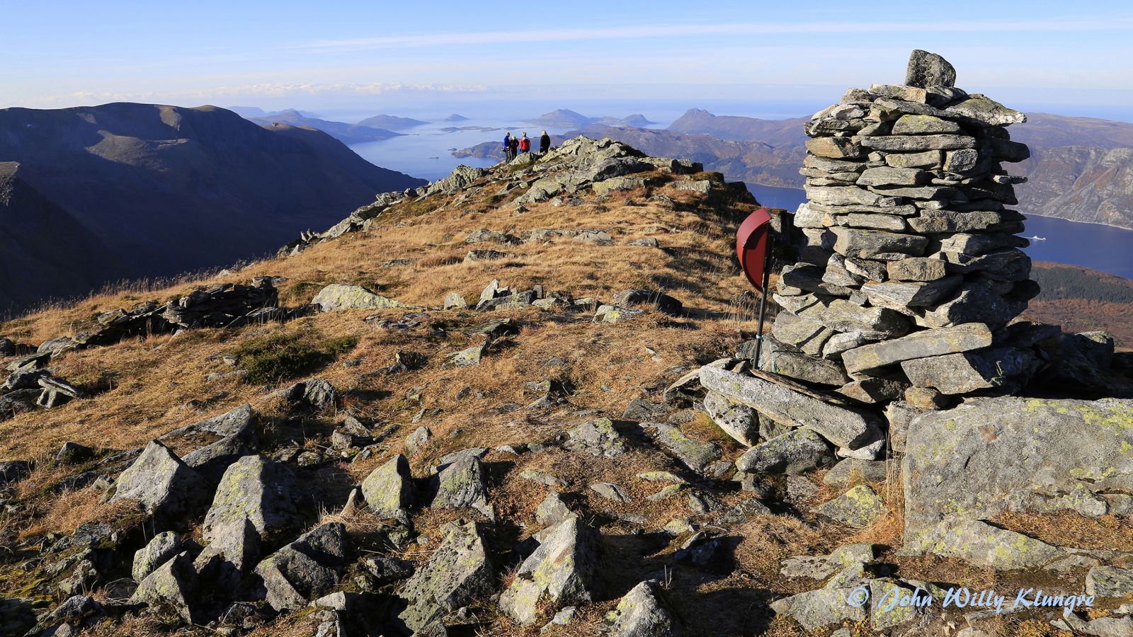
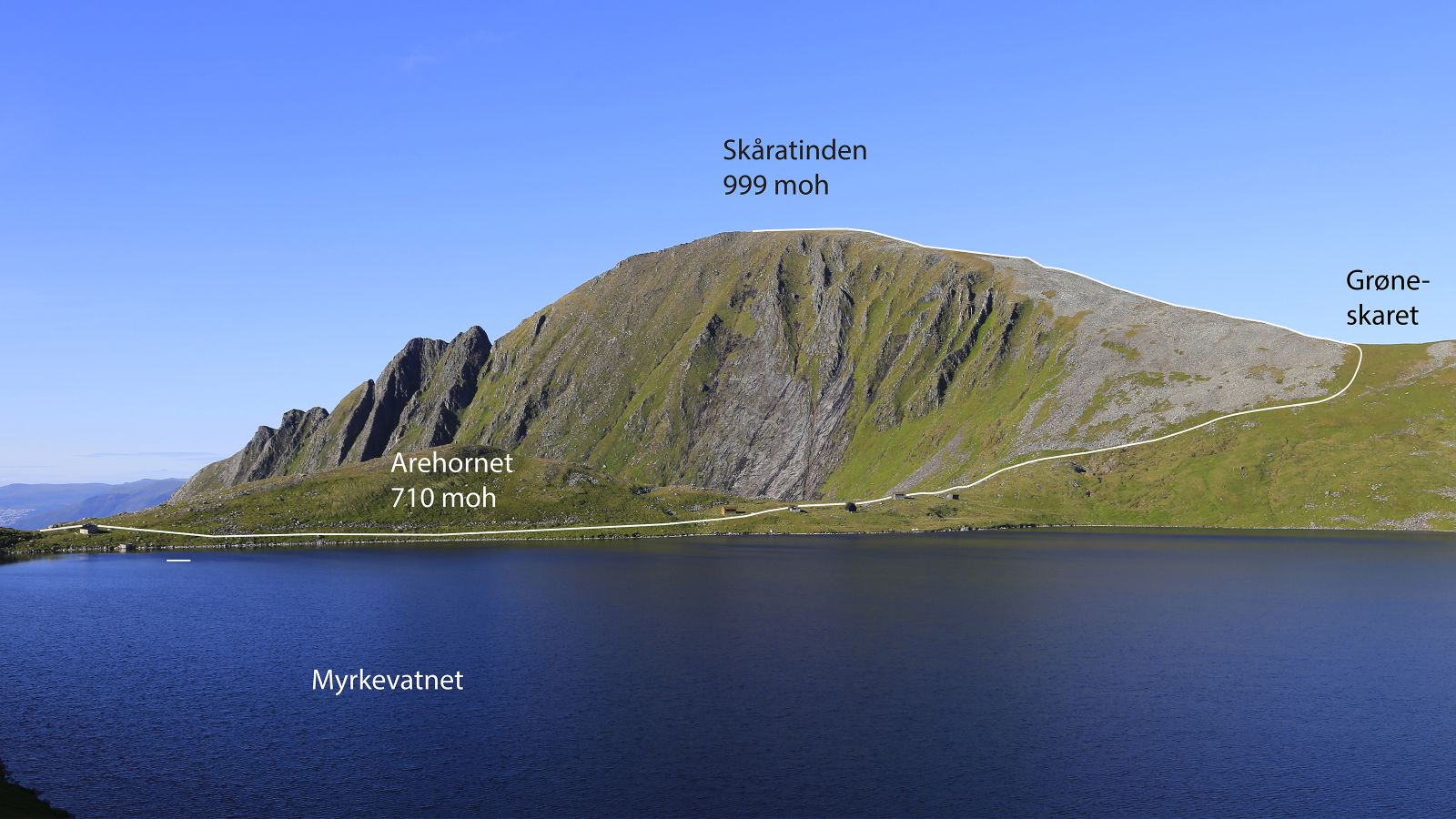
This scenic hiking trail takes you up one of the characteristic Rovde mountains. Skåratinden is a relatively free-standing mountain in Rovde with an amazing view in all directions. The mountaintop is clearly visible from both Ulsteinvik and Volda as well as from parts of the other neighbouring municipalities. The mountain is easily and quickly accessible from the road that goes up to 535 m a.s.l. Already after about 100 altitude metres, you will get a view of the ocean which will widen out as you ascend further. The trail covers easy and mostly dry terrain.
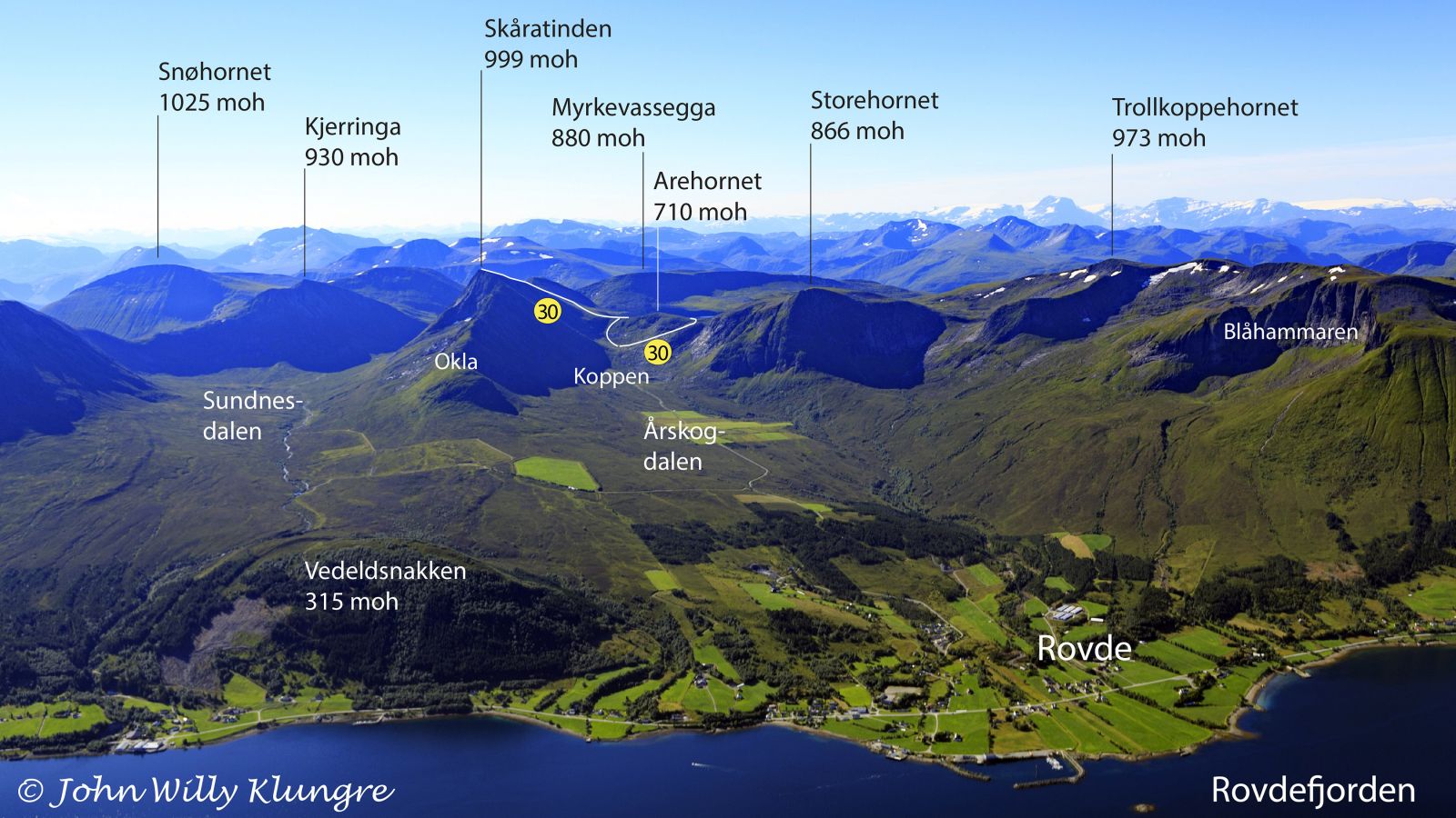
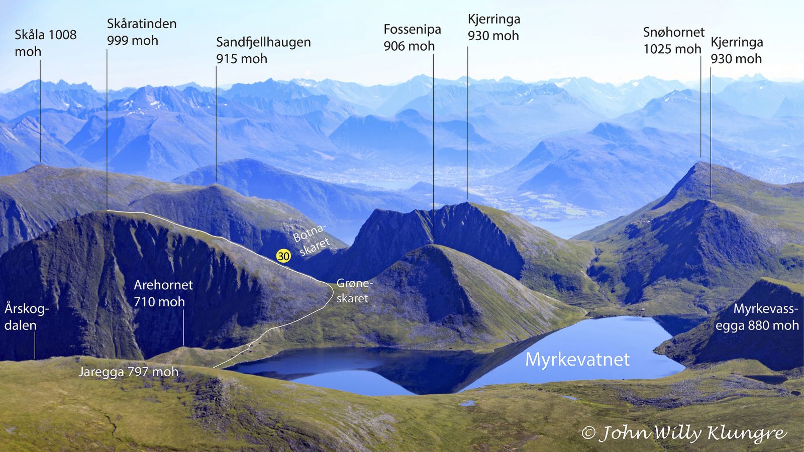
The elongated mountain is primarily formed by valley glaciers that created the valleys Sundnesdalen and Årskogdalen on each side of the mountain. The mountain was most probably named Skåratinden because of the many clefts (Nor. skar or skor) which are clearly visible on its surface. Some maps use the spelling Skoratinden instead of Skåratinden. Cirque glaciers have also actively formed the terrain, and the cirque at the furthest point of the Årskogdalen Valley is also created by this type of glacier. In this part of the country, a cirque is often referred to as “ein kopp” (Eng. “a cup”) which is why the cup-shaped depression in the Årskogdalen Valley is called Årskogkoppen (Eng. “Årskog’s cup”). Climbing up the side of Årskogkoppen, often simply referred to as Koppen, is the fastest and steepest route to Lake Myrkevatnet.
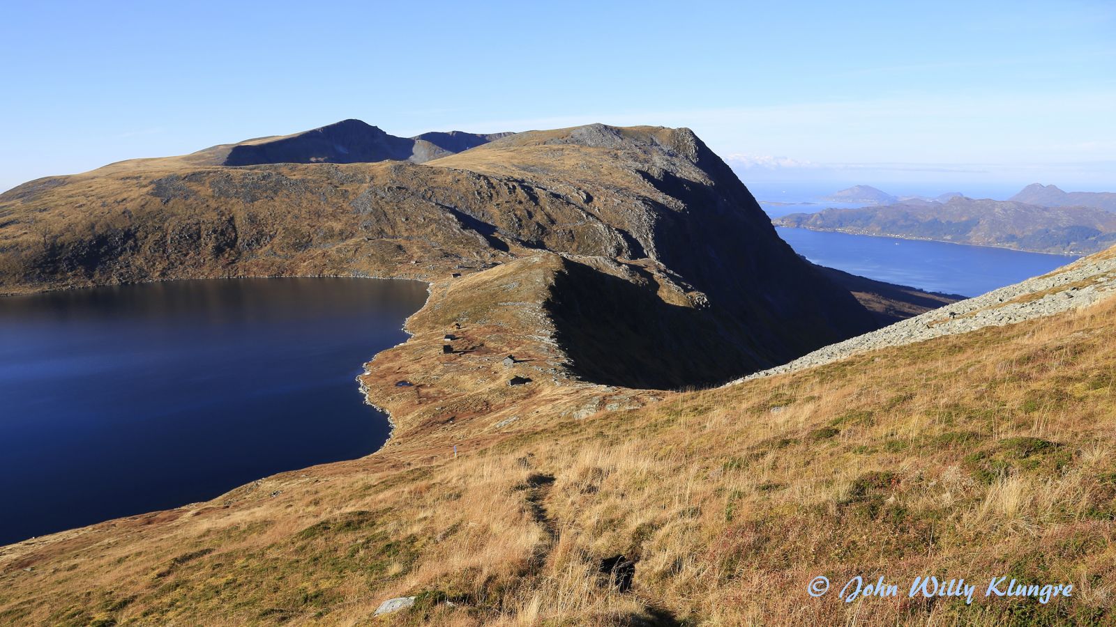
The trail starts at the end of the road in Årskogdalen and runs up to Lake Myrkevatnet. From there, it continues up the mountain ridge to the top of Mount Skåratinden. The shortest route up to Myrkevatnet is climbing up Koppen. A longer and more moderate route follows the road around Riddarbu (Riddarvegane). The GPS file and the map below show the shortest route up and the more gradual descent down from Myrkevatnet.
You will see a sign for Årskogdalen by the main road in Rovde, about 150 metres west of the COOP shop. A boom gate where you need to pay a toll fee of NOK 30 (as of 1.07.2017) is located at about 120 m a.s.l. Drive up to the end of this toll road that climbs up to 535 m a.s.l.
Leave your car at the well-maintained car park at the end of the road in Årskogdalen.
Duration
3 t. 35 min.

Sesong
Spring, Summer, Autumn
| Surface type |
Distance |
| Sti |
5 |
Vanylven hiking map is sold at local shops and petrol stations in Vanylven Municipality.
 Driving directions
 Route data
GeoJSON
Route data
GeoJSON