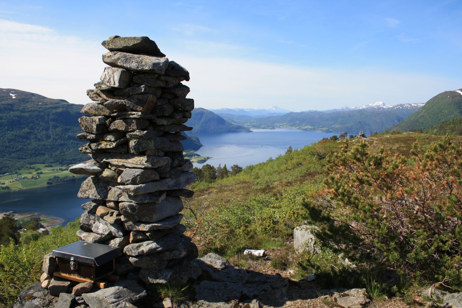
This hiking trail follows a forest road and leads to a cairn called Settemsvarden at the hilltop. Take a seat on a picnic bench next to the cairn and have a snack while enjoying the view of fjord and mountains.
From the car park in Settem, follow the marked path that is operated by the Kristiansund and Nordmøre Trekking Association (KNT) in the direction of the Jutulbu cabin. This path is part of Fjordruta (Eng. The Fjord Route). The hiking route runs up a forest road. About halfway through the hill, you can choose whether to keep to the forest road or take a shortcut along a steeper path that follows the hiking route. This path returns to the forest road further up the hill so you will find your way to the cairn regardless of the alternative you choose. Just before the edge of the hill, follow the path as it turns and climbs up to the hilltop. Take another turn at the sign that points in the direction of Settemsvarden.
Drive to Settemsdalen in Surnadal Municipality and take the turn to Bøfjorden. Drive for about 4 km until you reach the junction in Settem. Leave your car at the signposted car park in front of the commercial building on the right side of the road. This is the start of the KNT path to the Jutulbu cabin, which is part of Fjordruta. Follow this path.