Norsk

Around Sandfjelldalen, route 49 C and D – loop trail from Kvanndalen – Nordalen – Syvde

Vanylven

The trail at a glance

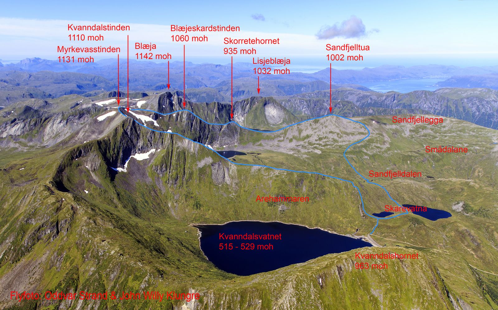
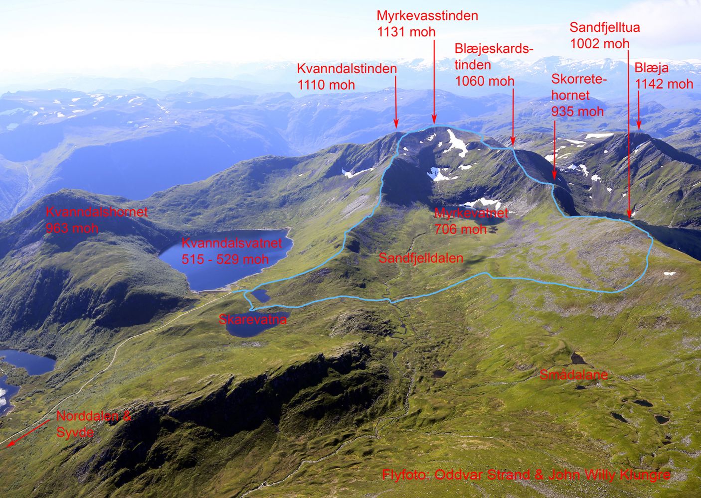
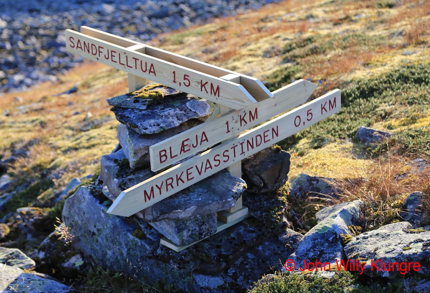
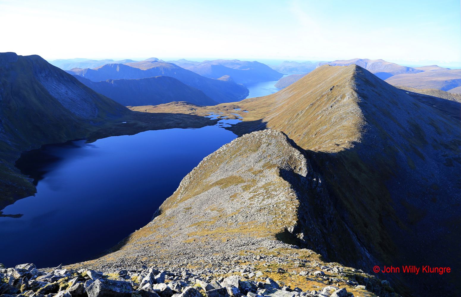
This scenic loop trail takes you to several mountaintops that rise to over 1000 m a.s.l. You will walk through open and gentle terrain and enjoy wide and lofty views over the Sunnmørsalpane mountain range, the mountains in Nordfjord, and the ocean. With the starting point at the height of 530 m a.s.l., you will ascend quickly and easily. The entire loop trail is marked with blue paint, and both intersections of paths are signposted. This trail is a combination of routes 49 C and 49 D, and it runs through both mountaintops, Myrkevasstinden and Sandfjelltua. If you have time, you could also visit Blæja, the highest mountain in Vanylven Municipality that rises to 1142 metres above sea level. Another possibility is to finish your hike with a dip in one of the many small lakes in the valleys north of Sandfjelltua. The trail runs around the Sandfjelldalen Valley which has very little evidence of human activity, except for the farm animals that graze here. The most prominent traces of human activity are to be found further down the valley where the river is directed into the tunnel that goes through the mountain to the reservoir in Kvanndalen. You can see the reservoir and the dam in Kvanndalen right at the start of the trail, but it does not take long before you enter the untouched nature. Lake Myrkevatnet lies at the furthest point of the Sandfjelldalen Valley. You can see a very clear terminal moraine at the forefront of the lake, and if you consider that the snow remains in the cirque behind the lake the entire summer and until early autumn, you may conclude that there was a cirque glacier in the area during the Little Ice Age a couple of hundred years ago. Before you go hiking around Sandfjelldalen, it could be useful to read about route 49 C to Myrkevasstinden at http://mrfylke.no/Morotur/Turar/Myrkevasstinden-rute-49-C-fraa-Kvanndalen-til-Myrkevasstinden and route 49 D to Sandfjelltua at http://mrfylke.no/Morotur/Turar/Sandfjelltua-fraa-Kvanndalen-i-Nordalen-rute-49d

Route description

The easiest hiking option for many people would be to walk up Myrkevasstinden first and then continue to Sandfjelltua. The path to Myrkevasstinden is solid and dry the entire time which makes it easier to follow it uphill. There is also a soft grassy slope further down when you descend Sandfjelltua. Most people find it easier to walk down rather than up this slope. If you choose to follow this route, the crossing of the river in Sandfjelldalen will be at the end of your hike, which would make things easier in case you get your feet wet while crossing the river. The trails to Myrkevasstinden and Sandfjelltua are both graded blue. The loop trail around Sandfjelldalen also includes the section between Myrkevasstinden and Sandfjelltua which is the steepest of the entire trail, and it also involves some easy mountain climbing on the northern side of Skorretehornet. This is the reason why the loop trail is graded red while the two other trails are blue. However, there is not much difference in the level of difficulty between the loop trail and the two other trails. If you prefer to do the easy mountain climbing section on your way up, it would be best for you to go to Sandfjelltua first and then visit Myrkevasstinden.

Access and parking

Drive from Syvde to Norddalen to get to the starting point of the trail in Kvanndalen. You will see the sign for Norddalen 300 metres northwest of the church in Syvde. Drive along the Norddalen Valley until it ends. Then drive along the mountain road that begins at the end of the valley until the road ends by the dam at the Kvanndalen power station. There is plenty of parking space at the car park next to the dam. From the starting point in Kvanndalen, follow the path that will quickly take you up to the two Skarevatna lakes. Here, you will come up to the first intersection of paths where you can choose which mountaintop you want to visit first, Myrkevasstinden or Sandfjelltua.
Hiking route
Red
Distance
8,03 km one way
Elevation
592 m
Duration
3 t. 30 min.
Highest Point
1131 masl

Map route

Surface type Distance
Sti 7
Ingen sti 1

Map

Hiking map: På tur i Vanylven (Eng. Hiking in Vanylven) – can be purchased at local shops and petrol stations in Vanylven Municipality.
Driving directions

API endpoints

Route data GeoJSON