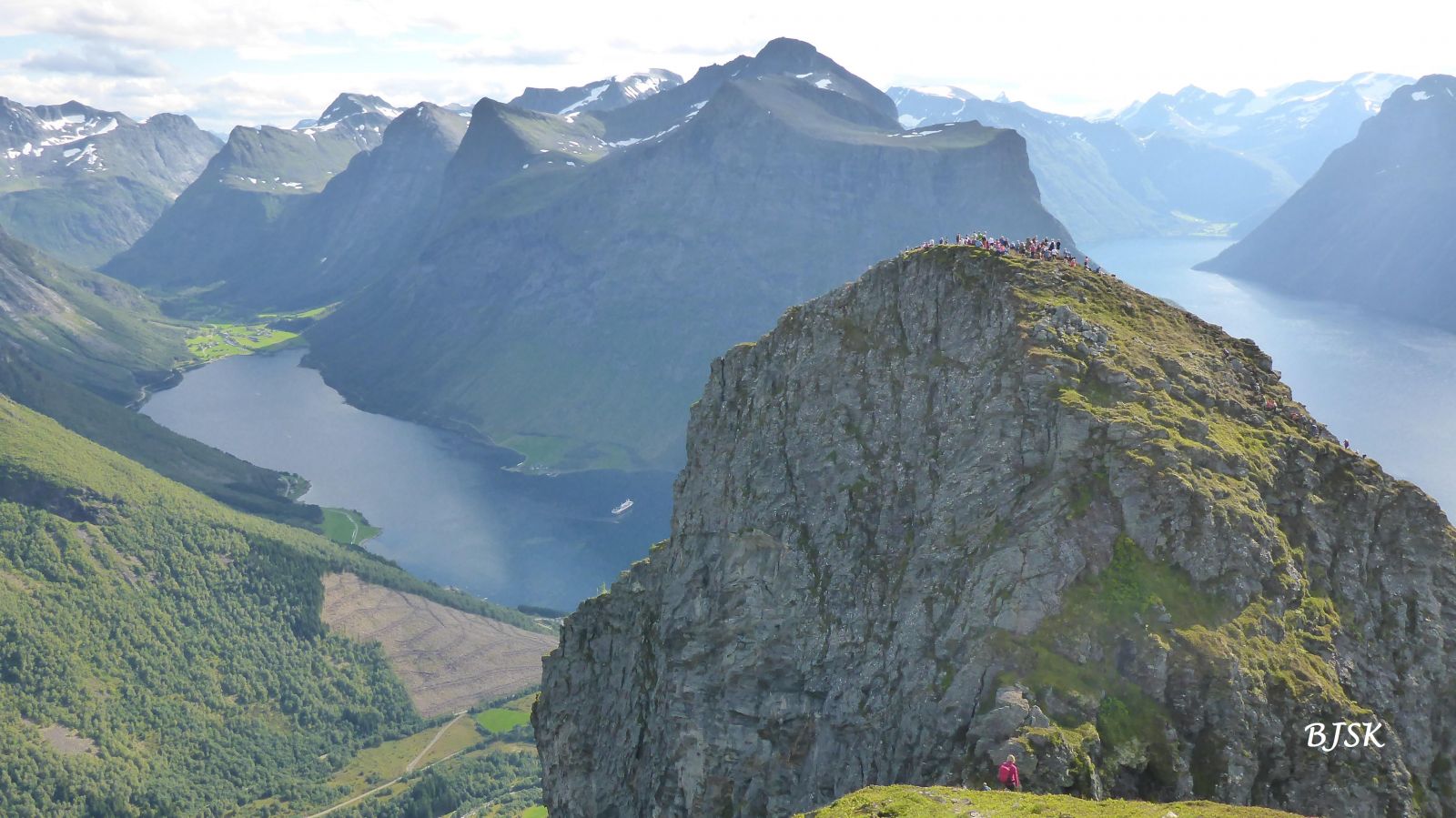
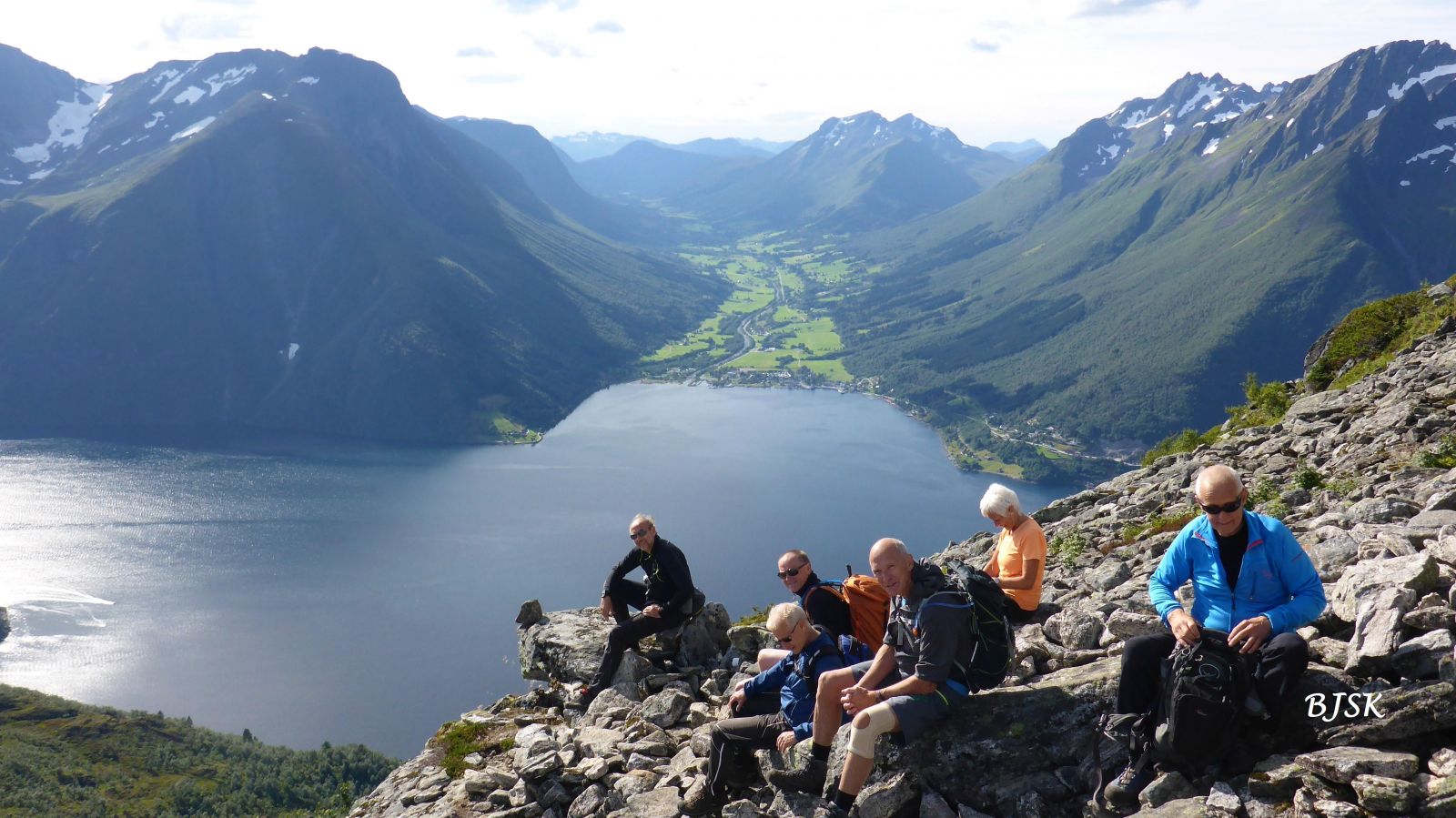
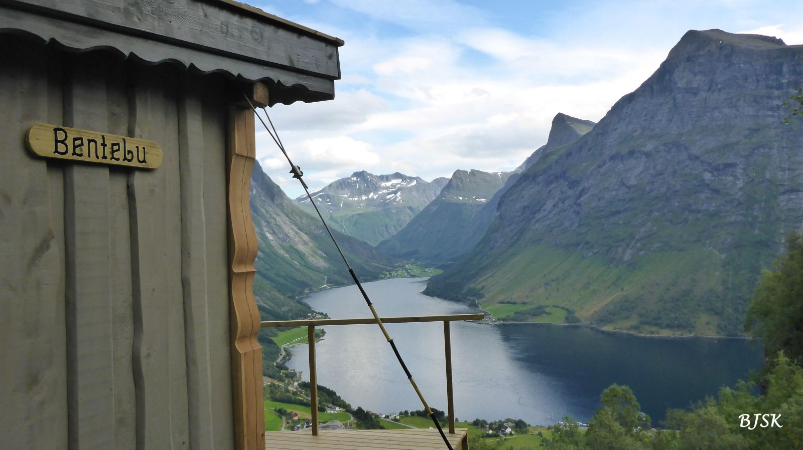
Mount Saksa lies on the eastern side on the Hjørundfjorden and offers a magnificent view. On this hike, you will also see a traditional gapahuk shelter, remains of old mountain farms, stone stairs that were built by Sherpas, and an old bear cave in Leknesdalen.
The hiking path runs from the car park by the Urkeelva River up through the forest. You will meet a gravel road after about 250 metres along this path. Turn right and follow the road until you see a forest road/path branching off to the left past a cabin. The path now climbs up towards the Leknesdalen Valley. Once you come up to the edge of the valley, you will see a gapahuk shelter on your right, which is a great viewing point. Once you are up in the Leknesdalen Valley, the path runs north taking large turns up to a scree area. Here, the path zigzags up the stone stairs that lead to the mountaintop.
This trail takes you to the southern peak of Mount Saksa. The highest point of the mountain is on its northern peak, and the path there runs steeply down the northern side of the southern peak and over another smaller peak. The trail from the southern to the northern peak covers lofty terrain and is not recommended if you have a fear of heights.
From the west: Follow E39 to Ørsta, turn off the main road in the centre of Ørsta and take FV655 that is signposted to Sæbø. Take a ferry from Sæbø to Leknes (Remember to check the timetable to avoid the long waiting time between the departures). Drive for 1.8 km from Leknes to Urke. Drive to the Urke grocery store and turn left just after the store. You will find the hiking car park after about 100 metres.
From the east: turn off from FV60 about 4 km west of Hellesylt and follow FV655 to Urke. Turn right just after the Urkeelva River. You will find the hiking car park after about 100 metres.
To reach the car park in Urke, take the road that runs along the Urkeelva River in the centre of the village.
Duration
4 t. 5 min

| Surface type |
Distance |
| Sti |
5,9 |
The path to Mount Saksa was repaired, and stairs over the scree area were built by Sherpas in 2015. A gapahuk shelter was also built at the edge of the Leknesdalen Valley in the same year. You can see the remains of old mountain farms and an old bear cave in Leknesdalen.
Sunnmørsalpane, M711 1219 III, sunnmorskart.no
 Driving directions
 Route data
GeoJSON
Route data
GeoJSON