The island of Runde that lies far out in the ocean is famous for its birdlife. Runde Lighthouse is also a popular attraction. This hiking trail starts on the island of Runde, follows its edge for about 1.5 km until you reach Lundeura, continues up to Rundebranden, takes a detour to Runde Lighthouse, and ends in Goksøyr. The starting point is different from where the majority starts this hike.
Route description
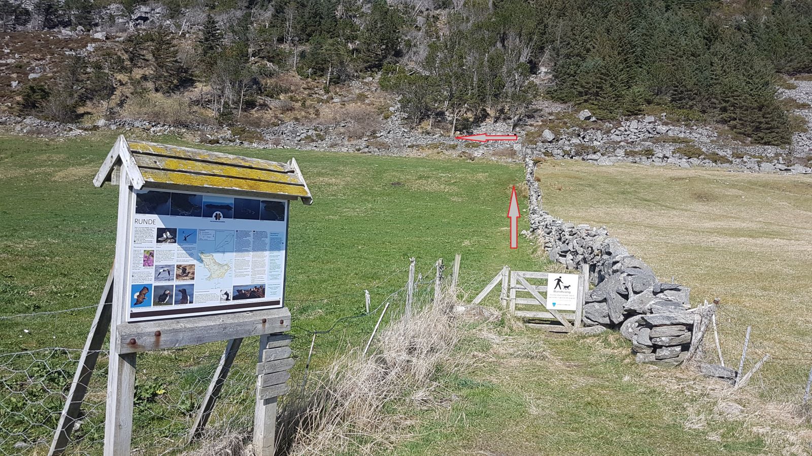
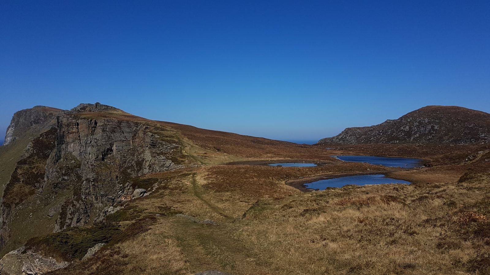
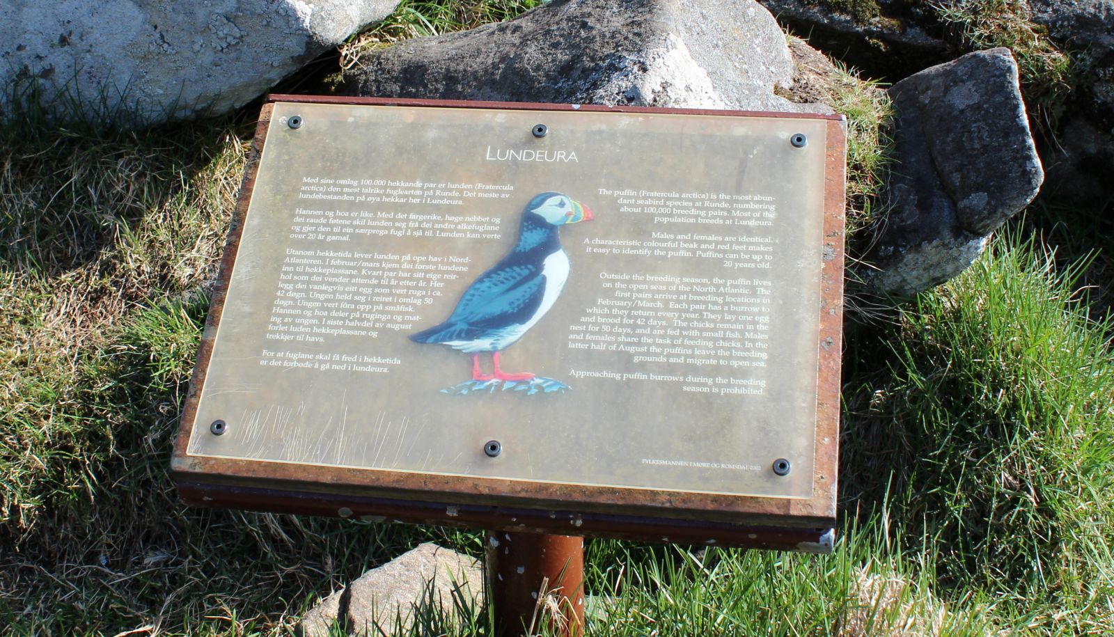
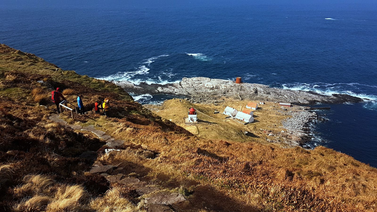
Take the gravel road to the left just after the Runde Bridge and follow it for about 500 m. The starting point of the trail is next to an information board about Runde. Follow the path along the stone fence, walk through a gate, and turn left after the gate. The entire path is well defined. The section of the trail that leads up to about 200 m a.s.l. is slightly steep. From here, the trail flattens out, and you can follow the edge until you reach a path from Goksøyr. You will enjoy scenic views the entire time. Feel free to take a detour to Lundeura. The Atlantic puffins usually come here in the evening, which is a spectacular sight. Continue up the hill until you reach Rundebranden with its bustling birdlife. From Rundebranden, continue walking along the rocky edge until you reach the fork in the path from where you can go down to Runde Lighthouse. The path has been upgraded in recent years, so it is easy to walk on, even when it is a little steep. The highest point of the trail is just under 200 metres above sea level, and it is absolutely worth the trip. The houses near Runde Lighthouse are now used by the Norwegian Trekking Association (DNT), so it is possible to stay there overnight. Walk up the same way from Runde Lighthouse and continue along the main route when you reach the fork in the path. Large parts of the trail from here to Goksøyr are paved or covered with wooden footpaths.
Runde is a popular tourist destination. To protect nature, large sections of the hiking trails have been paved with stones or covered with planks of wood. Please use them and always stick to established paths.
Access and parking
Follow County Road 654 (FV654) towards Fosnavåg and take FV18 towards Runde near a school (Leinevegen Road). You will see a sign for Runde. Turn left just after the Runde Bridge and drive for about 500 m to the starting point of the trail. It is quite far to walk from Goksøyr to the starting point, so you might consider having two cars, one at each end of the route.
You can park your car at the start of the hike, but the parking space is limited here. There is also a designated car park in Goksøyr. Most people start walking from there.
The trail covers an area which is both a bird conservation area and a nature reserve with limited hiking opportunities. Please read information boards and only follow established paths and signs.
Feel free to stop by Runde Environmental Centre (Runde Miljøsenter): http://rundecentre.no/