Rødlandstua (355 m a.s.l.) from Reiakvam
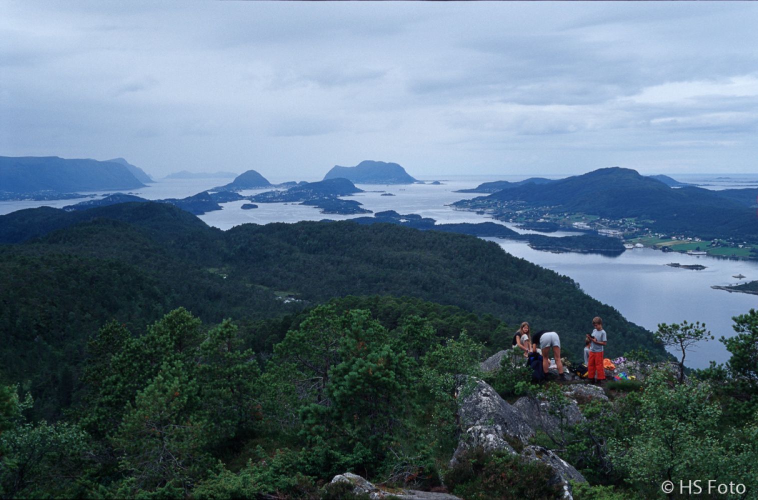
Ålesund
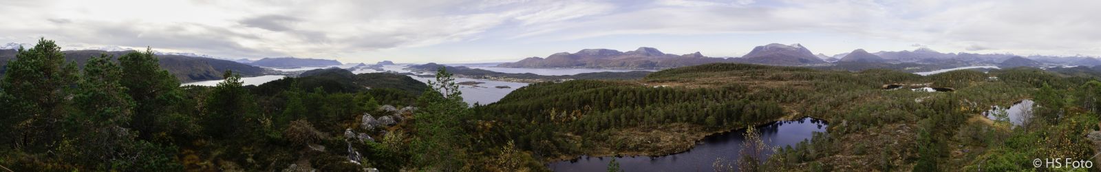
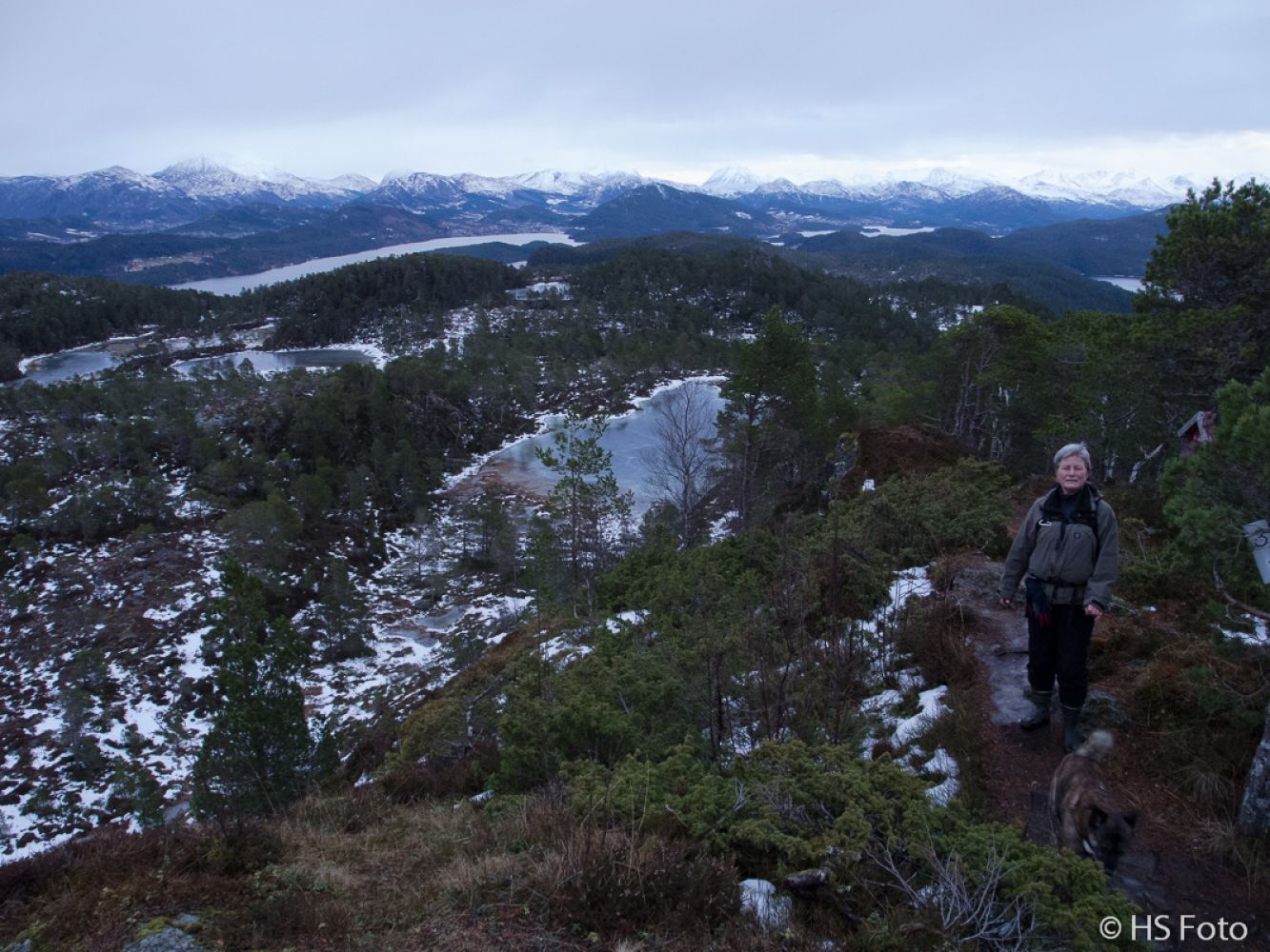
The destination of this trail is called “Rollandstua” on some of the maps, which seems to be the correct name of this hill that lies north of Reiakvam in Skodje municipality. This is an easy destination with a great view to the southwest, north and southeast. Only Mount Emblemsfjellet blocks the view south. There are some nice spots along the path where it is convenient to stop and eat a snack, but the majority of hikers manage to walk for about 1.5 km up to the top in order to enjoy the view from there.The sports associations of Brusdal and Utvikbygda have set up their trail postboxes at the top of the hill. If you want, you can register there. There are several lakes along the way which can be great swimming areas in summer and ice skating spots in winter. Remember to check the thickness of the ice first! Don’t forget to take ice prods with you to get out of the water in case of an accident. The area is relatively marshy, and there can be mosquitoes there. There are many berries and mushrooms in the area. The area is also used for deer hunting in autumn. A pair of waterproof shoes is a must here even in summer. We recommend extending the trail to Varden (330 m a.s.l.) just north of Rødlandstua.
The trail initially follows a well-defined tractor road in the western direction. After a couple of hundred metres, this road turns into a good path/road which winds its way up. As you walk further, you will come across several forks in the path. Since you are heading for the top of the hill, it will be clear which path to choose on your way up. The trail can be a bit trickier as you walk down :-)The thing to remember on your way down is that after the second bridge you need to turn left (east) at the first road crossing. Then you will walk over two more bridges, and you need to turn left (east) here again. The 4 bridges are of relatively poor quality. They are simply logs laid across the river. The logs are both worn-out and slippery, so make sure you do not slip. Each bridge is about 3 metres long. At the height of 250 m a.s.l., you will walk past a spruce tree. In December this tree is decorated with tinsel and other Christmas decorations. The tree is added to the GPS-file as a waypoint. The marshy area starts at 260 m a.s.l. The path here is marked with blue ribbons on trees up to Lake Lillevatnet. Because the area is quite marshy, it is criss-crossed by a number of paths. Rødlandstua is the trail destination for the majority of hikers, but not for everyone. As long as you walk along the path that follows the waymarks, you will find your way up.
The same as the starting point. The car park is added to the GPS-file as a separate waypoint.
The start of the trail is marked with a waypoint. Only motor vehicles are allowed to access this car park which lies north of E39 near Reiakvam/Slettebakken in Skodje. You are not allowed to cycle or walk along E39.
Instead, you can follow the old Brusdalsvei Road, Fv111. About 200 metres east of the car park, there is a tunnel under E39 with a path leading up to the starting point of the trail.
There are no toll or other fees to be paid (2013). Note: this is a forest road, so please make sure you do not block the access to this and other forest roads so that the landowners can drive in and out with timber.
This car park lies to the north of E39, the entrance road to Ålesund. No parking fee applies.
Distance
2,92 km both ways
Duration
1 t. 15 min.

| Surface type |
Distance |
| Sti |
2,1 |
Some buses pass by, but there are no bus stops in the area. Another option is to use Skodjeruta that goes via Gamle Brusdalsvei, then go up and walk under E39 near Reiakvam.
Please go to
http://www.177mr.no or
http://www.nettbuss.no for more information.
Sykkylven, Sheet 1219 IV in map series M711 and Ålesund in tourist map series
 Driving directions
 Route data
GeoJSON
Route data
GeoJSON