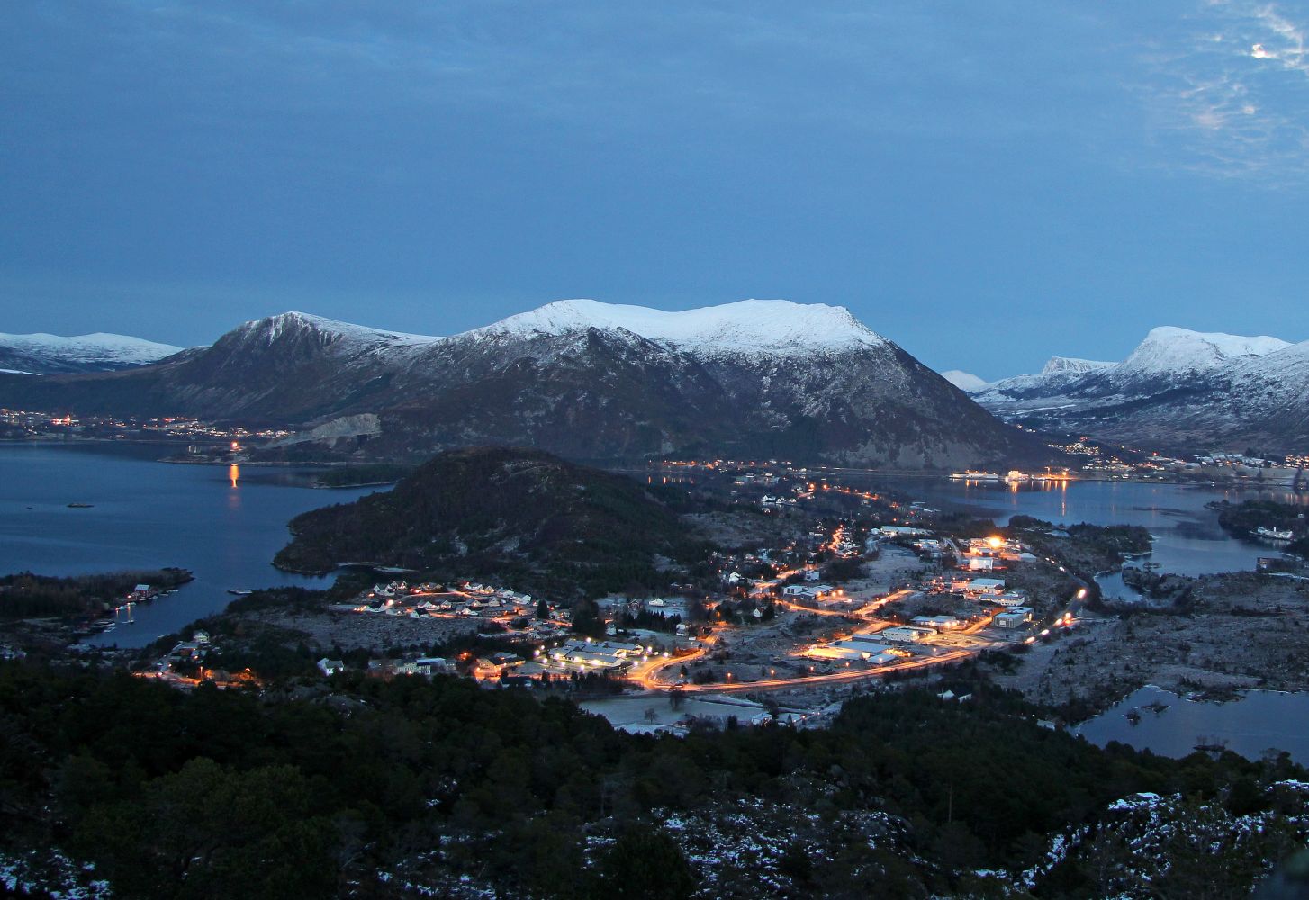
Rambjøra is the easternmost peak on the island of Gurskøya. It is a popular hiking destination for many locals, and the trails from Myrvåg and Dragsund are widely used. Rambjøra, which is only 132 metres high, is the lowest of the 18 mountain peaks in Herøy Municipality and of the 12 peaks on the island of Gurskøya with a primary factor of 100 m or more.
Despite its modest height, Rambjøra offers a scenic view. The mountain is easily accessible for the majority of people, and the paths are easy to walk on. Since the area does not have a barren landscape, the birch forest can give shelter from the wind.
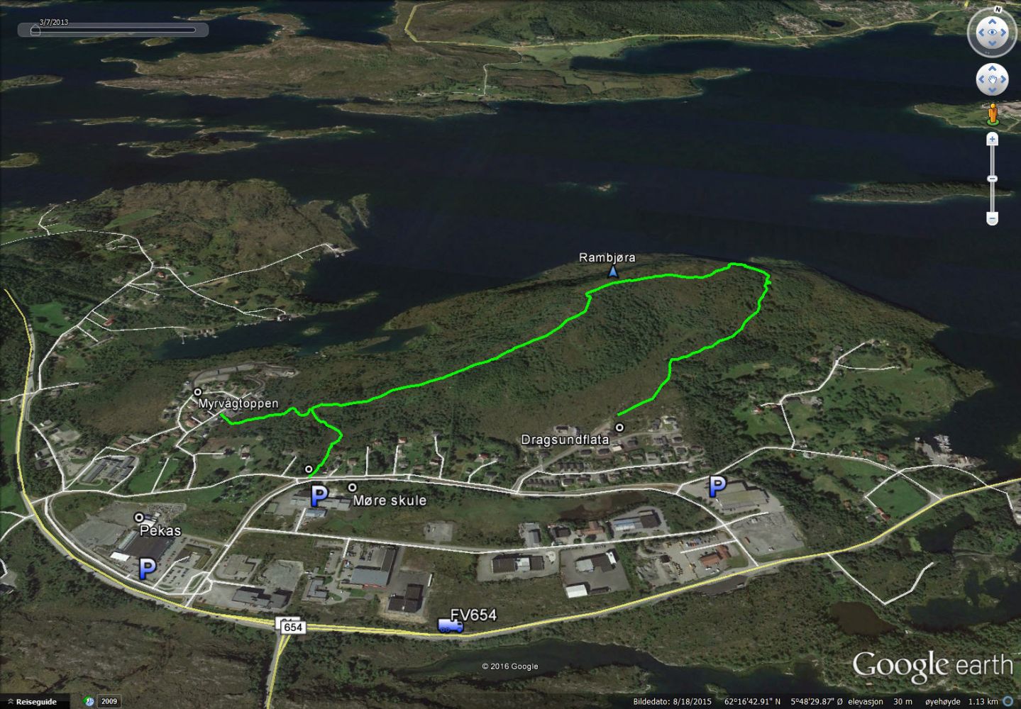
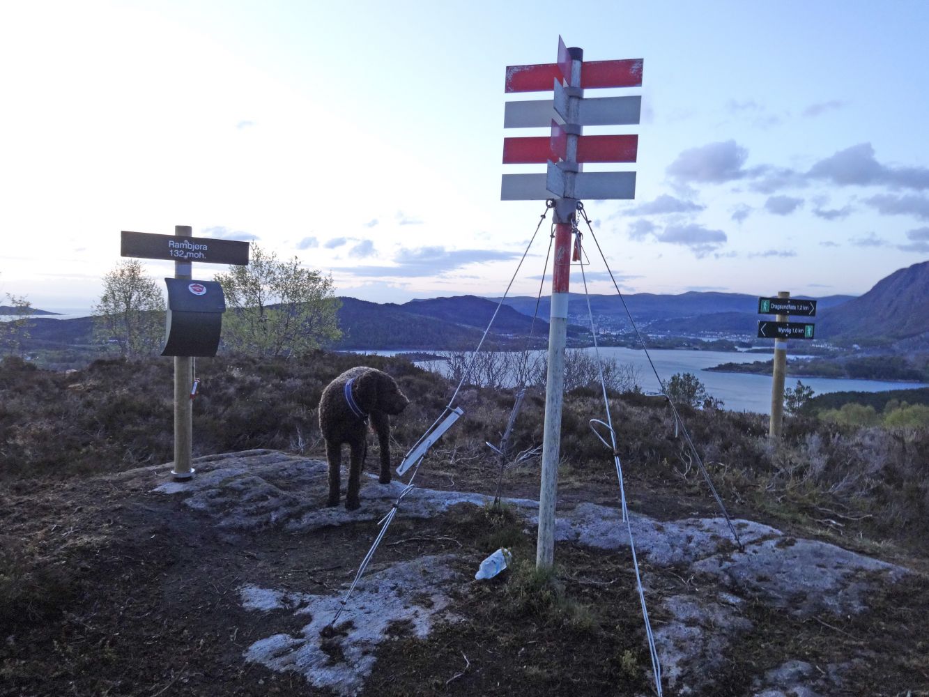
There are 3 main routes to the top of Rambjøra: from Myrvågtoppen, from Møre School, and from Dragsundflata. The map shows a circular trail from Møre School with a return route via Dragsundflata. All routes are marked with both signs and sticks, as well as with reflectors further along the trail. You will find the trail postbox at the peak.
Route 1: Myrvågtoppen – Rambjøra (1 km)
The trail starts in the residential area and follows a well-defined path through an area of heathland and scrub before you meet the southwestern ridge of Rambjøra. You will meet the path from Møre School. Continue walking along the ridge until you reach the top. Parts of the trail can be quite wet after rain.
Route 2: Møre School – Rambjøra (1 km)
The trail starts above Møre School. After about 250 metres, you will meet the path from Myrvågtoppen. Please see Route 1.
Route 3: Dragsundflata – Rambjøra (1.2 km)
The trail starts at the top of the residential site in Dragsund. Walk northeast along the path over a marshy area until you enter a dense forest southeast of the peak. Continue walking through the forest until you reach a junction in the path. Keep to the left. The path to the right is not marked and runs down to Øvre Dragsund. Follow the path as it later turns west and continue along the western ridge until you reach the mountaintop.
Depending on where you want to go, you will find car parks by the chapel, Pekas/Kiwi, Møre School, and the fire station / Djupvikbygget (the Djupvik building).
Route 1 (Myrvågtoppen):
Follow County Road 654 (FV654) towards Fosnavåg. Turn right near Pekas/Kiwi in Myrvåg. The nearest car park is by Møre School. Follow Dragsundvegen Road for 170 m and turn right at the first junction. Møre School is the first building on the left-hand side. Return to Dragsundvegen and walk up that road until you reach the first junction. Turn left and follow Åsvegen Road for 250 m. Then turn right and follow Myrvågtoppen Road for 250 m (keep to the right at the first junction). The start of the trail is marked with the sign that reads “Rambjøra 1 km”.
Route 2 (Møre School):
Please see Route 1 for the directions to the car park by Møre School. Walk up Dragsundvegen Road until you reach the first junction. Follow the walking and cycling path for a few metres until you see the sign “Rambjøra 1 km”.
Route 3 (Dragsundflata):
Follow County Road 654 (FV654) towards Fosnavåg. Please see Route 1 for the directions to the car park by Møre School. Follow Dragsundvegen Road for 500 m and turn left up Dragsundflata Road. After 280 m at the end of the road, you will see the sign that reads “Rambjøra 1.2 km”. Alternative car park is next to the fire station / Djupvikbygget (Djupvik building) at the junction of Dragsundvegen and Nedre Dragsund roads. The distance to Dragsundflata from here is a little shorter than from Møre School.