Ræstadhornet via Rørsethornet
Molde
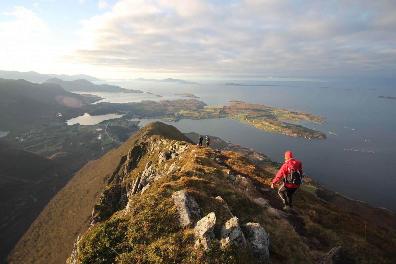
This scenic ridge traverse offers a view of the ocean on the one side and the mountains of Romsdal and Sunnmøre on the other.
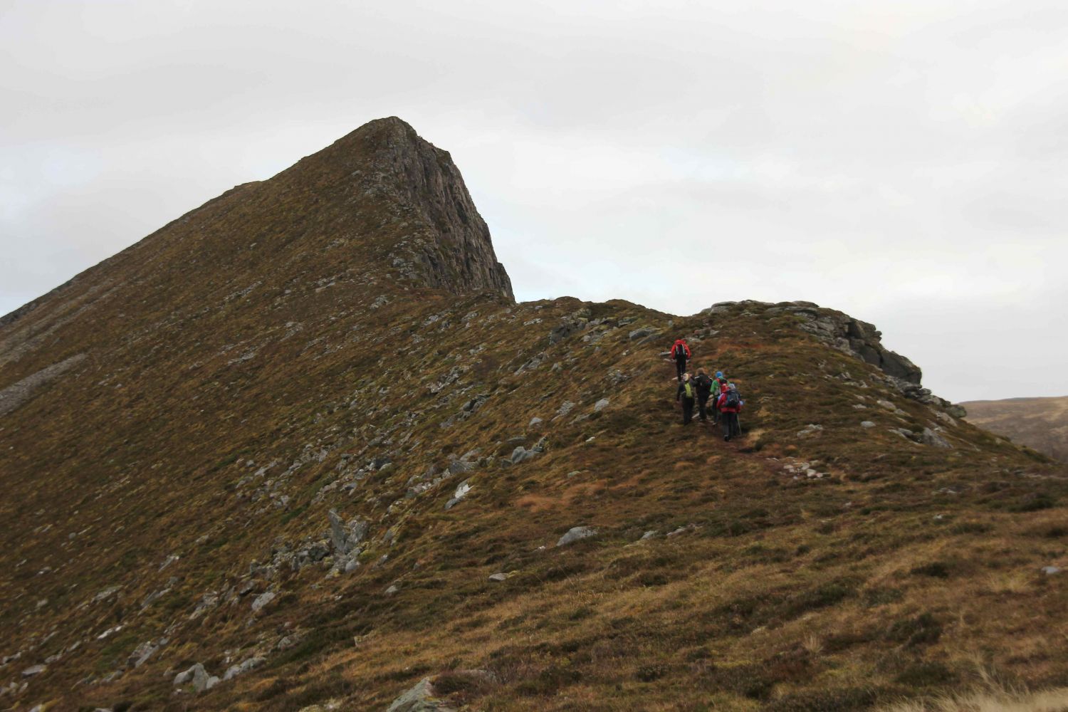
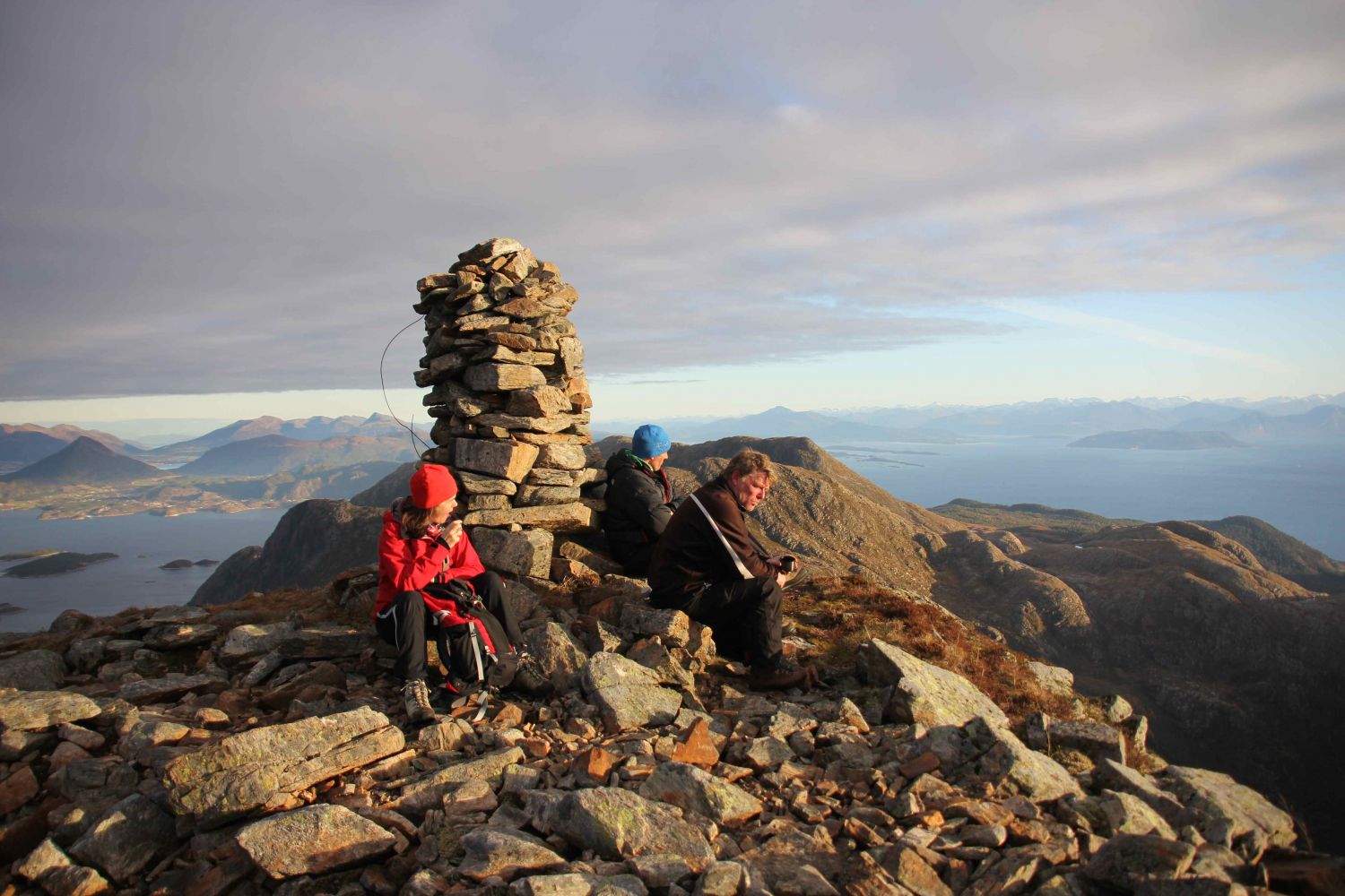
Follow the prepared hiking trail from the car park and walk across the national road. Keep following the path, the waymarks, and the stairs up the western ridge of the mountain towards Rørsethornet. A large part of the trail follows the stairs built by Sherpas, but the final section towards Rørsethornet follows a path that runs along the ridge up to the mountaintop. From Rørsethornet (659 m a.s.l.), continue following the narrow ridge eastwards. Follow the path that runs along the ridge. The path will gradually become less clear, but you can aim for the cairn at the top of Ræstadhornet in front of you. Follow the same route back.
If you are coming from the side of Molde/Nordmøre, take the Magerholm–Solholmen ferry. Turn right after the ferry terminal and follow National Road 668 along the northern side of the island. Continue straight ahead until you reach the western end of the Ræstahornet/Rørsethornet mountain massif. If you reach Rakvåg/Torsvika, you have driven too far. If you are coming from Sunnmøre, take a ferry from Brattvågen to Dryna. Drive over the island of Midøya, the Midsundet Strait, and the northern side of the island of Otrøya until you reach the starting point of the hike west of Rørset. Leave your car at the well-prepared car park.