Ørskogfjellet – Måslia – Jutevatnet
Vestnes
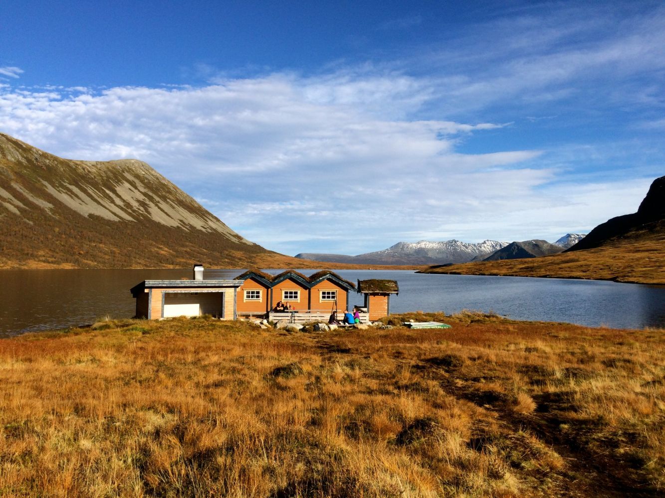
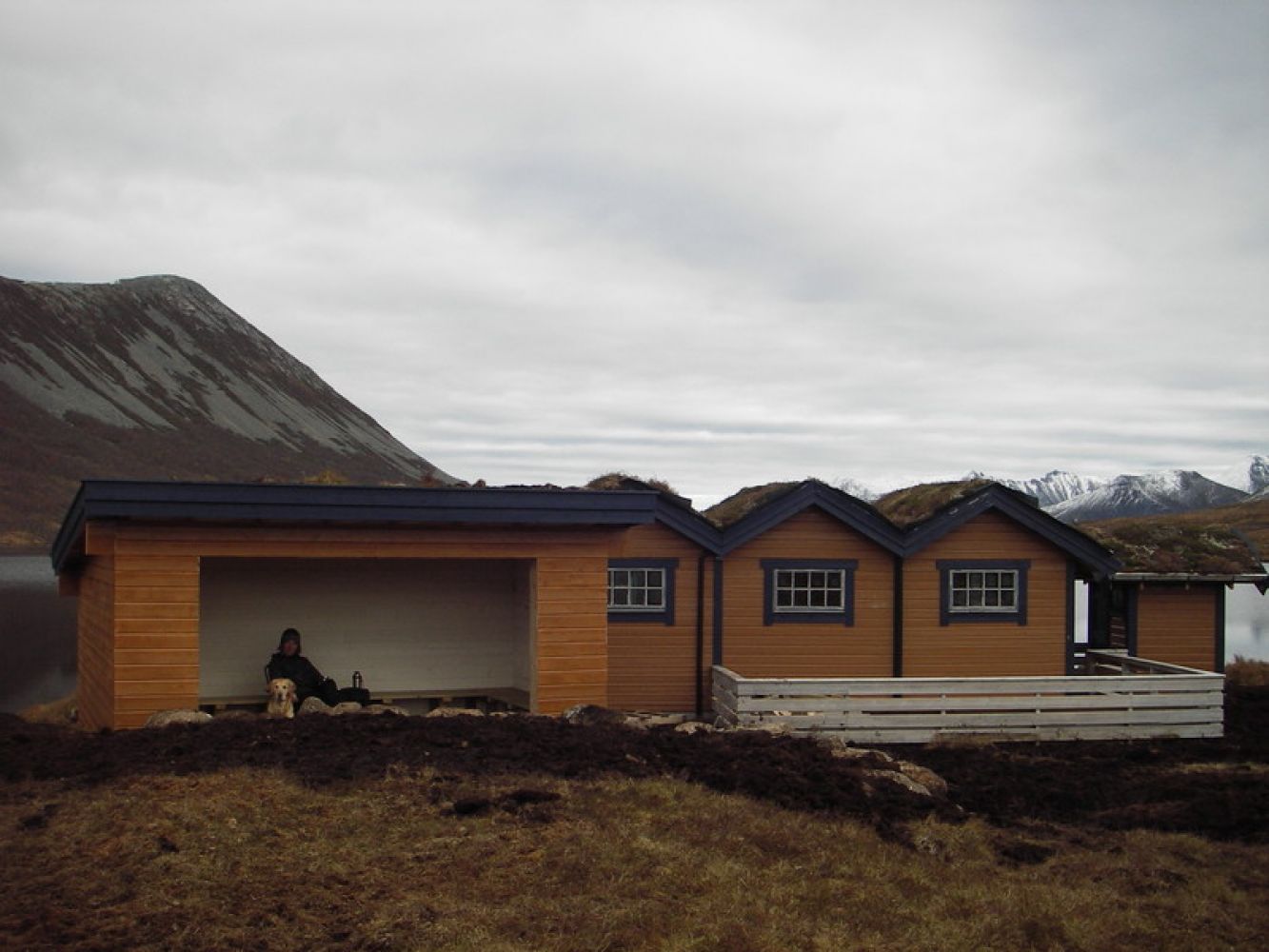
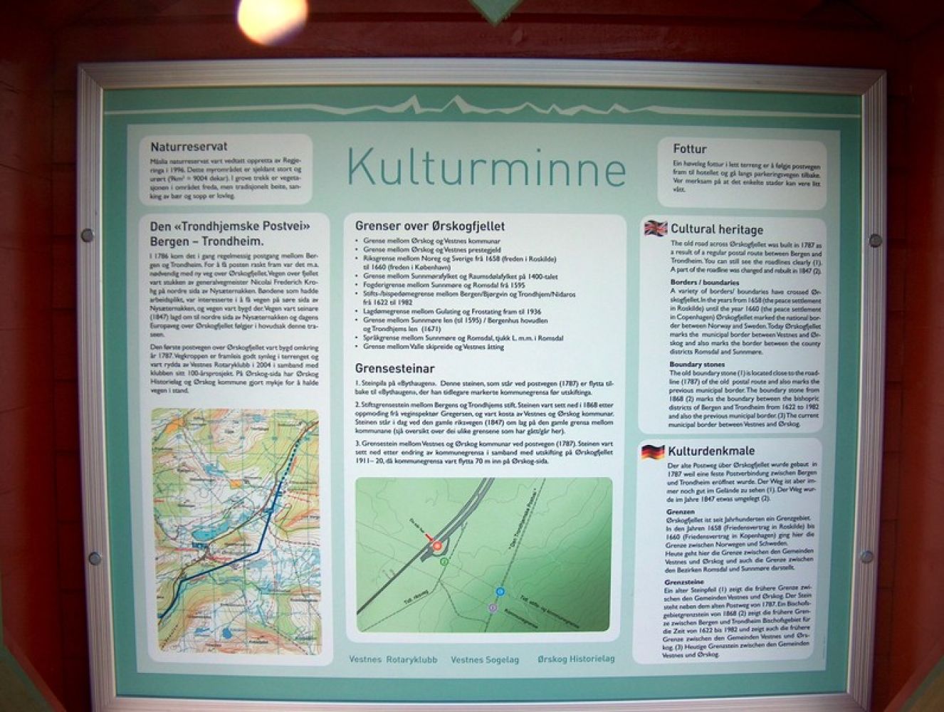
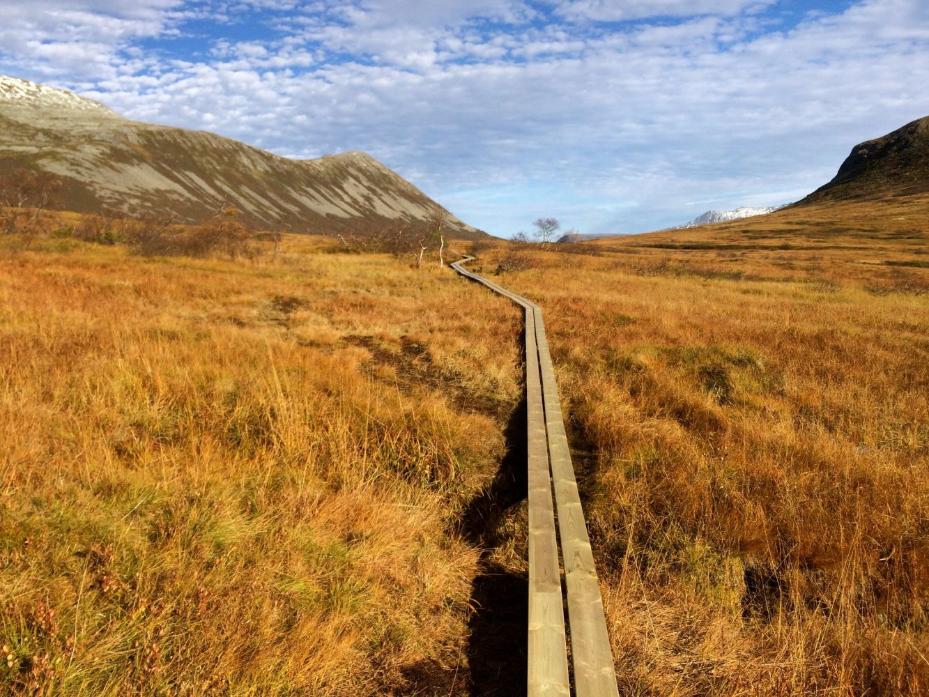
An information board at the car park describes the national border between Norway and Sweden in the 1600s, the boundary stones that you will pass on your way to Måslia, and the old postal route that you will follow for a couple of hundred metres along a gravel road. You will be able to see the old postal route in the terrain.The trail is suitable for all age groups and for the majority of people who are generally fit. It is possible to cycle and to push a stroller along this trail. It is also accessible for wheelchair users, but you should keep in mind that the trail is long and goes uphill the entire time. An assistant or an electric wheelchair would be a good choice. The total ascent is 170 m, and you will see a mountain landscape with a view in all directions. If you want, you can climb all the mountains you see. Some of the trails are marked. The mountains are 800–1200 m high, and you will find a trail postbox and a journal on most of them. Once you come to the summer mountain farm, Måslia, after 4 km, the gravel road ends by a picnic bench. If you want to go to Lake Jutevatnet and the nice “gapahuk” shelter there, continue walking straight ahead for 1.5 km. You will walk over about 40 planked footways that are built on the wettest sections of the trail. The Måslia Nature Reserve was established in 1996. Once you reach the “gapahuk” shelter, you can have a barbecue on the campfire, eat your packed lunch, or stay here overnight you want to. Lake Jutevatnet contains a lot of fish, but it is small.
The trail starts at the height of 310 m a.s.l. on a large car park in the Ørskogfjellet area, on the border between Ørskog and Vestnes municipalities. Turn off to the left if you are coming from Vestnes. You will see a public toilet on the left and an information board on the right. Walk from the car park up to the picnic area, and you will come across a gravel road after about 50 m. Keep to the right, and you will reach a closed boom gate after 100 m. There are no crossing roads now. The gravel road gently ascends to 400–500 m, then there is a relatively steep section, and the road turns north. From here on, the trail ascends slightly all the way to Måslia that lies at 480 m a.s.l. You have now walked for 4 km. Walk for another 1.5 km up to the “gapahuk” shelter as the path gently climbs up. The area is partly wet and marshy.
The trail starts from a car park in the Ørskogfjellet area along E39 on the border between Ørskog and Vestnes municipalities. Car parking is free of charge. The gravel road is closed with a boom gate.
GPS coordinates: Latitude: 62.532718 Longitude: 6.949764
No parking fee applies.
Duration
3 t. 0 min

Tourist map 1:50.000 Ørskogfjellet
 Driving directions
 Route data
GeoJSON
Route data
GeoJSON