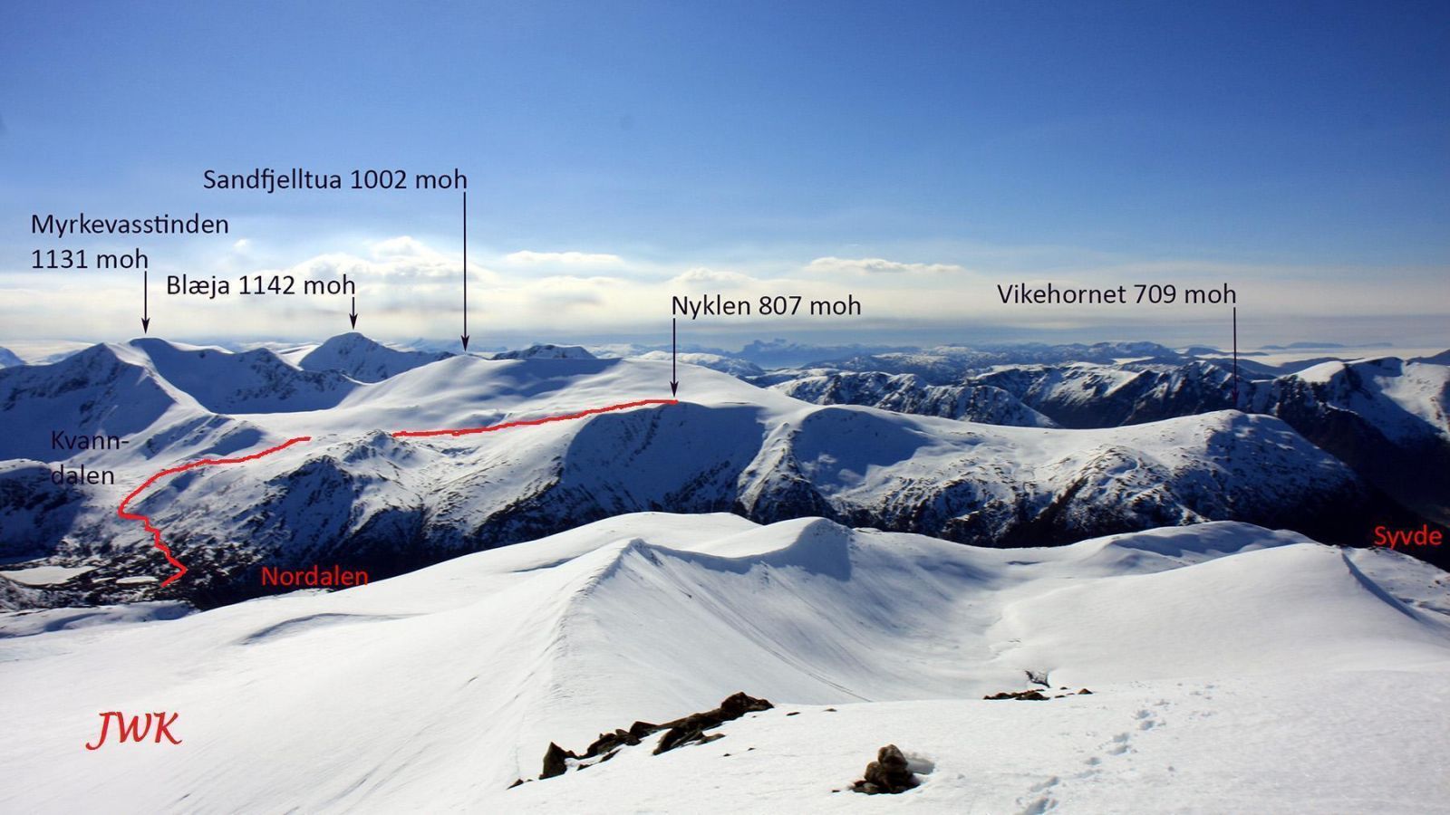
This skiing route to Nyklen is fairly easy and lets you explore the ski terrain in the mountains of Syvde. You may also want to try the skiing routes to Sandfjelltua and Vikehornet with the same starting point as this one. The route described here has a starting point at Lake Bruvatnet and the round trip is 7.6 km with an elevation gain of 650 m. The road to Bruvatnet is usually open during Easter. Before Easter and when there is a lot of snow, you have to start from the car park in Nordalen. The length of the round trip will then be 12 km and the elevation gain 950 m. If you are lucky, the road can be open all the way to Lake Kvanndalsvatnet in May. In that case, the round trip is 5.5 km and the elevation gain is 500 m.
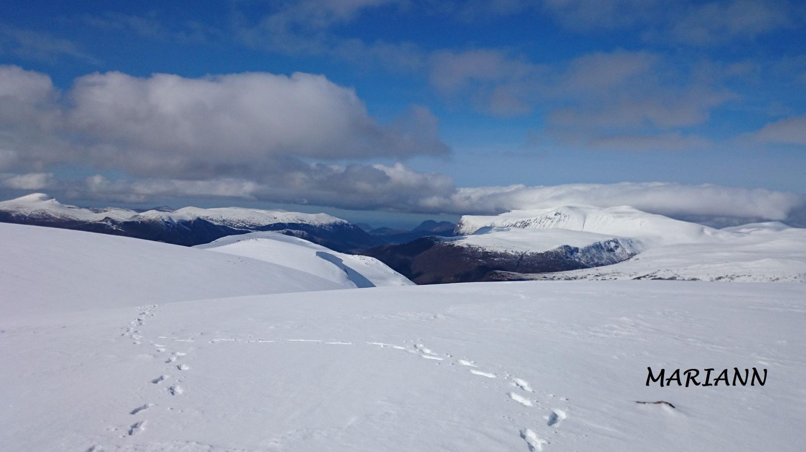
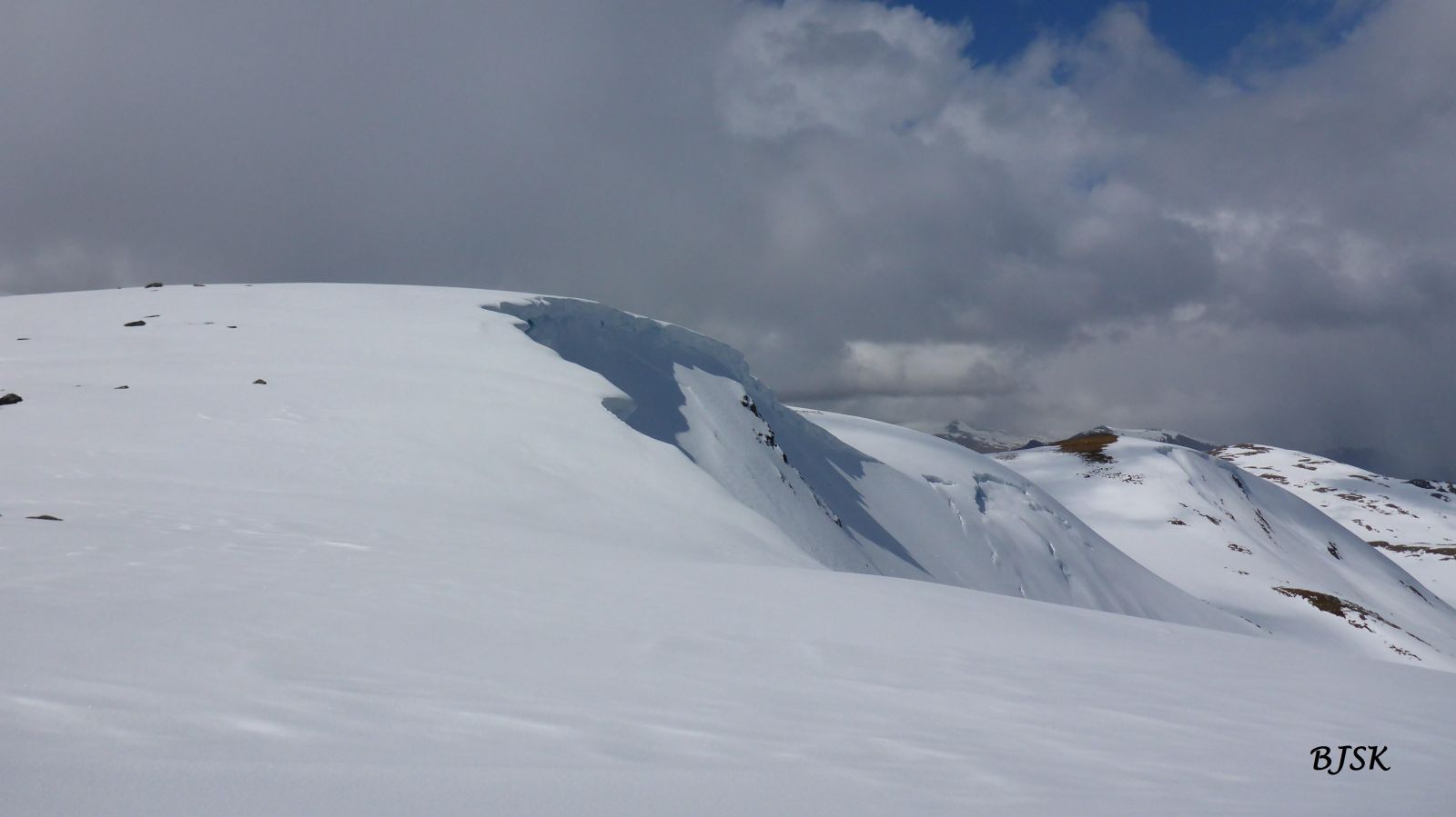
The starting point of this skiing route is by Lake Bruvatnet. If the mountain road is closed, you have to start from the car park in Nordalen and follow the mountain road until you reach Lake Bruvatnet. From there, follow the mountain road towards Lake Kvanndalsvatnet. About 500 m before Kvanndalsvatnet, turn right and go uphill towards Lake Skoravatnet. Ski along the south side of Skoravatnet and continue in the direction of the Sandfjelldalen Valley via the lowest point in the terrain. Go down Sandfjelldalen, turn right, and continue north along the valley. Nyklen lies to the northwest of where you are now. You cannot see the peak from Sandfjelldalen, but it will become visible as you approach it. Be careful when you ascend Nyklen. The top of the mountain is quite flat so it is difficult to find the highest point, and there is often a large snow cornice in the northeast, which is dangerous to walk on.
Take County Road 652 (FV652) to Syvde, turn off to Nordal on the northeast side of the centre of Syvde, and drive into the Nordalen Valley for as long as possible.
There is a good car park by Lake Bruvatnet. If the road is closed, you have to leave your car at the car park in Nordalen. As the mountain road gradually opens, you will find many parking places along it.
Skiing route
Red fjellski
Duration
2 t. 15 min.

På tur i Vanylven (Eng. Hiking in Vanylven) M711 1119 II, sunnmorskart.no
 Driving directions
 Route data
GeoJSON
Route data
GeoJSON