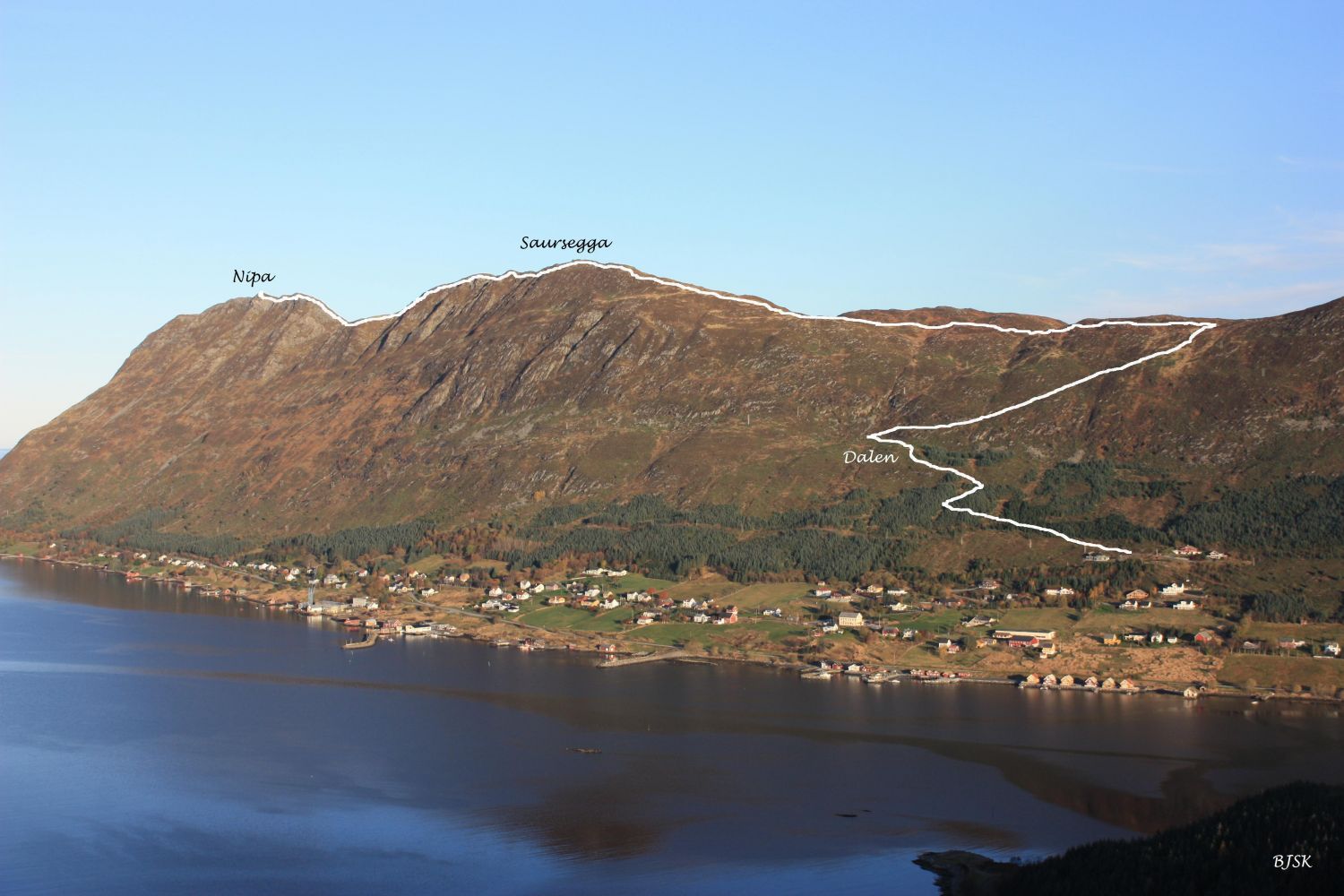
Nipa (Gjøna) from Haugsbygda
Sande
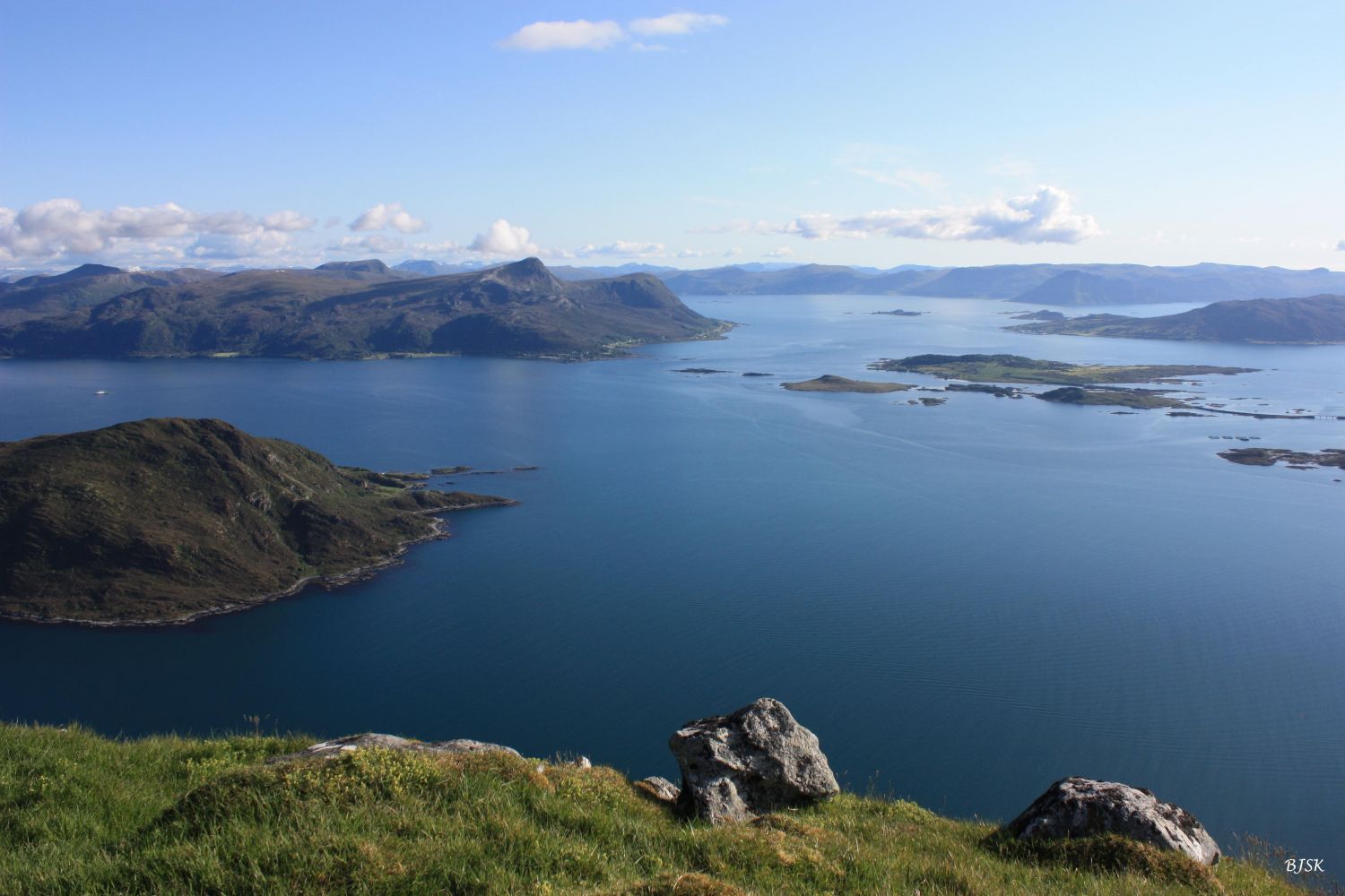
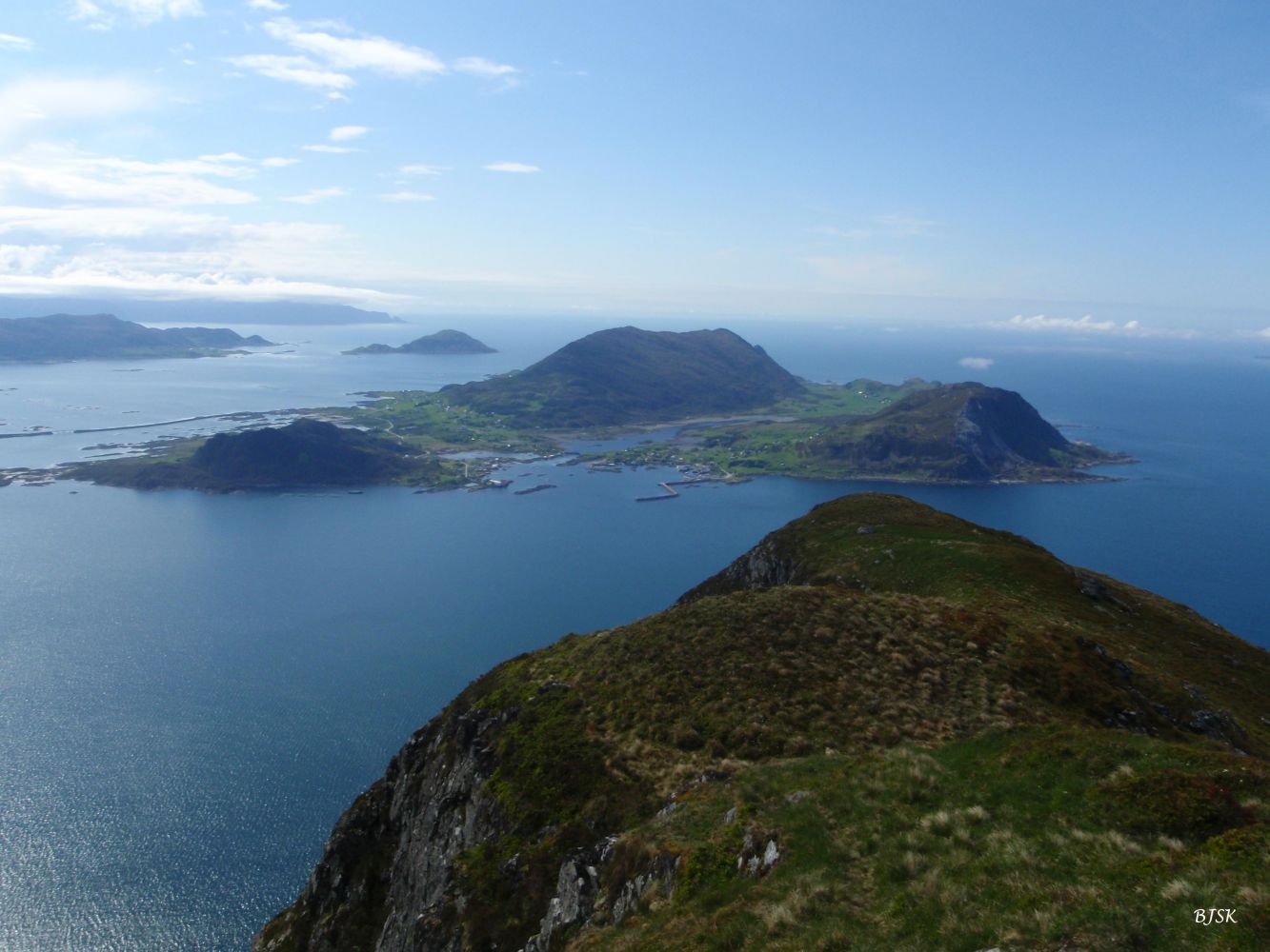
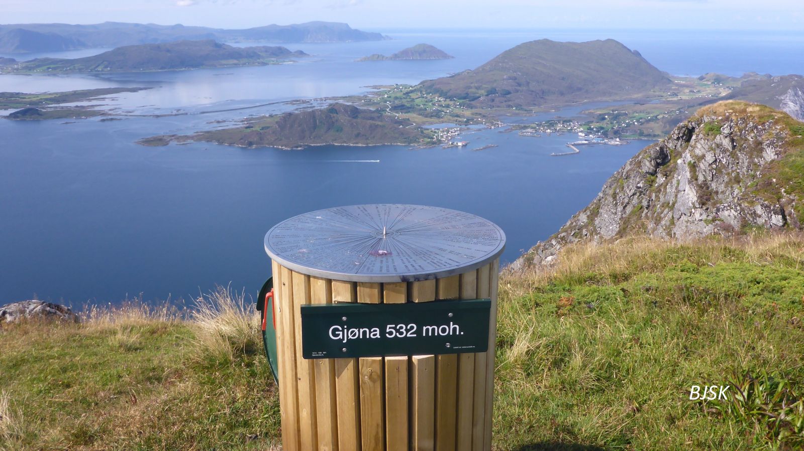
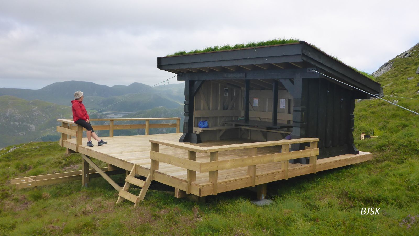
This hike offers a stunning view of the outer Sunnmøre and the ocean. Parts of the trail follow the old farm road between Haugsbygda and Gjerdsvika which was used before a road around Gjøneset was built. The Gjerdsvika Sports Association (Gjerdsvika IL) has a trail post on Nipa.
The starting point of this hike is in the Haugelia residential area. The path begins at the end of the upper road. Go west, and you will see two gates in the fence. Walk past the first one and follow the path as it enters the second gate. Continue following the path as it takes you through the forest where there might be some wet sections. You will reach Dalen with the remains of old cattle sheds once you are out of the forest. From here, the path follows the old farm road that climbs up the mountainside. When you come to the power line, turn off the path which continues to Haugshornet and follow the power line until you reach the next set of posts. Here, you will find the path to Nipa. Follow this path west as it takes you over some peat bogs. It can be difficult to find your way here, but once you get to the ridge that leads up to Saursegga, the path follows the ridge all the way to Nipa. On your ascent to Nipa from the lowest point between Saursegga and Nipa, the path climbs up a steep slope. If you find it too steep, you can turn right and follow a path that runs up the north side of the steepest section. The breathtaking view from the peak is well worth the effort. Important! Please use caution since the south side of the mountain is very steep.
The starting point of the trail is in the Haugelia residential area in Haugsbygda. Turn off County Road 61 (FV61) in Gursken at the sign for Haugsbygda. Drive for 4 km and turn right at the sign for Vonheim. Drive for 1 km and turn right after you pass an old school. Continue all the way to the top of the Haugelia residential area. There is a designated car park in Haugelia.
Distance
8,20 km both ways
Duration
3 t. 50 min.

Sesong
Spring, Summer, Autumn
Signage
Both signed and marked
| Surface type |
Distance |
| Asfalt |
0,3 |
| Sti |
7,9 |
Hiking map of Ytre Søre Sunnmøre, M711 1119 III, M711 1119 IV, Sunnmorskart.no
 Driving directions
 Route data
GeoJSON
Route data
GeoJSON