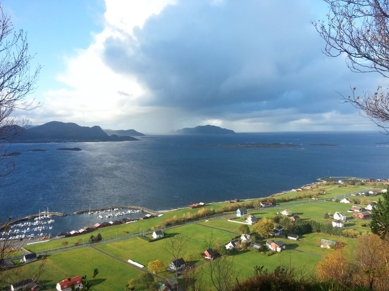
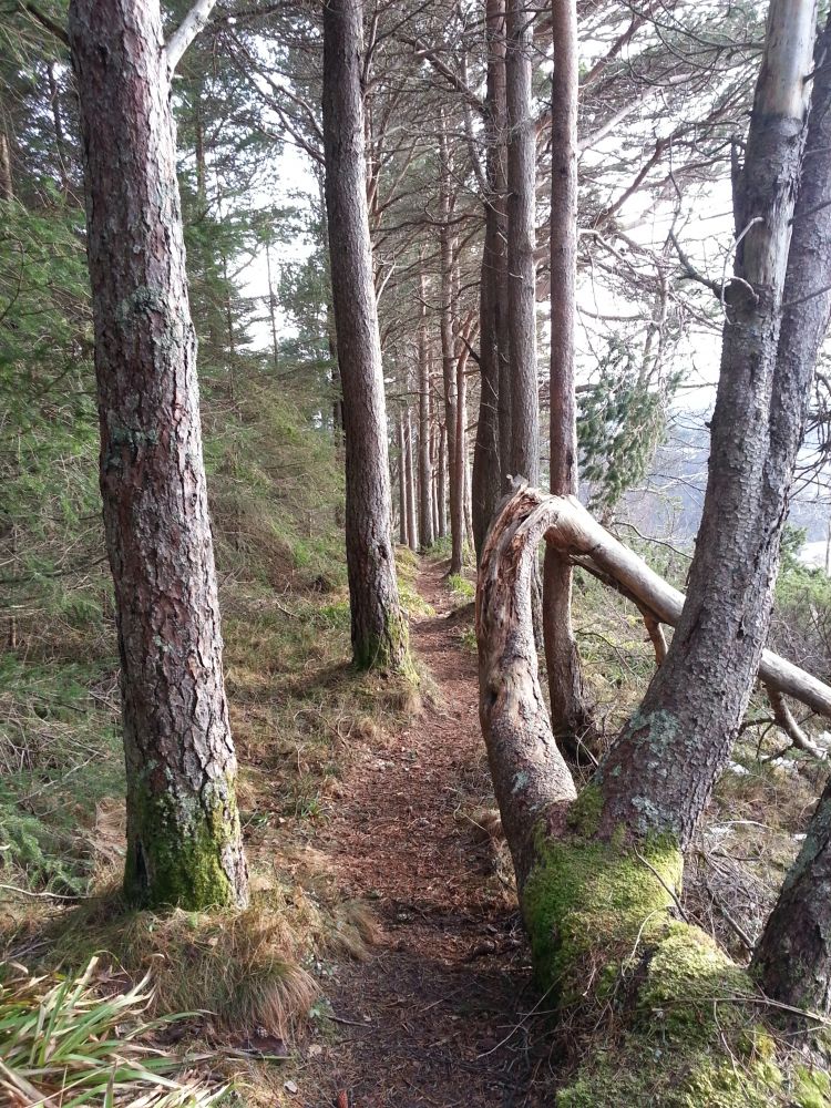
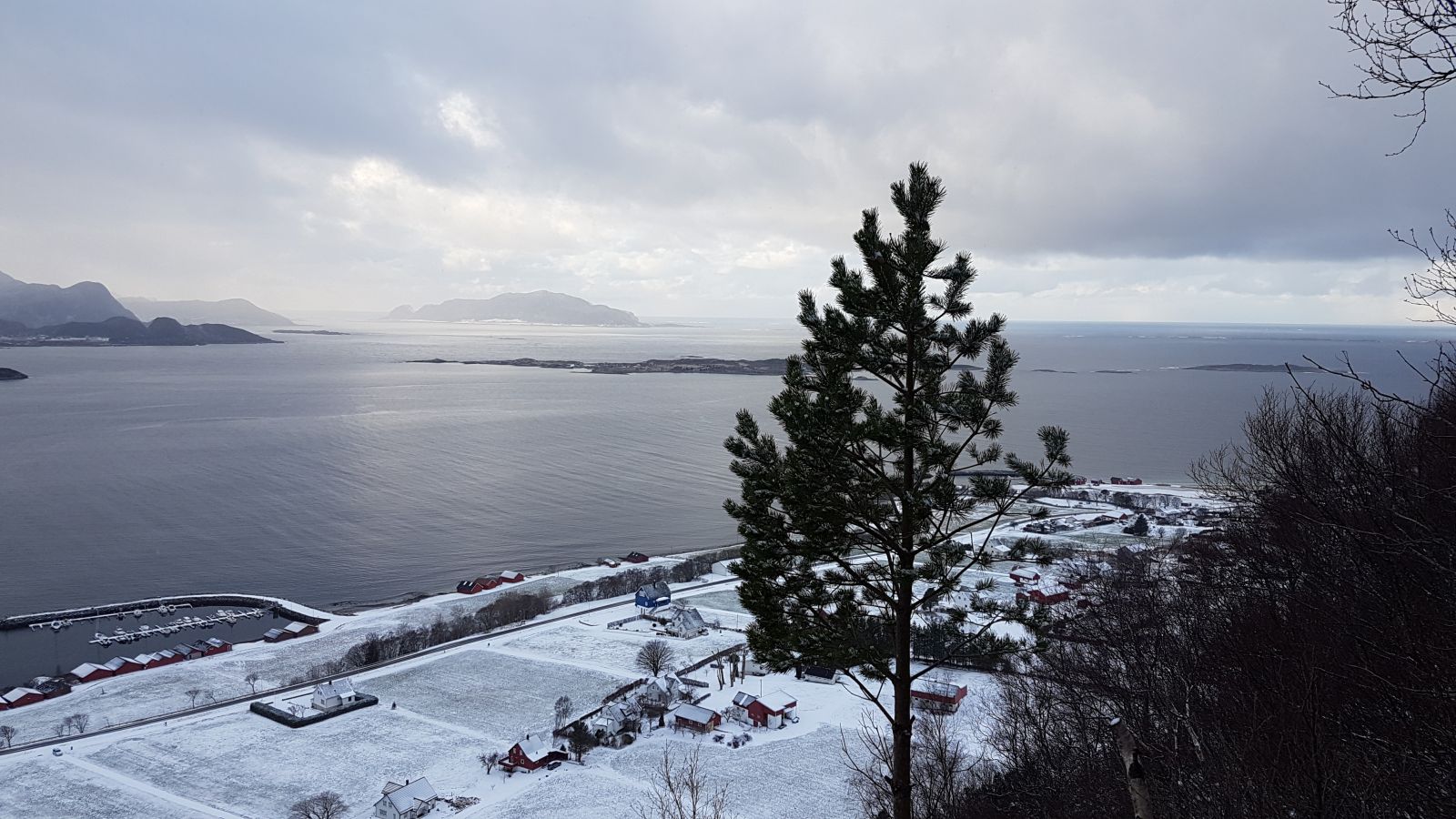
The trail from Bugarden to Nibben is one of the most popular hiking destinations in Ulsteinvik. It follows a gravel hiking path/forest road all the way up to the top. The trail is popular among people of all ages, including families with children and the elderly, as well as schools and nursery schools. It is also possible to start this trail from Skeide. The trail starts from the outdoor area Bugardsmyrane where you will find barbecue places, a “gapahuk” shelter, and illumination along some sections of the road. An outdoor fitness facility, Tufteparken Ulstein is also located here. Parts of the trail go through a dense spruce forest, and when you come out of the forest, you will get a fantastic view of Skeide and above with islets and islands in the south.
Route description
The first part of the trail is almost entirely evenly shaped. It follows a gravel road through the idyllic outdoor area of Bugardsmyrane. Then you need to turn right and start walking up a forest road/tractor road in the direction of Nibben. The road zigzags through the dense spruce forest and continues further to Nibben. You will get a great view from the top.
Access and parking
The trail starts from Bugardsmyrane, an outdoor area in Ulsteinvik. From Hareid: drive along County Road 61 (FV61) in the direction of Ulsteinvik, turn right onto Øvrevegen Road at the sign that reads “Sunnmøre Folkehøgskule” and follow this road all the way to Bugarden. From Ørsta/Volda: follow Eiksund Sambandet (the road system that joins several islands in Ulstein Municipality) towards the centre of Ulsteinvik. Follow Sjøgata Street and take the right turn after the second roundabout before the City Hall. Turn left onto Kyrkjegata Street and drive up Kyrkjebakken Hill to the right. Turn right onto Gjerdegata Street and follow Skulevegen Road, then Bakkegata Street and Vikebakkvegen Road all the way to Bugarden.
There are two parking options in Bugardsmyrane. There is space for several cars along the road turn above Tufteparken Ulstein. You will also find space for several cars in Osnesbrunene below Tufteparken Ulstein. No parking fee applies.
Hiking route
Green
Distance
1,8 km one way
Elevation
130 m
Duration
1 t. 10 min.
Sesong
Winter, Spring, Summer, Autumn
Highest Point
168 masl
Map route
Public transport
There are bus routes from Volda/Ørsta/Fosnavåg in the direction of Ulsteinvik and from Hareid to Ulsteinvik. Please check http://www.frammr.no