Naustådalssetra, Kårvatn
Surnadal
This hike starts from Kårvatn, the mountain farm in Trollheimen that lies at the furthest point in Todalen. The path up the hill is well waymarked. The mountain farm Naustådalssetra lies above the tree line where the terrain flattens out. You will find a postbox with a trail journal set up by the Todalen Sports Association here.
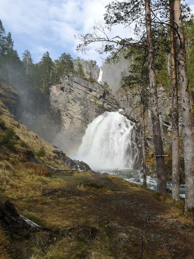
Follow the marked hiking trail from the tourist information point at the car park in Kårvatn in the direction of the Trollheimshytta cabin. Cross the bridge near the shop and follow the private gravel road that later turns into a path until you reach the marked hiking trail. Once you are above the tree line, you will soon reach the mountain farm Naustådalssetra, also called Dalasetra. On your way back, you can walk through a waterfall called Nauståfossen. Here, you will also see a signposted fork in the path on your way down. The waterfall is 110 metres high. The path near the waterfall can be slippery during the periods of high water.
Drive to Todalen and then to Kårvatn. Leave your car at the large car park before the turnoff to Kårvatn Fjellutstyr AS (Eng. Kårvatn Mountain Equipment). Cross the bridge near the shop and follow the gravel road. Follow the red-marked hiking trail towards the Trollheimshytta cabin.
Duration
1,5-2t

Sesong
Spring, Summer, Autumn
| Surface type |
Distance |
| Sti |
2 |
Naustådalssetra is one of the ten hiking trails where the Todalen Sports Association (Todalen IL) set up their postboxes with trail journals.
No public transport. The distance from Matkroken in Todalen to Kårvatn is about 10 kilometres.
 Driving directions
 Route data
GeoJSON
Route data
GeoJSON