Nakken – Vardfjellet
Molde
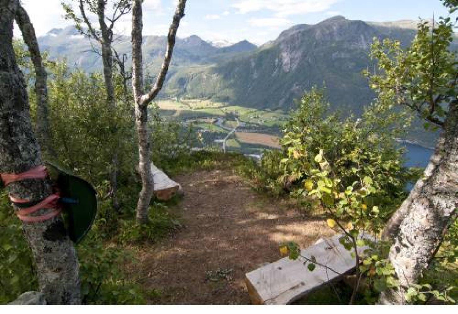
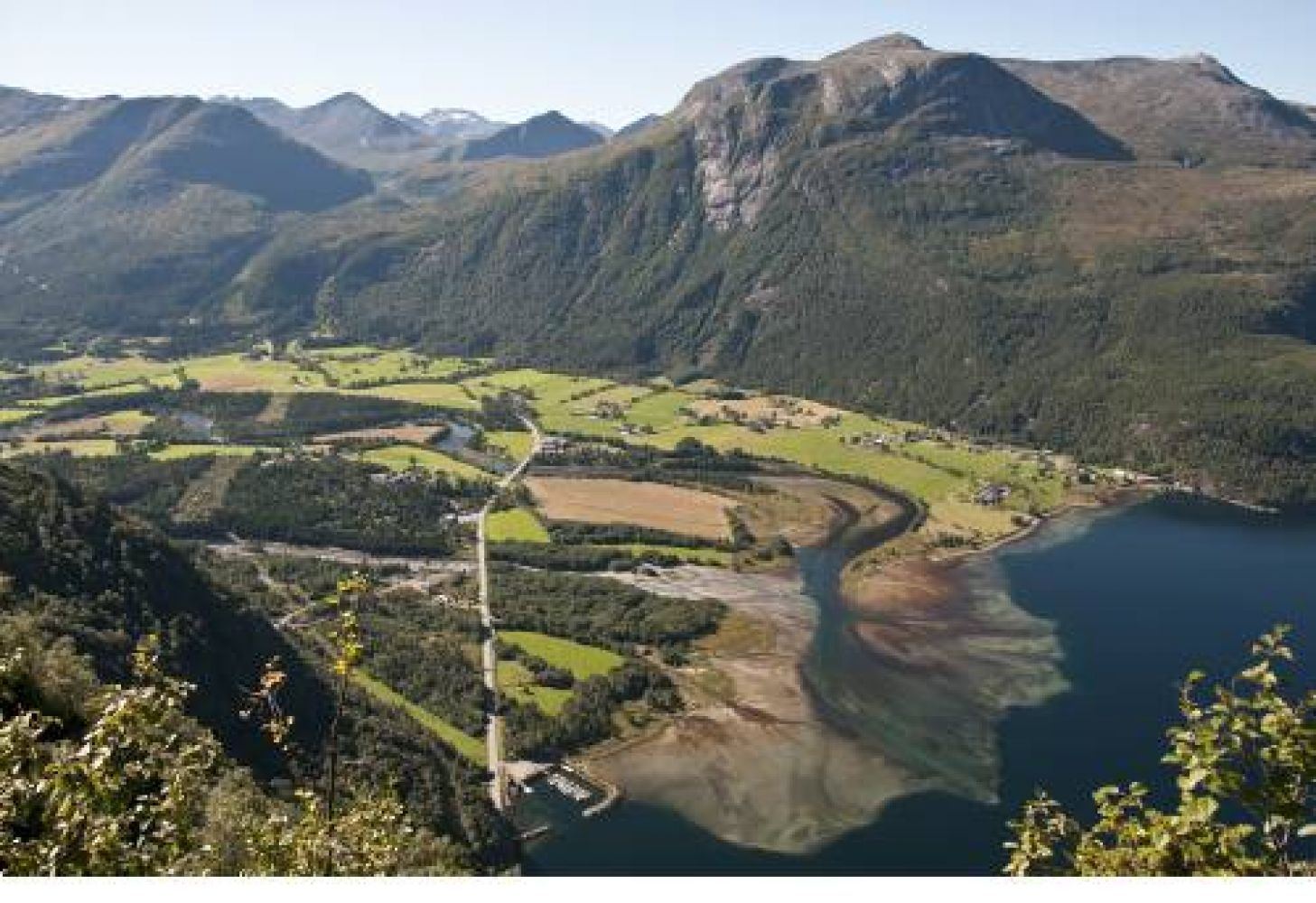
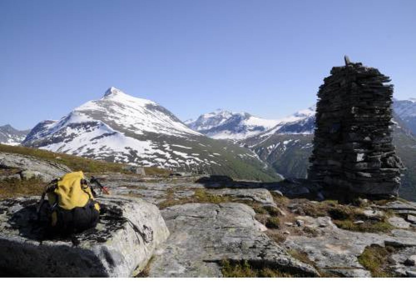
Eresfjord. This scenic hike follows a forest road and a path and is fairly easy. You can choose to walk to the first viewing point Nakken (520 m a.s.l.) only or continue to Mount Vardfjellet (831 m a.s.l.). From Nakken, you will get a fantastic view of the Langfjorden in the north and the village of Eresfjord below you. You will see the marina in Paulen, Eresfjord straight down below. This is one of the most popular fitness trails in Eresfjord. If you want, you can extend your hike east of Vardfjellet and walk towards Nordmørsskaret and down to Kanndalen.
Nakken: follow the forest road. When you come under the power line, you will see a clearly defined path on your right. Turn off the forest road and follow the good-quality path up the birch forest. You will walk onto another forest road further up. From there, the viewing point Nakken will be just a short distance away.
Vardfjellet: from Nakken, you can walk further up to Mount Vardfjellet. Follow that path/forest road further up. Walk straight ahead at the next signpost. You may also turn right, but the path there runs through a much wetter marshy area. The sign points to the driest path which is only about 100 metres longer. The path and the waymarks will lead you over the marshy area in the direction of the mountain ridge that goes through the forest. You are now on a well-trodden path again which you should follow up to the top of Vardfjellet.
Turn off the county road on the eastern side of Eresfjord and take the municipal road in the direction of Grandsetra. Follow that road all the way to the boom gate in Grandsetra. Park your car there.