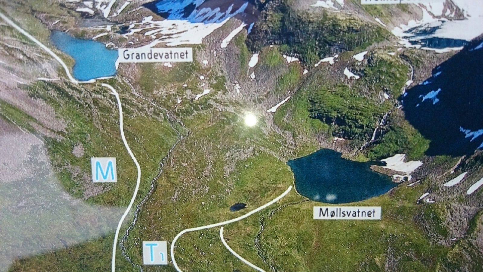
Lake Møllsvatnet lies in the Gråsteindalen valley. This lovely trail takes you through gently ascending terrain up to the idyllic lake. The trail if full of cultural heritage in the form of remains of old summer mountain farms. This is a family-friendly trail, and you can take a dip in the lake or just relax and enjoy the view once you reach the trail destination.
The trail starts from the car park in Korsmyra which is the highest point of the road section Eidsdal–Geiranger. Start walking from Korsmyra and follow the tractor road on the left side of the river as it takes you into the Gråsteindalen valley. After about 2 km along the tractor road with gentle ascent, you will cross the river over a bridge. The path continues further up on the other side of the river. It goes through a slightly steeper terrain for 500 m before you come up to the lake. The trail postbox is set up right next to the lake, but you will have to walk over a stone dam above the small brook. You can see an alternative route back to Korsmyra on the map. This route follows the other side of the river. You will walk along a marked path that gently takes you downhill until you come down to the tractor road after passing the bridge.
The trail starts from Korsmyra at 620 m a.s.l. Korsmyra is 9 km away from the centre of Geiranger and 16 km away from Eidsdal.
You can park your car in Korsmyra. No parking fee applies.
Duration
3 t. 10 min.

| Surface type |
Distance |
| Sti |
1 |
Tafjordfjella 2533 and Stranda municipality tourist map
 Driving directions
 Route data
GeoJSON
Route data
GeoJSON