Melshornet from Pilskog
Hareid
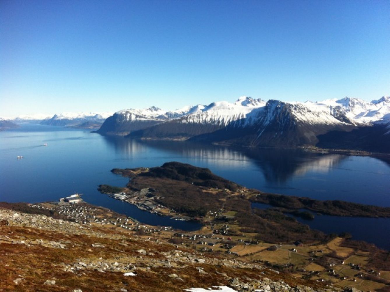
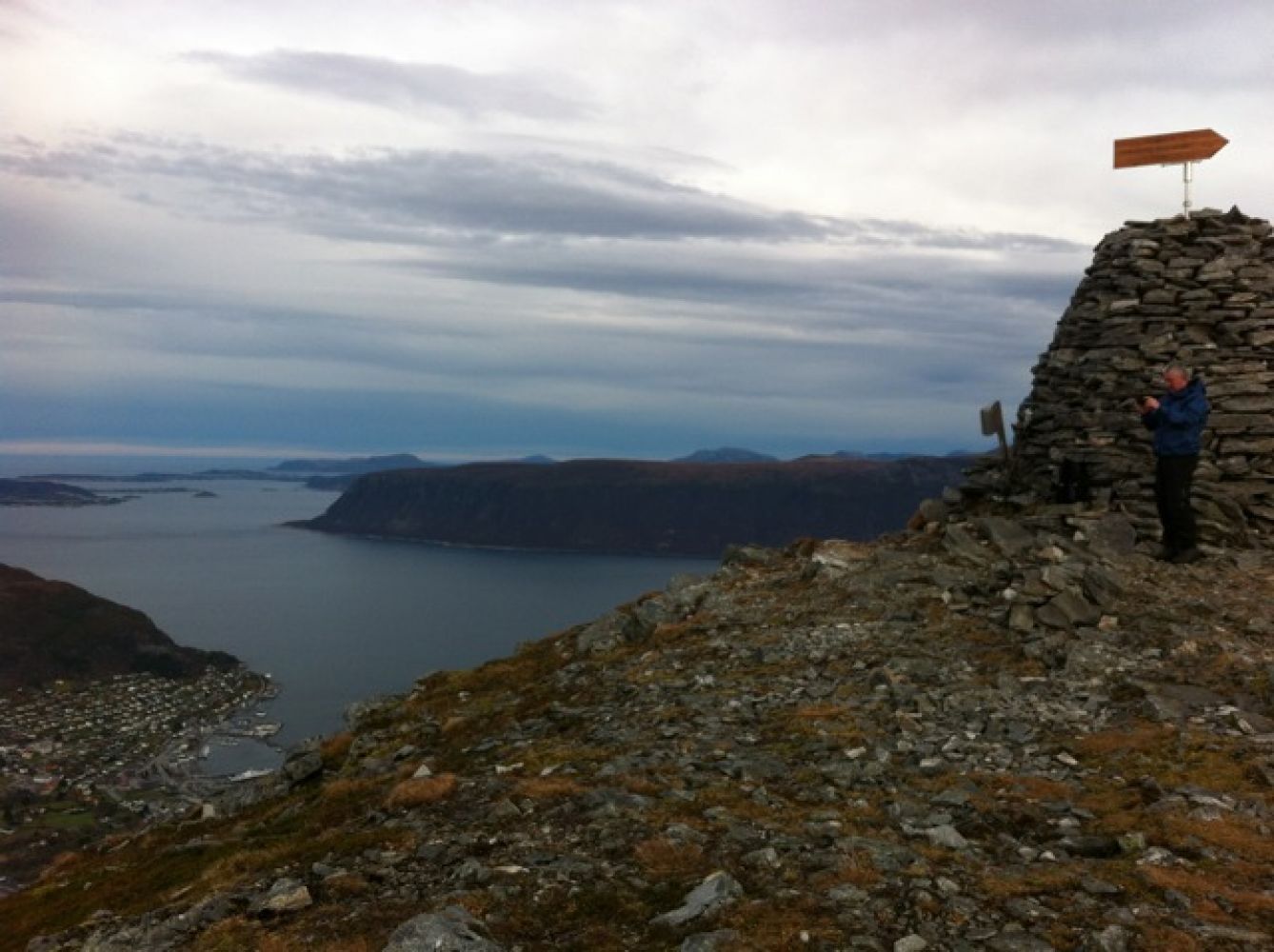
At the top, you will find beautiful, expansive views in all directions: Ulstein and the Herøy islands to the west, Breisundet and Nordøya islands to the north, Storfjorden and Ørskog to the east, and Vartdalfjell and the Sunnmøre Alps to the south. An impressive toposcope displays the names of most of the mountaintops. A large cairn has also been built here.
At the beginning of Pilskogvegen, right behind the bus shelter, there is a separate parking area with an information board for hikers. The board has a map and aerial photos of the hiking area with descriptions. Continue on Pilskogvegen to the end. At the edge of the woods by the sign "Melshornet", continue up to the sign "Øvstegardsråsa" at the trail crossing and continue until you see two signs for Melshornet. Here you can choose between two alternatives. The distance to Melshornet is about the same for both trails, about 3.5 km. The best and dryest trail is the one that goes over Grøthornet. This is the path marked on the map in this route description.
There is a separate parking area for hikers right behind the bus shelter at the start of Pilskogvegen.