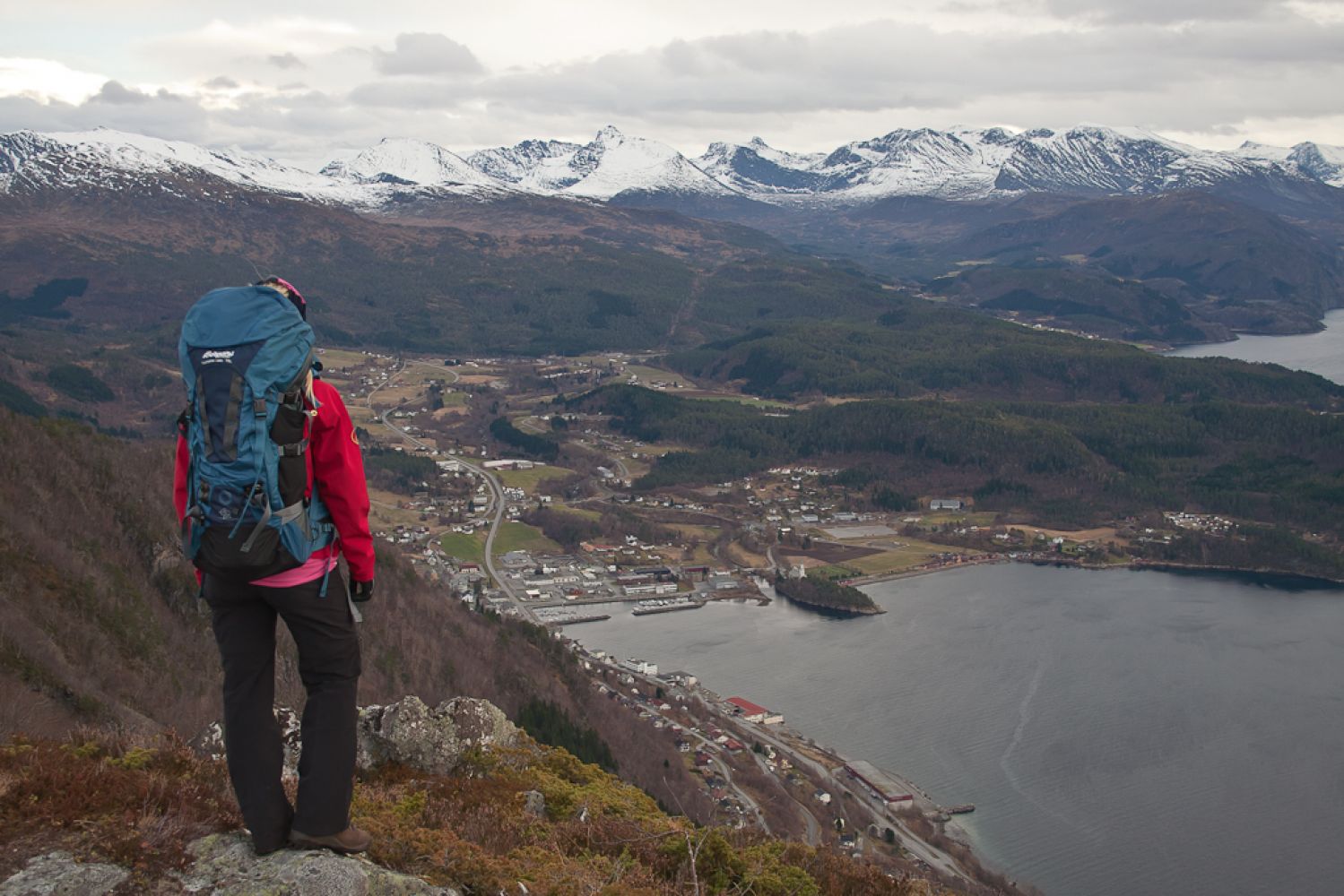
This is a diverse hiking trail along a good quality path with some wet sections over marshy areas. You will walk through a forest, over small marshes, and finally follow a mountain ridge west with a great view of the centre of Sjøholt and Ørskogvika. If you go hiking on a summer’s afternoon or evening, you can often see cruise ships leaving Storfjorden on their way from Geiranger.
.
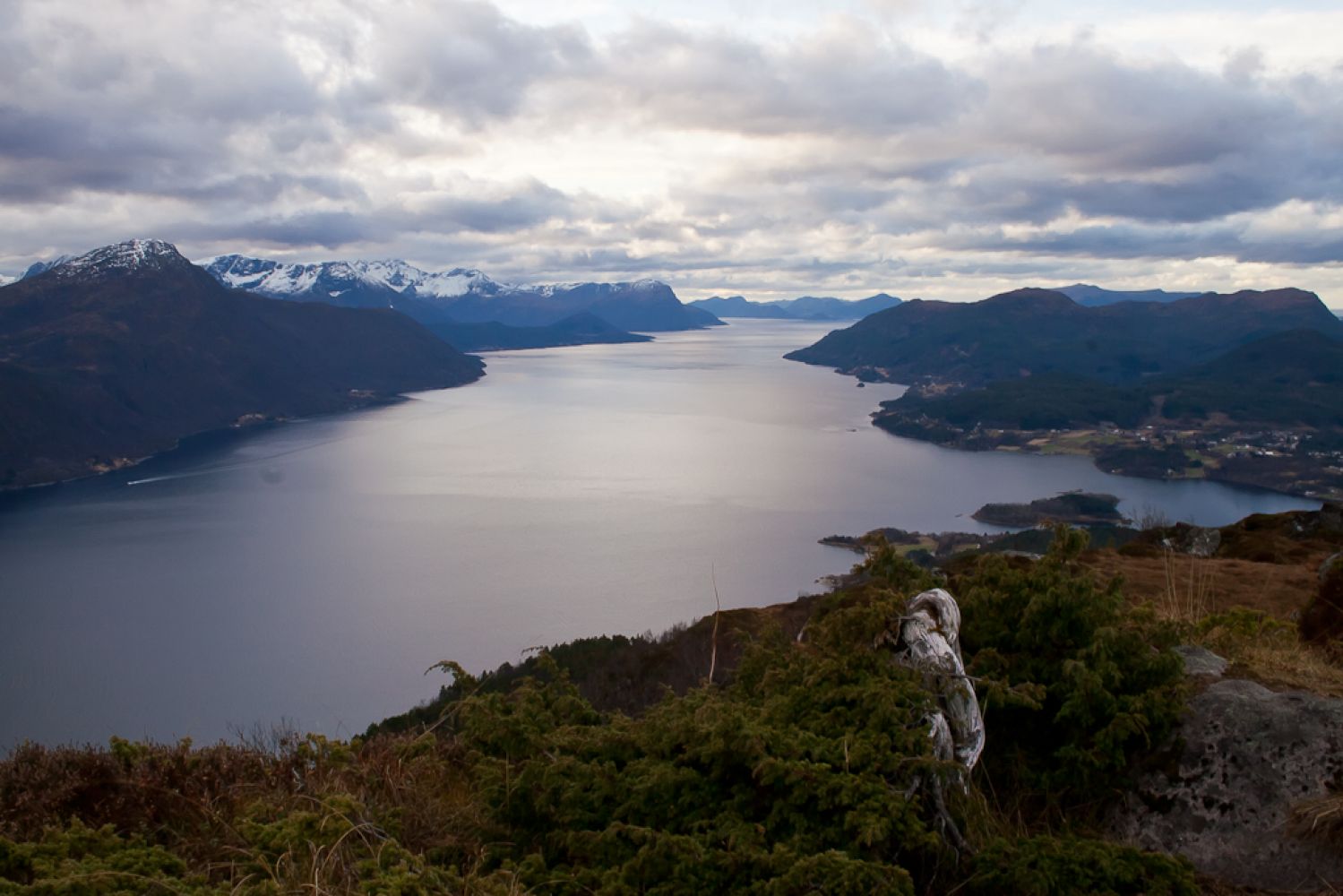
The highest point of the trail is in the far west of the long and narrow mountain ridge. From the mountain top, you will see Storfjorden and the farms of Ramstaddalen and Furstranda in the south and west. Ørskogvika Bay and parts of Sjøholt can be seen in the south and east. In the northwest, you will find the Solnør farm and the Skodje municipal centre.
You can also see the mountain tops of Vaksvikfjellet and Ørskogfjellet far in the east, and Mount Frostadtinden lies in the north.
Ørskog Sports Association placed a postbox with a trail journal where you can register your name on a pole next to the trigonometrical point.
The first section of the trail goes through a pine forest and over small marshes. It has a gradual ascent. The path is clearly seen the entire time. As you approach the tree line, the path splits in two. You can either walk through the old barrack for workers of the former mine (now converted into a cottage and privately owned), or keep going west. At this point, the largest part of the climbing will be over and you will enter the Liafjellet Nature Reserve. Follow the mountain ridge west along the good quality path and enjoy a fantastic view until you reach the trigonometrical point. Liafjellet is an elongated “peak” with marshy and rocky areas. This trail destination is also popular among the residents of Skodje who call the mountain Solnørfjellet. Another name of the mountain is Liaveten, which tells the story of a beacon fire (Nor. vete) that used to be lit up here to warn the people about an unrest in the country.
Turn off from E39 in the centre of Sjøholt and drive north at the sign for Solnørdal. Follow Solnørdalsvegen Road for about 2 km until you reach a hilltop with a car park.
You will also find a path and a trail sign that reads “Liafjellet” right next to the car park, on the other side of the road.
Park your car along the county road between Sjøholt and Braute in Solnørdalen.
Duration
2 t. 35 min.

Sesong
Spring, Summer, Autumn
| Surface type |
Distance |
| Sti |
7,8 |
You can take a bus, for example, Timeekspressen, to the centre of Sjøholt and walk for about 2 km along the county road in the direction of Solnørdalen.
Liafjellet has been repeatedly used for the extraction of iron ore. On the southern side of the mountain, you can find several adits, open-cast mines, and remains of the old extraction industry. More information about the area can be found in Ørskog Sports Association’s book called “På tur i Ørskog” (Eng. “Hiking in Ørskog”).
The area is snow free from the middle of May.
 Driving directions
 Route data
GeoJSON
Route data
GeoJSON