Lauparen (1434 m a.s.l.) from Grytalisætra
Ålesund
Mount Lauparen rises to 1434 metres above sea level and is the highest peak in the former Ørskog Municipality. The view from the top is simply fantastic! This is a scenic but fairly difficult trail where the final section follows a steep ascent. However, with good footwear and respect for the mountains, the trail can be tackled by most people. The mountaintop is quite large and offers a magnificent view. You can see the ocean and the mountains on the islands of Godøya and Hessa in the west. In the north, you have the Romsdalsfjorden and Molde. Mount Stordalsfjella lies closer to you, the Storfjorden and Stranda are in the south, and you can also see several famous mountain peaks in Hjørundfjorden and Sykkylven in the southwest.
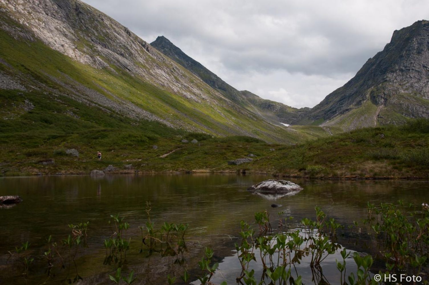
The first section of the trail runs through gentle terrain up to Lake Grytavatnet. This is a great hiking destination in itself. There are nice camping spots in the area and some trout in the lake. Please buy a fishing licence if you want to go fishing. On your way there, you will walk along some streams and idyllic smaller lakes which are perfect photo spots. This hike is well signposted up to Trangbotn (998 m a.s.l.).The path is also clearly defined until the outer part of Trangbotn but then becomes less clear. Here, you will often find some snow even in late summer. The snow is easy to walk on. You can also fill up your bottle with water before walking further. Keep to the right as you move further into Trangbotn and aim for the cairn up on the mountain pass in your line of sight. You will occasionally see some traces of paths. When you climb up to the mountain pass, the path continues to the left (north). From here, a large part of the trail to the mountaintop is clear. The only place where you might wonder about the route is a short section over some large stones, but you can use the small cairns as waymarks. The main path drifts slightly to the left on its way up the ridge. After about 100 metres over the stone surface, you will return to the ground/sand where the path is clearly visible again. This path will take you up to about 1300 m a.s.l. Keep to the left as you approach the peak aiming for a small but clear cleft in the rock. Here, you will see some “stairs” and railings to hold on to. This is the steepest section of the hike, but it is well secured. Once you climb up this cleft, you are only a few metres away from the peak, but you have to manoeuvre a little because of the stones.
The return route follows the same path which may look a little scary from the top, but with enough time and pauses along the way it is completely manageable. The return route can take about the same time as the way up to the top so please plan accordingly. There are several loose stones and some gravel on the path down to 1100 m a.s.l. The terrain becomes easier from there to Lake Grytavatnet. The remaining section of the trail from Grytavatnet down to Grytalisætra follows a good-quality path without major challenges.
Take FV650 towards Valldal/Geiranger from Sjøholt (E39). Follow that road for about 7.5 km. Turn left (north) towards Vaksvika. Drive past Vaksvik Chapel, continue along the gravel road, and turn right towards Grytalisætra where you will find a designated car park. The toll fee is NOK 20 (2013).
From Romsdal: drive to the innermost part of the Tresfjorden. Turn off the road and drive along the river past the stadium and up the Kjersemdalen Valley. Continue further up and over the tree line past Lake Kjersemvatnet. Turn off to the left and drive up to the car park by Grytalisætra.
Duration
6 t. 30 min.

Sesong
Spring, Summer, Autumn
Mobile coverage
Partially
| Surface type |
Distance |
| Sti |
11,5 |
There are some loose stones as you approach the peak. Keep to the left from the mountain pass at Trongbotn (998 m a.s.l.). The path is usually fairly good from mid-July. For those who do not want to climb to the mountaintop, a gap above Trangbotn (998 m a.s.l.) with a large cairn on top can be a good alternative. From here, you will have a beautiful view down to Jasvollbotn, which is also a great hiking destination, as well as a view back to the Storfjorden.
Hiking map Ørskogfjellet in hiking map series or Stranda, Sheet 1219 I in map series M711.
Cash payment of NOK 20 (2013)
 Driving directions
 Route data
GeoJSON
Route data
GeoJSON