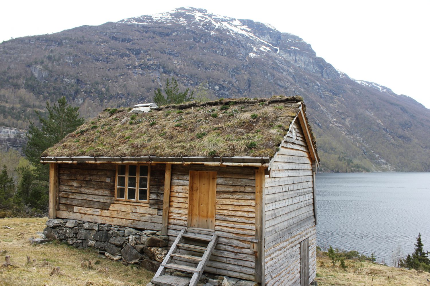
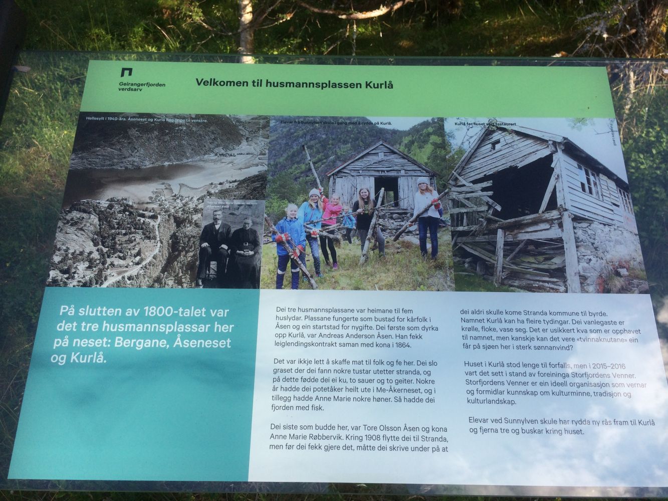
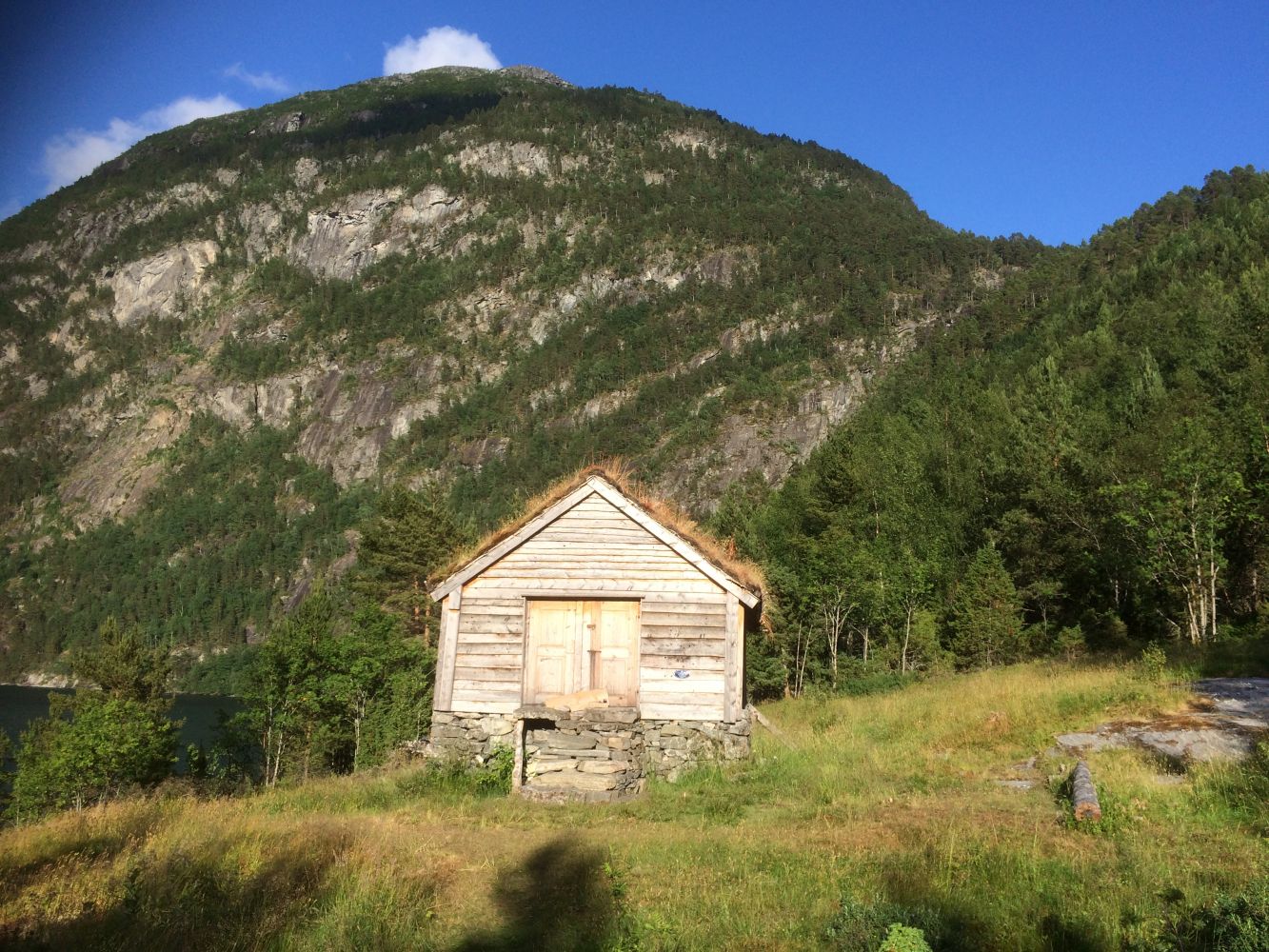
A large section of the trail takes you along Sunnylvsfjorden and offers a great view of the fjord. You will also walk past several cultural attractions. Kurla is the last old homestead that still stands along Sunnylvsfjorden. It has been fully renovated by the Storfjordens Venner organisation (“Friends of Storfjorden”). The renovation was finished in 2016. You will also walk past two other homesteads on your way to Kurla. These are Bergane and Åseneset. A monumental stone in Jogarden reminds you of where the first church in Sunnylven once stood.
The trail starts from the Hellesylt Stadium. Follow the asphalt road in the direction of Sunnylvsbygda for about 150 metres. Turn left and walk in the direction of the two farms in Jogarden. At the road crossing in the farmyard of the two farms, take the turn to the left and follow the gravel road until it ends (an old Shell dock). This is where the trail starts running through the terrain with some patches of bare rock until you reach Åseneset. Once you come to Åseneset, you will see a crossing of several paths. Follow the marked path that leads to Kurlå.
The trail ends with the old homestead Kurla. From there, follow the same way back to the car park.
(You can also walk up to the farms in Åsen and follow the road down to the Hellesylt Stadium from there. This would be a nice round trip for those who want to extend the trail. This alternative route is not shown on the map.)
The trail starts from the Hellesylt Stadium where you can park your car. Once you reach the centre of Hellesylt, turn right (at the Formvac AS factory building) and drive for about 300 m. You are now in front of the Hellesylt Stadium. You can park your car free of charge here.
You can park your car by the Hellesylt Stadium. No parking fee applies.