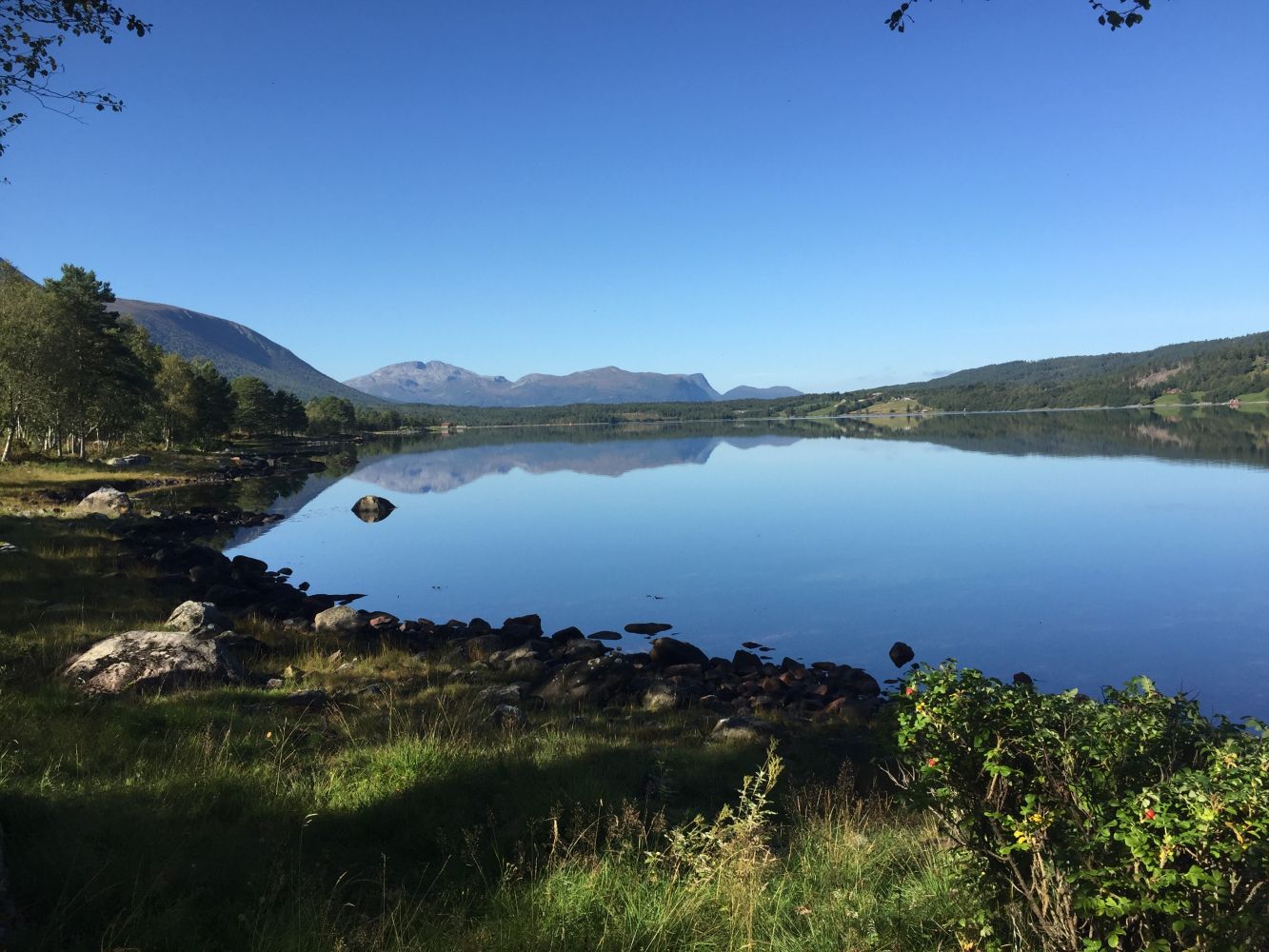
The trail along the stream, Vestnesstraumen, to Kråkvika and Kråkneset is widely accessible and easy to follow. It offers a great outdoor experience with a beautiful view and diverse bird life. You might spot deer, squirrels, and otters along the way. The area has some nice fishing spots. In autumn, you can find blueberries, cranberries, and mushrooms in the forest nearby. There are also picnic areas with barbecue spots. This is a description of the main route through the outdoor area, but there are many detours to take for those who like walking along forest paths. It is impossible to go astray.You will be close to the village and at the same time out in the nature with all the experiences it has to offer. The starting point of the trail is the same as its endpoint.
Route description
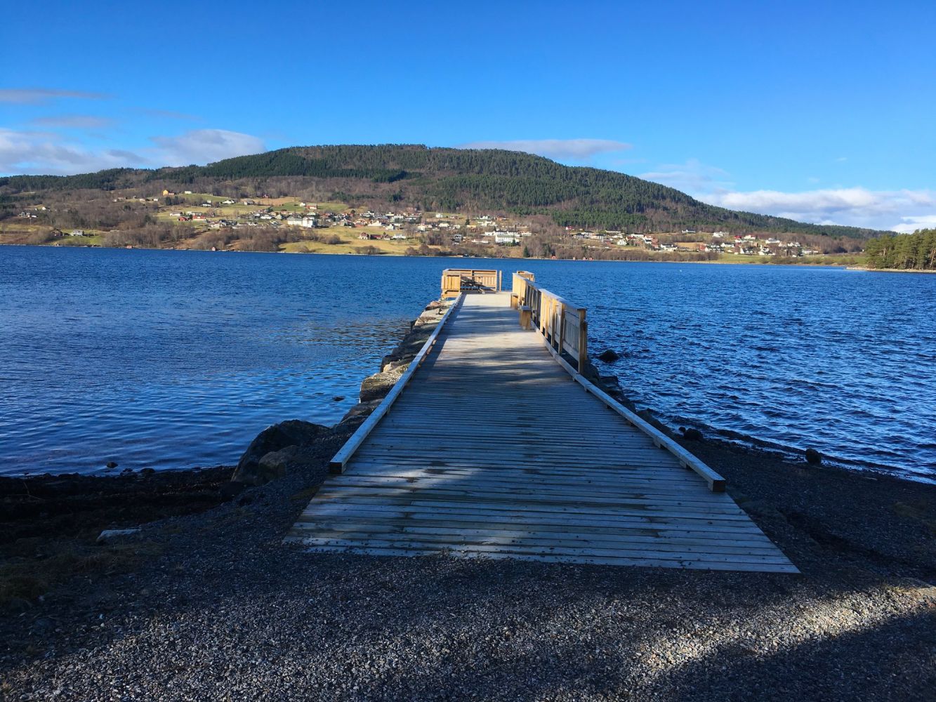
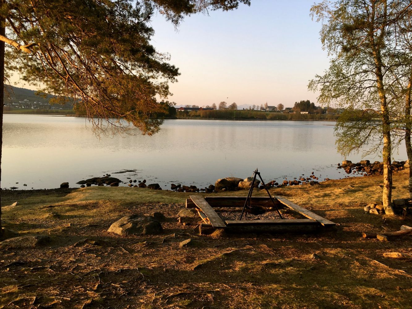
Start from a stone with an information plate southeast of the Straum Bridge over the Vestnesstraumen. The trail follows a narrow road west along the Vestnesstraumen and goes under the Vestnes Bridge. There is a public toilet on your right below a distribution kiosk. Construction works on a swimming area are in progress here. After 0.75 km, you will reach a small bridge and enter the Kråkvika Outdoor Area. Just as you walk over the bridge in the inner part of Kråkvika Bay, you will see two roads joining from the left. Continue to the right. After 1.26 km, follow the arrow marked “Bålplass” pointing right towards Kråknesodden. You will reach a beautiful bare rock and grassland area with a campfire site and benches (1.43 km). On your way back, follow your “main road” to the right (north). A road to a “new” campfire site and a pier where you can try fishing is on your right (1.73 km). To the left of the road across the pier, you will see a Stikk Ut postbox attached to a toilet building. A “gapahuk” shelter with a campfire is on your right. For a longer walk, follow a gravel road past the pier and along the seaside towards Flatevågen. There are several benches and campfire sites along the way and a nice trail shelter with a barbecue place at the end of the road.
Keep on walking on the left side past the “gapahuk” shelter and into the forest after 2.03 km. Turn around at the boom gate near the municipal industrial area. After 2.19 km, take a path on your right. It is a shortcut back to Kråkvika (2.33 km) and the bridge you crossed on your way here. This is where you start walking back. After 2.53 km, a path on the right leads to a small spit of land with benches. The nursery school’s “gapahuk” shelter will be on your right (2.67 km). 2.81 km – you will see an incinerator that belongs to the former Hellandheimen institution up on the hill. 2.88 km – you are now back at the toilet building (now on your left). 3.25 km – turn right to get to the sports park, Vestnes Idrettspark. 3.50 km – you are back at the start.
Access and parking
There are three bridges over the Vestnesstraumen. The trail starts from the one in the middle. Seen from the Shell petrol station in the centre of Vestnes, the starting point is diagonally across the roundabout. Coordinates: 32 V 0401989 and 6945133. There are several car parks in the area, such as the one in Kataholmen by the Hurtigbåt ferry terminal or next to the Vestnes Stadium. You can also start from the entrance to Kråkvika Outdoor Area. There is a large car park near the day care centre “Gamle Strandbo” in Hellandheimen. To get there, drive down a steep hill past the adult education centre at Myra 21, please check with the map.
Hiking route
Green
Elevation
35 m
Duration
1 t. 50 min.
Sesong
Winter, Spring, Summer, Autumn
Highest Point
8 masl
Signage
Signed
Map route
Surface type
Distance
Asfalt
1,2
Grus
2,22
Public transport
There is a bus and an express boat connection to the centre of Vestnes.
Other
No information about climbing is included in the description since it is insignificant. The trail has a total ascent of 22 metres.
Map
You can use a map on the website of Vestnes Municipality.