Note! Stikk UT codes are in place, but there is still snow on some parts of the hiking trail.
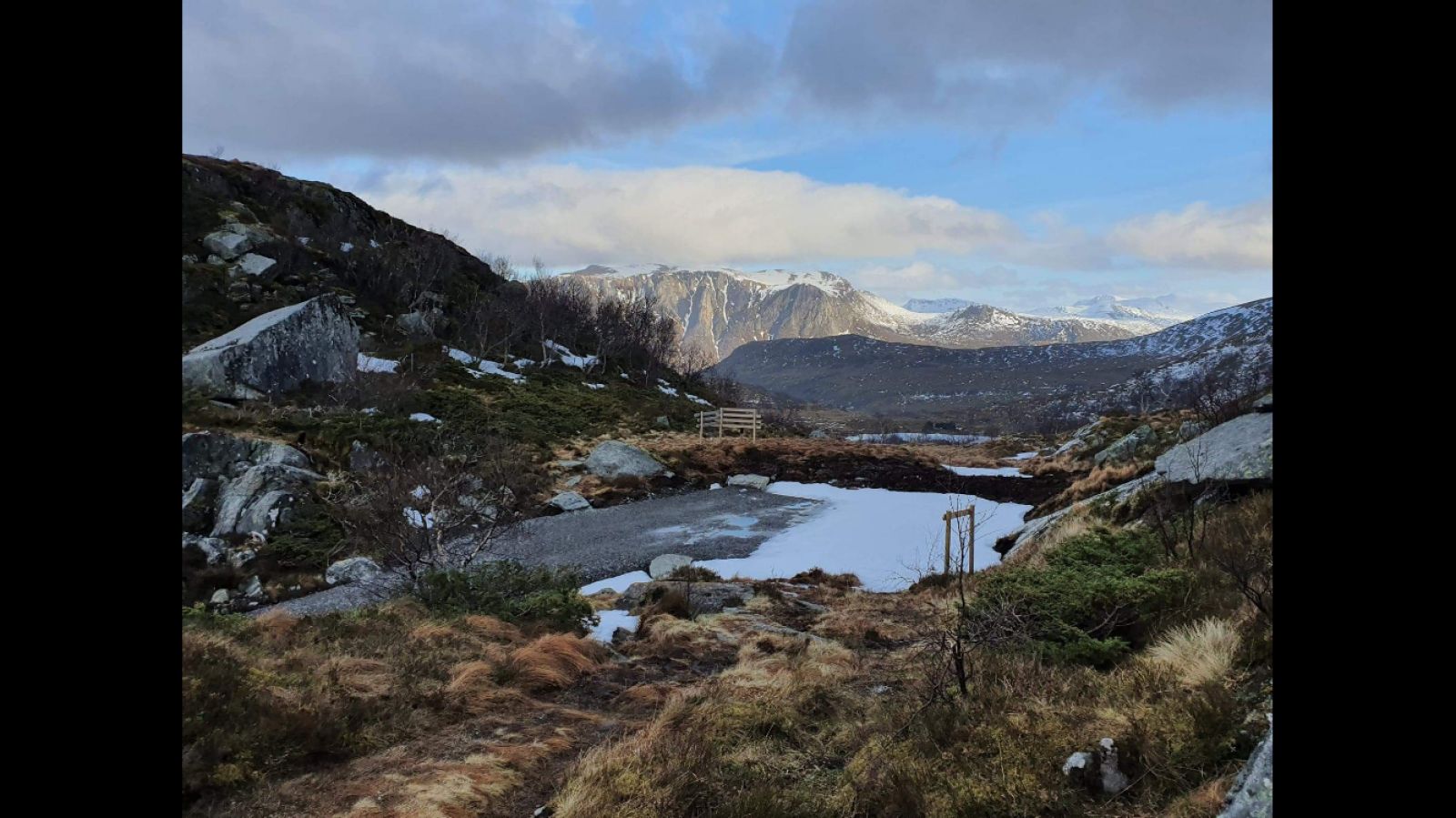
The entire trail to Kleiva is a gentle ascent with a slightly steeper climb at the end. The hiking trail is short and fairly easy, which makes it perfect for an afternoon walk or a Sunday trip with children.
Route description
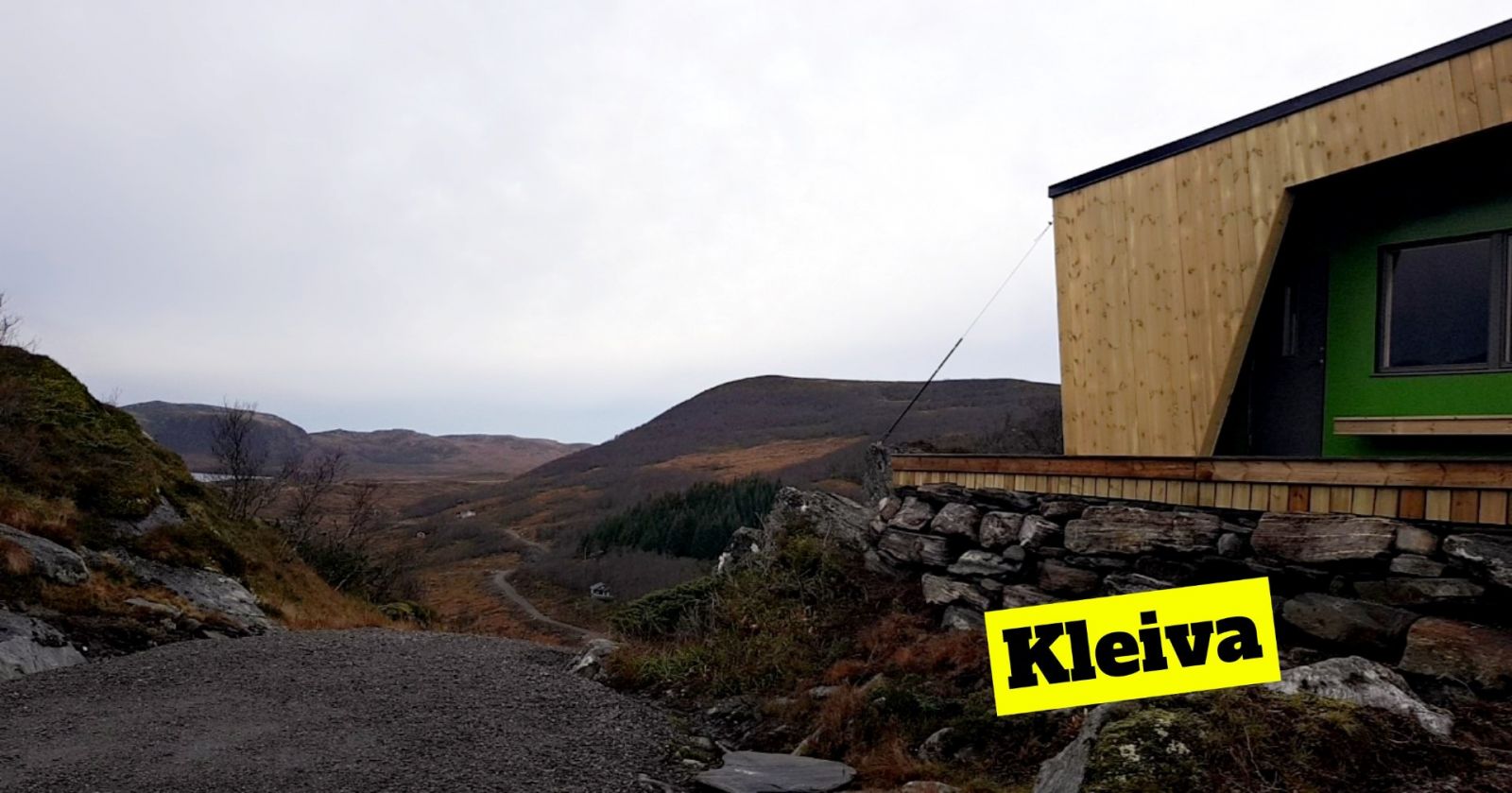
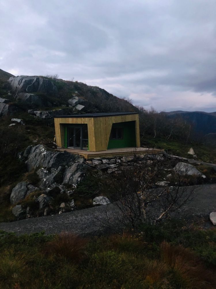
With the starting point in Sandnessætra, this hike is suitable for people of all ages, including children. You will follow a good-quality path the entire time. It is a gentle climb from the car park to the destination, where you will get a scenic view of Kvandalen and Golida. The trail to Kleiva is a great starting point for several other hikes in the area.
Access and parking
The route described here has a starting point in Sandnessætra. To get there, turn off County Road 61 (FV61) and take the old road about halfway between Koparnes and Eidså, 2 km from the centre of Eidså. Drive up Sandnesdalen until the end of the road. This is a toll road with a fee of NOK 50 for one trip and NOK 500 for an annual pass. There is a free car park at the end of the road.
Hiking route
Green
Distance
1,33 km one way
Elevation
113 m
Duration
1 t. 0 min
Sesong
Winter, Spring, Summer, Autumn
Highest Point
443 masl
Signage
No signage or markings
Map route
Surface type
Distance
Sti
1,33
Payment method for toll road
NOK 50 or NOK 500 for an annual pass. You can pay with Vipps or cash.