Tussen from Jensgurilia
Molde
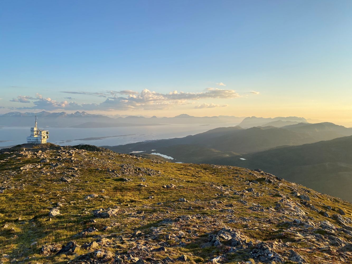
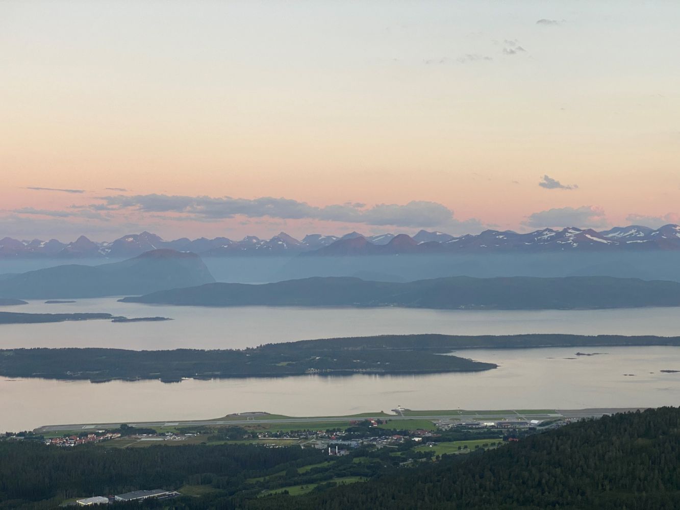
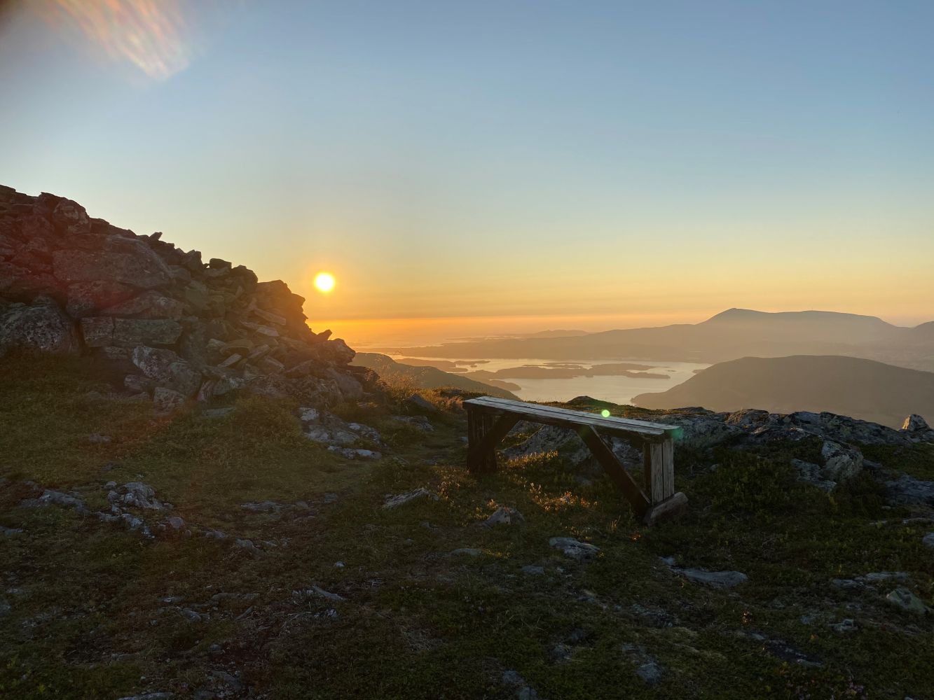
Nice route for hiking, skiing and cycling. The trail is easy enough for families with children up to Tussenvegen. You can turn around there or hike to the top of Tussen, which is more challenging. There are splendid views at the top of Romsdalen and the row of mountain peaks to the south and of the sea to the west, with a 360-degree view of the Skaret Intermunicipal ski facility to the east and Varden to the west.
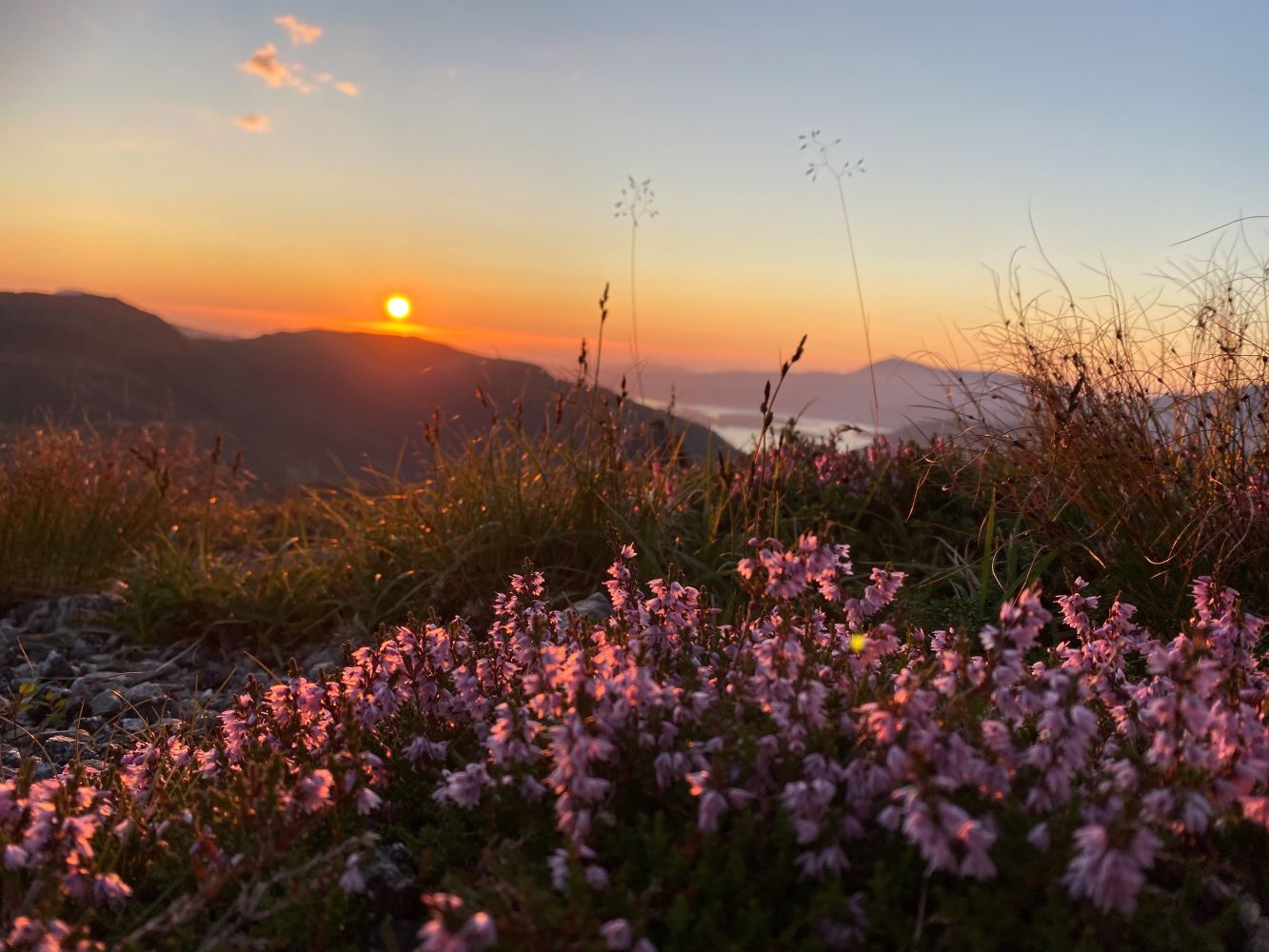
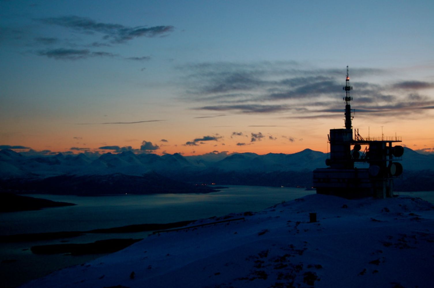
The route starts from the parking area at Jensgurilia. Head east along a well-prepared hiking trail and continue southeast of Øverlandsvatnet lake. At the east end of the lake, turn right at the bend and follow a new trail towards Hindalen. This is a well-prepared trail, and along the way you will see the peak of Tussen mountain with its characteristic tower. You will eventually come to Tussenvegen, which is a construction road up to the tower. Turn left at the Hindalen-Tussenvegen junction and follow the construction road upwards. When you come to a bend in the road after about 200 metres, you can choose whether to follow the Norwegian Trekking Association's hiking trail, which is signposted at the bend, or to continue along the construction road. The gravel road is steep, but it is otherwise well-developed. Just before you reach Tussentårnet, the trail turns to the right. Follow the trail eastward up to the cairn at the very top of Tussen mountain. This hike provides lovely views of the fjords and mountains, with a panoramic view from the top. This is an especially stunning route at sunrise and sunset.
Alternative starting point: You can also start the trail from the lower parking area by the ski cafe at Tusten Skiheiser AS. Follow the construction road from the starting point to the top, and turn off just before you come to the tower as described above. When starting here, you will pass Molde's beautiful ski facility.
Free parking for hikers in Jensgurilia. From the west, drive along Olav Oksviksveg. At the top of Olav Oksviksvei, turn off to the left and follow the signs for trail parking. You can also start the route from the lower parking area by the ski cafe at Tusten skiheis AS (ski lifts). Here you may have to pay a small parking fee.
Duration
3 t. 55 min.

Sesong
Spring, Summer, Autumn
| Surface type |
Distance |
| Grus |
10 |
Not only can you enjoy some great hikes here, you can also visit the High and Low Climbing Park by Tusten Skiheiser AS. The ski cafe by the parking area is open every weekend and daily through the summer from 11:00 to 17:00. Here you can purchase coffee, waffles, and more.
 Driving directions
 Route data
GeoJSON
Route data
GeoJSON