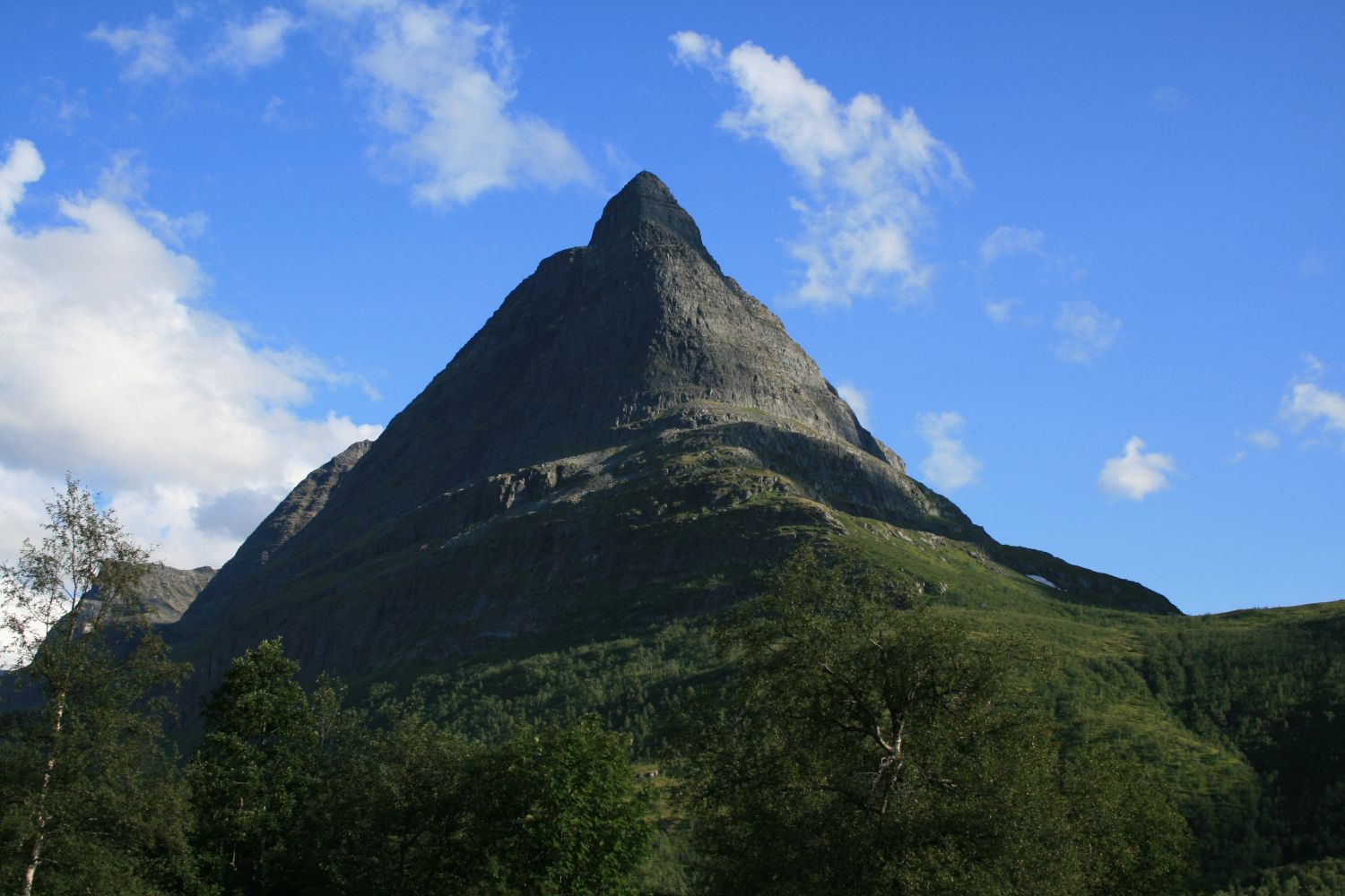
Innerdalstårnet is perhaps the most famous mountain in Nordmøre. With its steep walls that rise up to a small plateau at 1452 metres above sea level, Mount Innerdalstårnet is a very popular photo spot. The hike is not recommended in wet terrain. The summit offers a fantastic view over the valleys Innerdalen and Giklingdalen and the surrounding mountains.
The trail described here starts from the Innerdalshytta cabin. You cannot drive up to the cabin so please check a separate trail description for Innerdalshytta.
There are several alternative ways to reach the peak of Mount Innerdaltårnet but most of them follow the normal route. This summit hike is usually completed without a security rope, but note that you will walk in exposed terrain where a fall can be very dangerous. The hike to Innerdalstårnet is partially steep, but it can be tackled by most people in dry weather. From the Innerdalshytta cabin, follow the “T”-marked path to Eiriksvollen in Sunndalen. Turn off from the marked path when you reach Lake Storvatnet and continue eastwards up the steep path in the direction of Tårnskaret. The final 150-metre ascent to the top is quite steep. You will walk on bare mountain so there is no path from here. You need to traverse the steep terrain to find the easiest and safest route to the mountaintop. Follow the same route on your way back.
You can park your car by the Innerdalshytta cabin. Please see the description of the route to the cabin.
Duration
4 t. 50 min.

| Surface type |
Distance |
| Sti |
7,4 |
This hike may seem more exposed and intimidating in wet terrain compared to hiking in dry weather.
Norge map series: Sunndalsøra, 1420 II Romfo
 Driving directions
 Route data
GeoJSON
Route data
GeoJSON