Høystakken/Breiteigsfjella – Route 44 – from Syvde to Høystakken/Breiteigsfjella
Vanylven
This ski trail over fairly easy terrain offers a fantastic view from the plateau just above Høystakken.
Depending on whether you can drive through the first part of the mountain road, the trail is about 10 km long each way. The terrain is gentle and avalanche safe, and you can enjoy scenic views the entire time. When you reach the plateau just above Høystakken, you will get to experience a very rare combination of mountain plateaus, peaks, alpine formations, coastal landscapes, and the ocean.
The starting point of this trail is a road that is usually covered in snow in winter. The trail continues over gentle and open terrain. There are no steep slopes or challenging sections along the way.
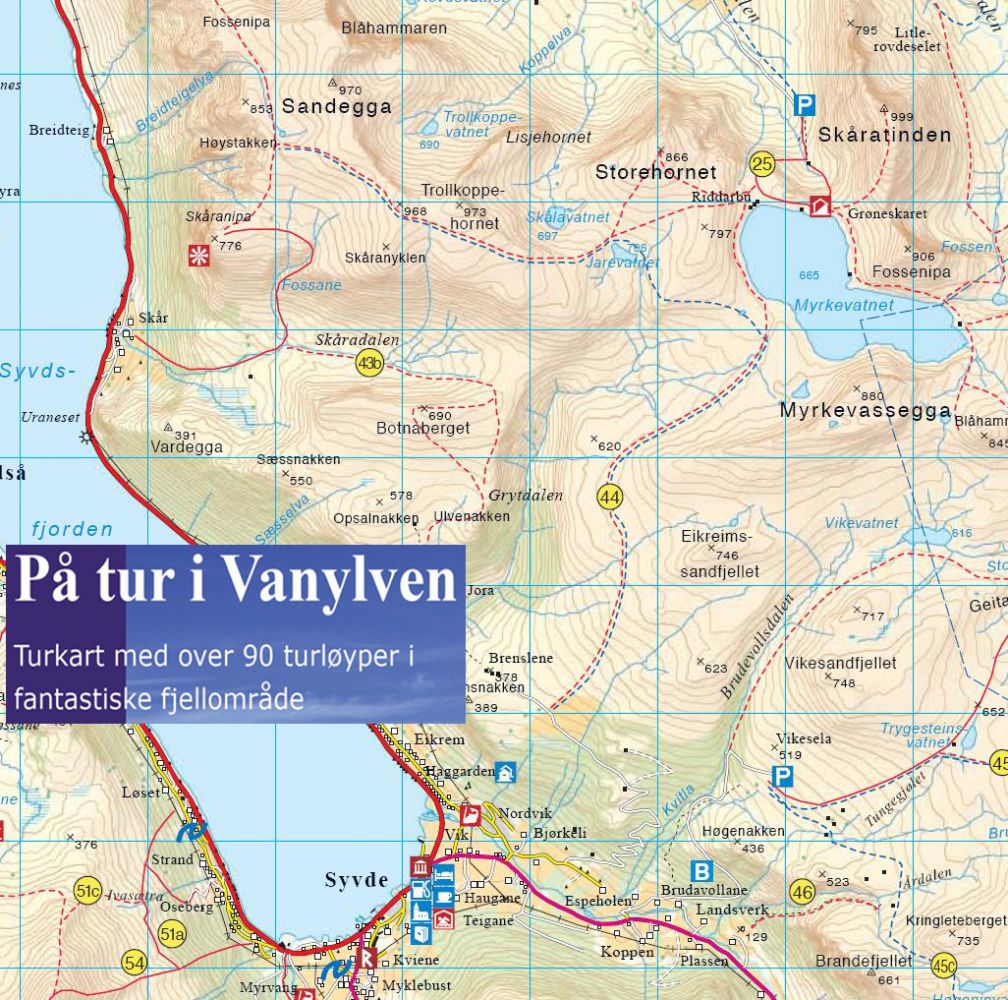
Drive in the direction of Nordal and turn off the national road in Syvde. Turn left over a bridge at the second junction. Turn right just after the bridge and drive for about 300 m along the asphalt road before the mountain road branches off to the left. Turn right at the end of the mountain road and move parallel to the Grytdalen Valley until you have almost reached Lake Myrkevatnet. Go northwest and then west across the mountain plateaus. Please see the blue dotted line in the picture showing a section of the map.
Skiing route
Blue fjellski
Duration
5 t. 50 min.

Hiking map: På tur i Vanylven (Eng. Hiking in Vanylven) – can be purchased at local shops and petrol stations in Vanylven Municipality.
 Driving directions
 Route data
GeoJSON
Route data
GeoJSON