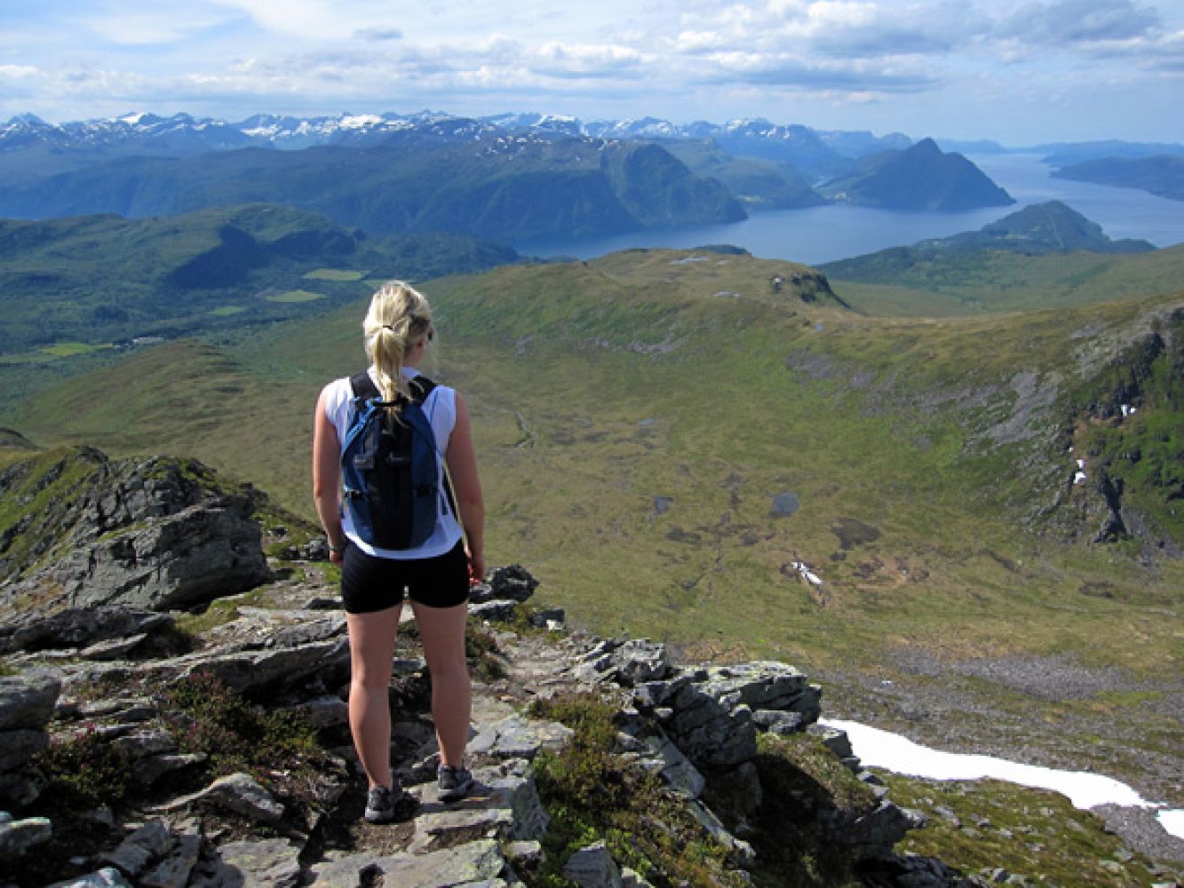
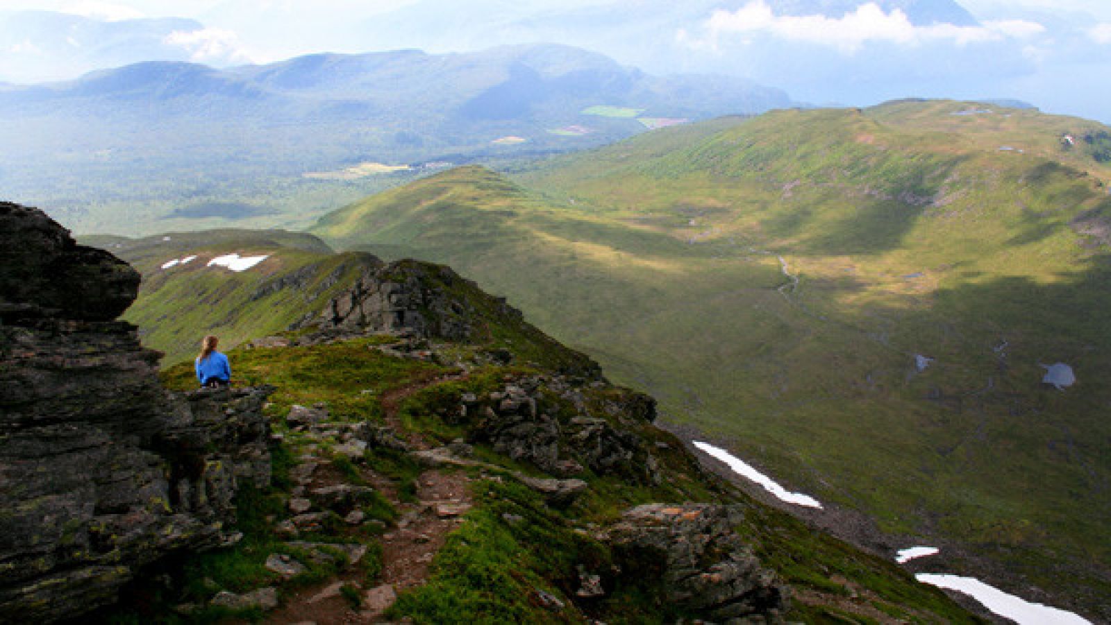
This trail has a medium level of difficulty. It runs through a mountain birch forest, heathland and grassland, and climbs steeply up a narrow mountain ridge. Among other things, you will have an amazing view of Vaksvikfjella, Ørskogfjellet, Molde, and Ålesund from the mountaintop. The area is mostly snow free from the second half of June.
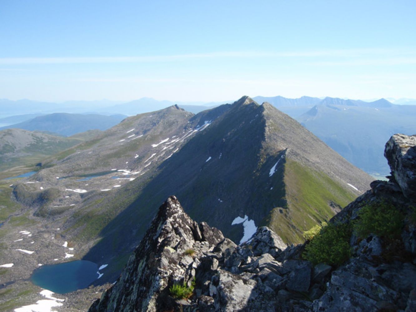
The path begins between the cabin and the Midtelva River. You will see a sign showing the direction. The path runs north along the river until you come up to the Kvandalen Valley. Cross the river near a lone standing rowan tree and walk diagonally up over the marshes towards the southern ridge of Mount Høgsvora. There is no clear path here, but as you walk, aim for the largest hill before the ridge of Høgsvora. You will then find the path that climbs up the ridge and follows it northwards to the mountaintop. The ridge is narrow and may feel very open in a couple of places. The top of the mountain is covered with rough scree and has steep north and east-facing sides. You will find a postbox with a trail journal where you can register your name at the cairn. From the mountaintop, you have a view east towards Mount Næremstindane and the mountains of Tresfjord and Rauma further away. In the southwest, you can see the villages of Vaksvika, Viset, and Dyrkorn that lie nearest and the mountain ranges Sykkylvsfjella and Sunnmørsalpane further away. You will also have a view over the Storfjorden and see Hareid, Sula, and Ålesund. In the north, you can see the Romsdalsfjorden and Molde, and Lauparen, Grytavasstinden, and the Skorkja mountains in the southeast.
Turn off National Road 650 (RV650) between Sjøholt and Stordal in Vaksvika. Drive east along the county road in the direction of Tresfjord. You will reach Vaksvikfjellet Camping after 4 km. Turn left before the building that used to be a chapel, Sportskapellet.
This is where the toll road to Sollisætra begins. The toll fee is NOK 50. Drive to the end of the toll road until you find a car park near the VIPP cabin.
Park your car by the cabin in Sollisetra.