The small island of Eika is a hidden gem of Sunnmøre and a popular hiking destination. The trail follows a gravel road right from the start and is therefore widely accessible. Although it is not evenly shaped due to the different types of surface and some uphill sections, the trail is still suitable for most people, including people with strollers and wheelchair users. From Høgda, you can choose to go further to the south of Eika and follow a gravel road that offers a beautiful view in the direction of Yksnøya, Voldsfjorden and Velsvika. Another option is to follow the path north from Høgda in the direction of the small top called Vassnakken. The trail destination, Høgda is located along the road where you will find benches and a table to enjoy a short break or eat a snack.
Route description
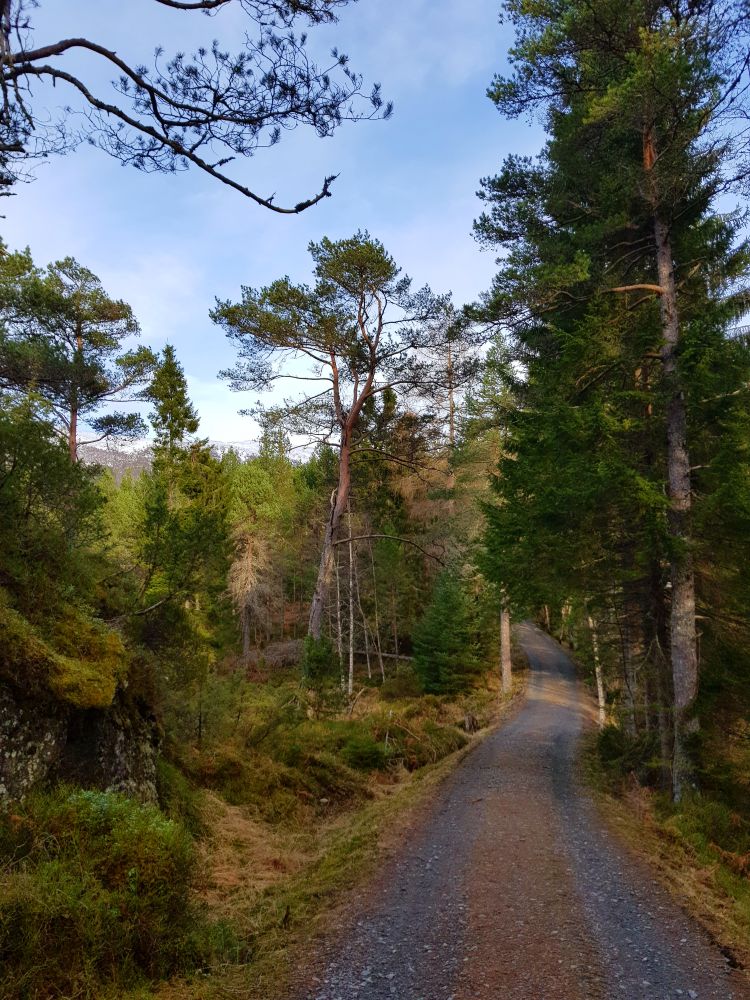
The trail starts from the car park just east of the entrance to the Eiksund Tunnel. When the road splits after a few hundred metres, take the right turn. Follow the road as it swings around Eikenakken Hill before you reach Høgda which is the highest point of the trail.
Access and parking
From Ørsta/Volda: follow Eiksund Sambandet (the road system that joins several islands in Ulstein Municipality) through the Eiksund Tunnel and turn right before the Eiksund Bridge. From Ulstein/Hareid/Fosnavåg: drive in the direction of Volda/Ørsta and turn left just before the Eiksund Tunnel. Park your car right after you turn off the main road.
You can park your car right after you turn off the main road.