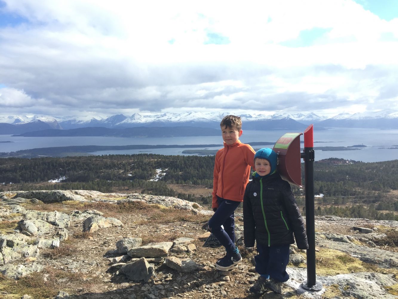
Once you are at the top of Haukarheia, you will get an amazing view over the entire Moldemarka area, as well as the fjord and mountains. If you would like to get an even better view, you can walk further up along the ridge to Mount Tusten.
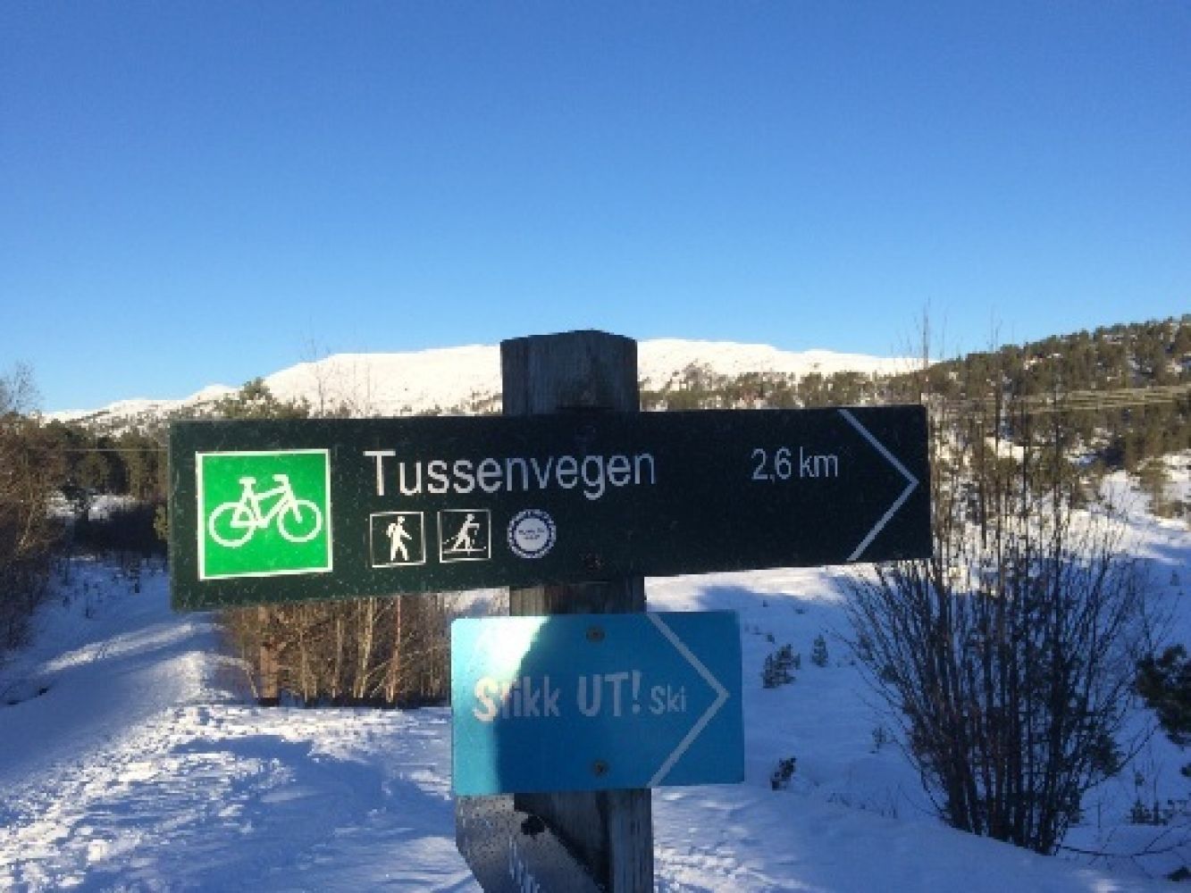
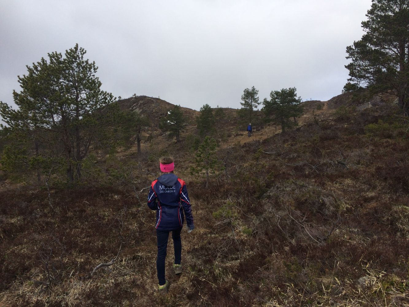
Start walking from the car park and follow the gravel-surfaced hiking trail eastwards past a water treatment plant and through a small boom gate. Continue following the hiking/cycling trail as it goes east (to the right) near Lake Øverlandsvannet. Follow the sign to Tussenveien. Walk to the east end of the lake. Once you reach the large left turn in the trail, you will see a gravel road which veers to the right. It leads to Tussenveien, the path to the top of Mount Tussen. The cycling trail is marked with the sign “Tussenveien 2.6 km”. When you reach Tussenveien, take the turn to the left and follow the path uphill until you are under the power line. At both junctions under the power line, take the left turn. From here, you will see the trail destination (a small hill roughly to the west). Go west and slightly uphill. As you follow the path, you will see waymarks at some places, but the path is not clearly visible the entire time and is often wet. You will need to walk across a small marsh right before you begin climbing the hill. This is a nice and easy trail which is also suitable for cycling all the way to the point where you turn off from Tussenveien. The same applies to baby carriages. This trail is 3.55 km long one way. Follow the same way back or make it into a looped trail and walk down under the power line towards Lake Bergsvatnet. Description of the alternative return route: As you walk down, you can follow the path that goes south from Haukarheia towards the southeast end of Lake Bergsvannet. This path is marked with 30-cm long red/white/blue-painted signs which are places quite close to each other on the way down through the forest. From Lake Bergsvatnet, follow the path further southwest until you return to the gravel hiking trail which will take you back to the car park. This return route is 2.54 km long.
The trail starts from the car park next to Jensgurilia Street in Nordbyen, Molde. Drive along Olav Oksviks Road and follow the sign that points to the car park and reads “Turparkering”.
Jensgurilia Street