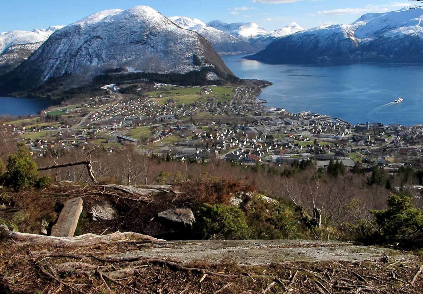
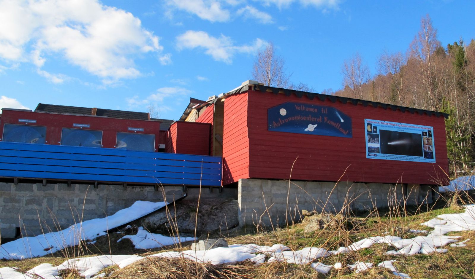
Gildrehammaren Hill is located above Klepp in the centre of Volda Municipality. This great viewing point is centrally located and easily accessible. The trail is a good fit for families. The Kometland Astronomy Centre on your way is worth your attention. Why not come back here one evening to study the night sky? You can read more about Kometland here: http://www.kometland.com/
Route description
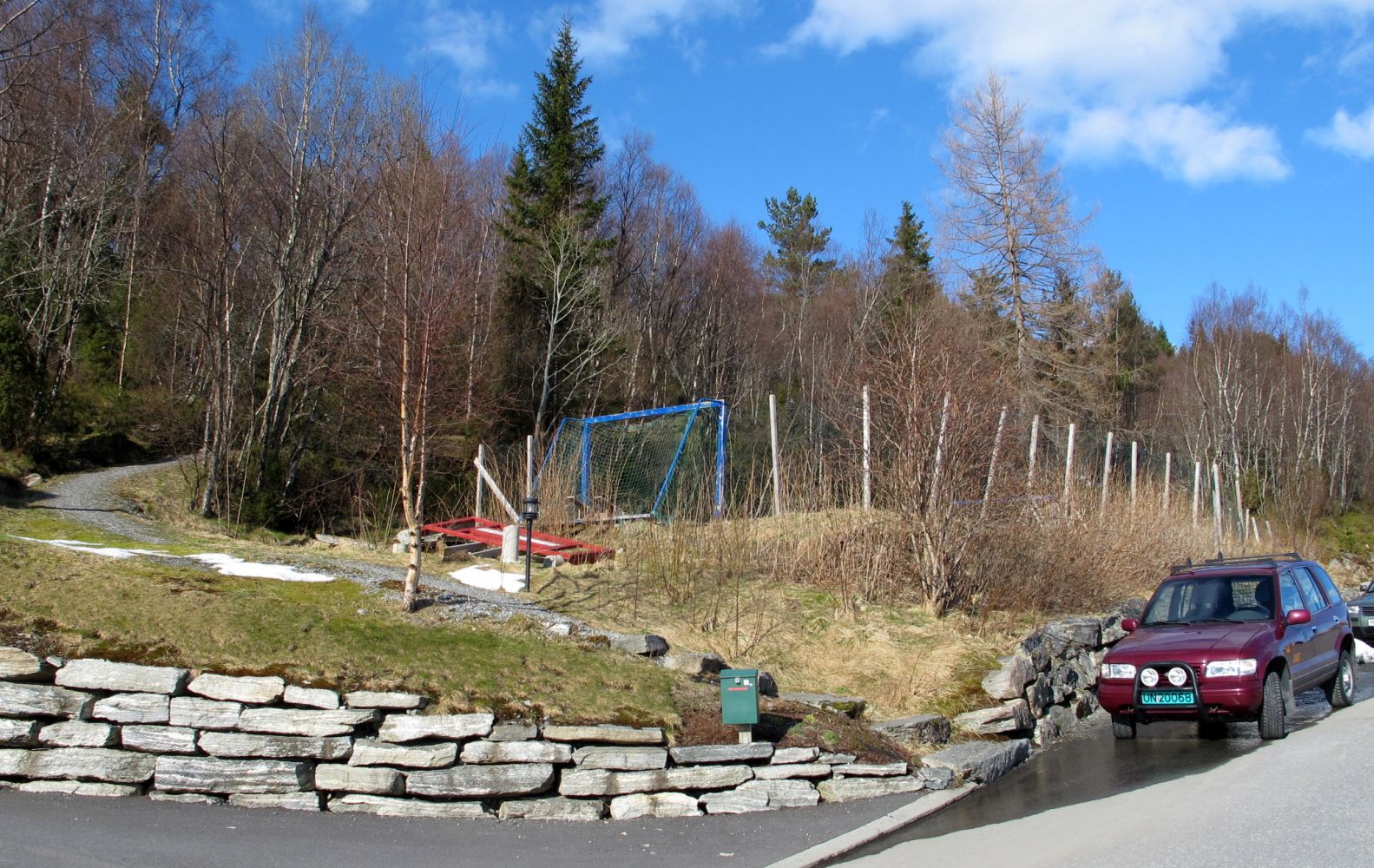
The path to Gildrehammaren is easy to find. Start walking from the top of Kleppevegen Road, between Kleppevegen 73 and the sports area/playground. In the beginning, you will follow the same road that leads to Kometland. After walking up the first hill, go straight ahead and follow the path that is signposted to Gildrehammaren. You will then come to Katadalen. The surface might be wet as you walk over some marshes and fields, so waterproof outdoor wear is definitely recommended. The path is clearly seen in the terrain. When you reach the next sign for Gildrehammaren, the path will climb up a steep hillside, but you will soon get to the trail destination where you can enjoy the view and perhaps your packed lunch. The forest around the hilltop is cleared by the Volda Rotary Club so the view is really good! Once you reach Gildrehammaren, there are many options to choose from if you want to extend your hike. You can go to Tverrberget, Niven, Kleppesetra or walk through Vardehornet all the way to Melshornet. But for many people, the trail to Gildrehammaren itself will be long enough. If so, you can do a loop trail as you walk back. Follow the path further east. To make it easier to climb, you can use the stairs built by the Volda Rotary Club. The path is clear as it runs further down through the forest. Once you come across a new and slightly wider path, go right and you will come down to the Kometland Astronomy Centre. Follow the gravel road down to the starting point. Are you wondering where the name “Gildrehammaren” comes from? The Norwegian word “gildre” refers to a particular type of hunting equipment in which an animal activates a trigger mechanism such as a trap or a self-shooting gun. This type of equipment is believed to have been used in the area, and this is how the hill got its name. Have a great hike!
Access and parking
The trail starts from the top of Kleppevegen Road and follows the same road that leads to the Kometland Astronomy Centre.
Drive up Storgata Street, Ottamarka Street and Engesetvegen Road from the centre of Volda. When you see a large white building (“Maurtua”), turn left and follow Kleppevegen Road until it ends. Park your car next to the sports area/playground.
Hiking route
Blue
Distance
1,4 km one way
Elevation
171 m
Duration
1 t. 10 min.
Sesong
Winter, Spring, Summer, Autumn
Highest Point
347 masl
Map route
Surface type
Distance
Grus
0,5
Sti
0,9
Public transport
Most of the people can walk from the centre of Volda.