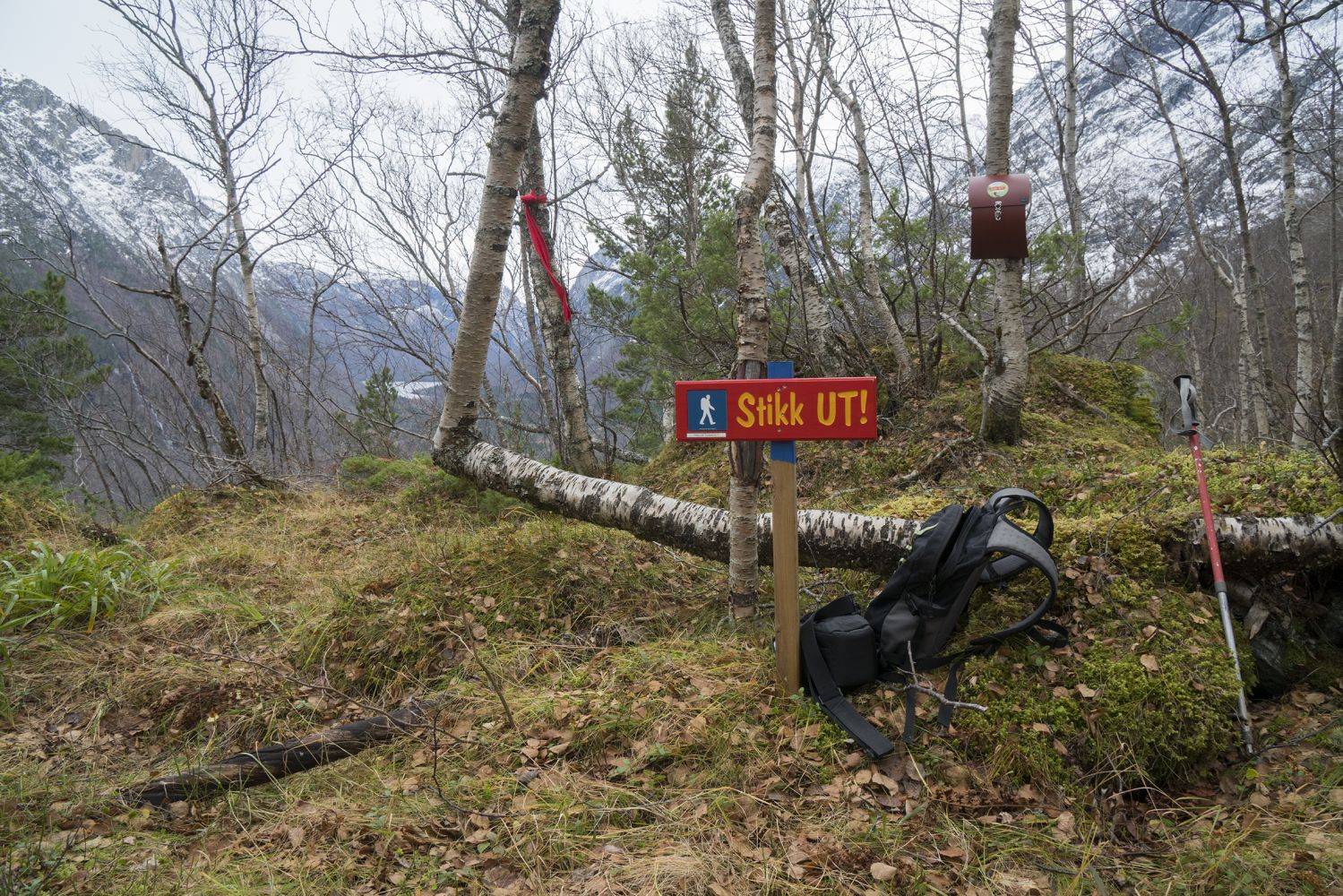
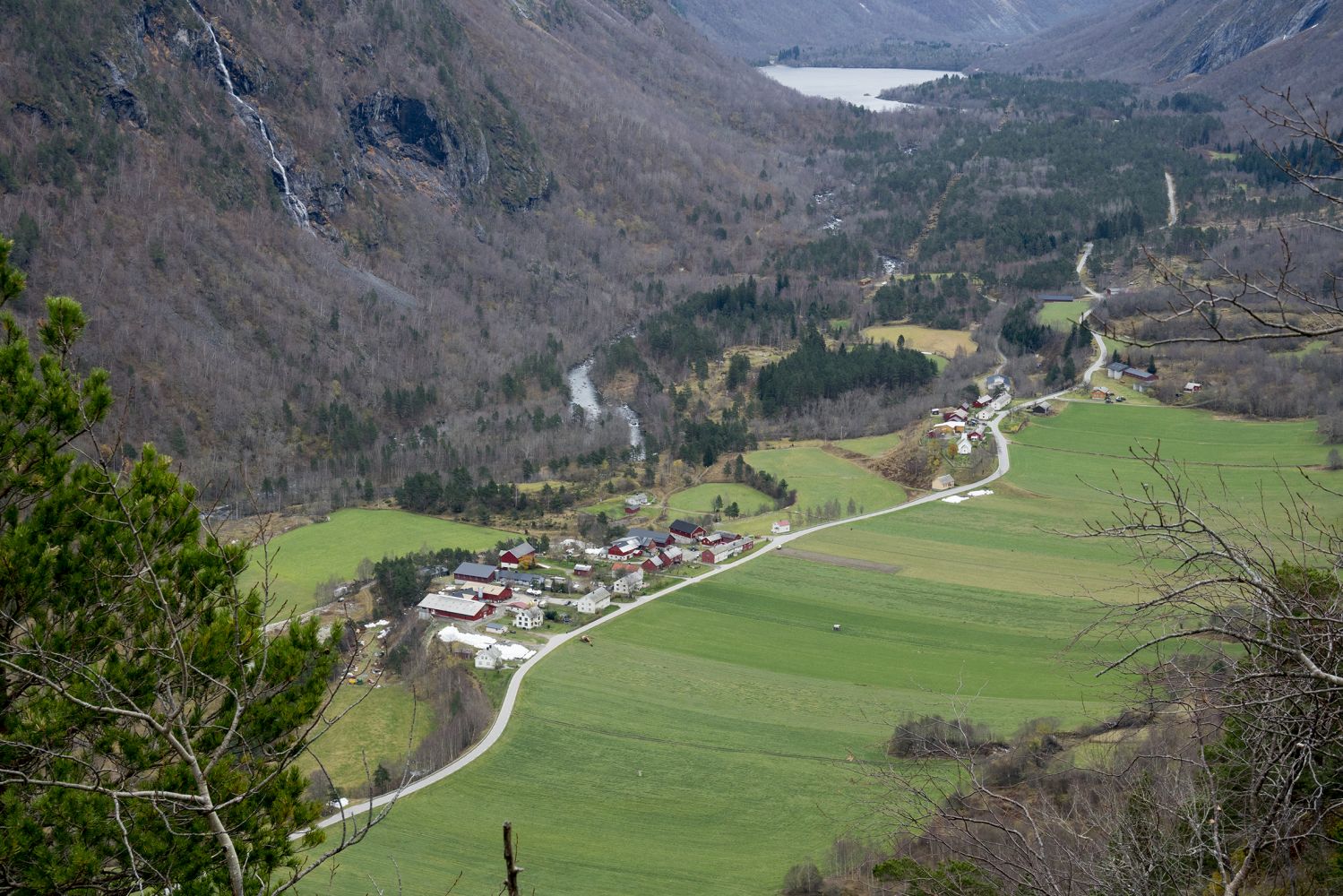
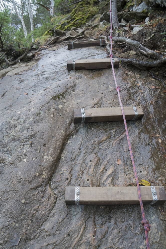
This is a relatively short trail that goes up to the height of about 390 metres above sea level. The trail offers a view both north towards Lake Eikesdalsvatnet and south of the village towards Utigard, Oppigard and Lake Litjvatnet. The trail partly goes through virgin forest and meanders between large boulders. The area is characterised by diverse birdlife.There are some steep sections along the trail. One of them has a rope which you can hold on to.
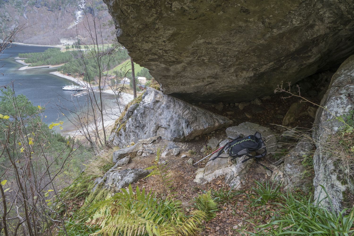
The trail starts from the toll road to the Mardalsfossen waterfall, past Kuhammaren. The distance to the starting point of the trail is about 600 metres if you follow the road towards Mardalen from the boom gate.Gaupåsen is an extension of the trail that was previously only marked up to Stortolla in Hamran. Blue-marked poles as well as rags tied to the trees will show you where the path goes. The trail starts in gentle terrain and drifts slightly south. After you have passed a steep hill, the path starts ascending slightly steeper. This is where you will walk past a large cave under a very big stone called Geitsteinen (“Goat Stone”) by the locals. From here, continue right up a steep hill where there is a rope that you can hold on to. After a while, the path flattens out slightly and drifts north. There is a small wet patch right under a bare rock slope. Soon after that, the path ascends steeply up and meanders through a slightly more open forest terrain with birch, aspen and pine trees. There are also some very large and impressive boulders here. The final section of the trail goes through a slightly flatter terrain southwards. Among other things you will walk past a section of muddy terrain where you might spot a deer. You will soon find yourself standing in front of the trail postbox with a view of Eikesdalen. The trail has historically been a sheep track used for early summer pasturing, before the animals was driven higher up the mountains towards Sandgrovbotnen. The trail is called Geitsteinstien. There are some maps where the trail is shown as a dotted line that crosses the Gjølbekken stream, follows the hill south all the way to the hiking trail up Rabben to Sandgrovbotnen.Once you reach the trail postbox, it is also possible to experience a steeper terrain if you walk up the hill towards the top of Mount Geitsida and Lake Mardalstjønna.
To get to Eikedal, follow National Road 660 (Rv660) to Eresfjord, then County Road 191 (Fv191) through the village and further along Lake Eikesdalsvatnet until you reach Eikesdal. You can eat or have a drink at Vertshuset Eikesdal when it is open.
You can park your car in front of the community house in Eikesdal, near the boom gate to Mardalsvegen Road (Mardalsfossen), so that you can walk along the toll road for 600 metres to the starting point of the trail. Alternatively, you can pay a toll fee (30 NOK) and park your car after 600 metres. There are parking spaces for some of cars there.
Duration
1 t. 40 min.

Norge map series 10078 Sunndalsøra
 Driving directions
 Route data
GeoJSON
Route data
GeoJSON