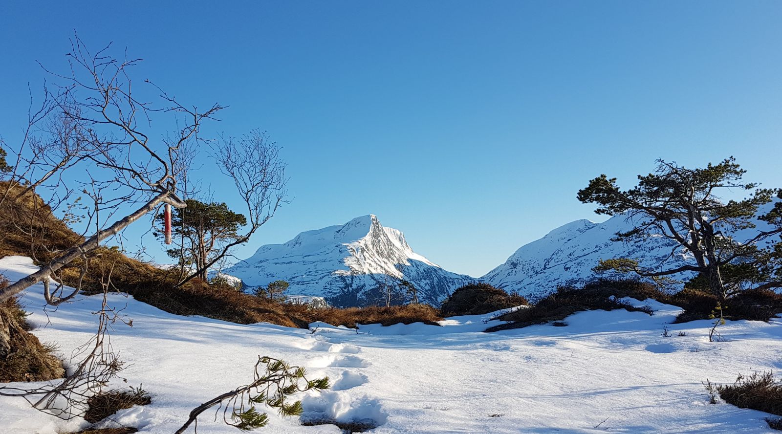
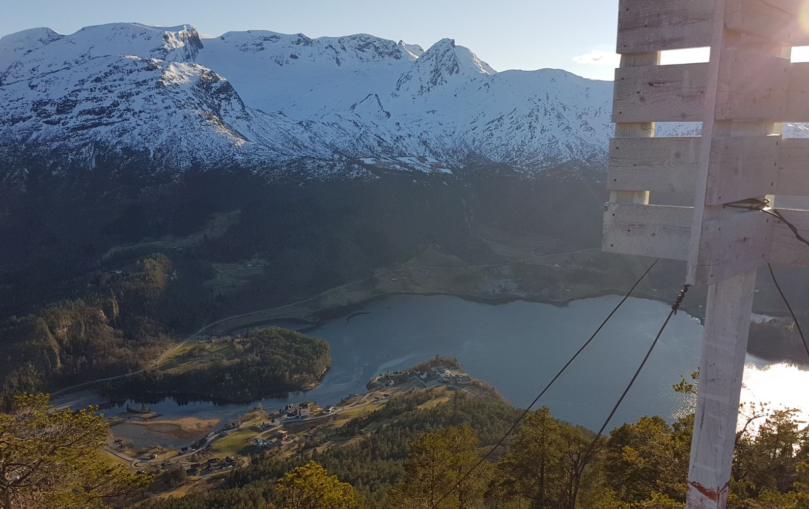
This trail follows a good quality path through a beautiful pine forest. There are great viewing points along the way and an amazing view from the top down, with Fyrde and Voldsfjorden within your line of sight. Fyrdsheida is also a nice spot to watch the sunset.
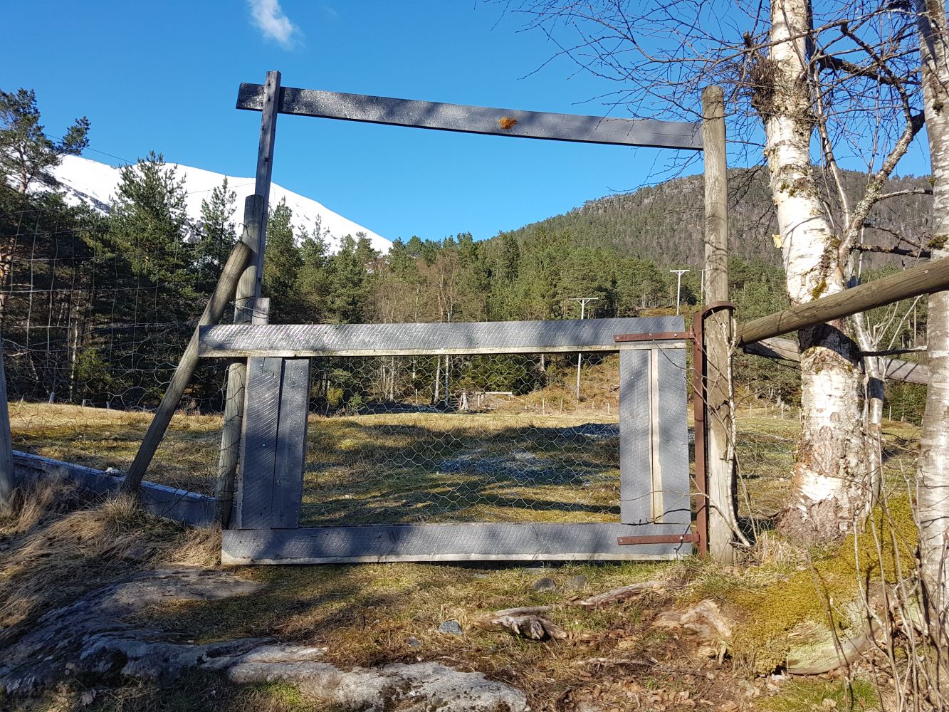
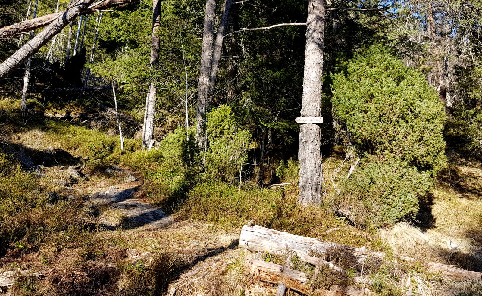
Start walking from the car park next to the Austefjord school. Cross over the road and follow a narrow gravel road past a couple of houses/cabins. It is signposted to Lisjedalen. Walk through the gate at the end of the gravel road, then over a field and through another gate. Please remember to close all the gates behind you! You will now reach a path that you need to follow further uphill. At (N62° 04.144’ E6° 19.608') 200 m a.s.l., you will come across the path that runs from the residential area in Fyrde. You will see a signpost for Lisjedalen. Turn off the path and walk up to Fyrdsheida at the height of 400 meters, just after the Sprengebakken viewing point. The place where you are supposed to turn off is marked with a stick. Follow the marked path up to the top. The trail is marked with sticks and several signs all the way from the start. There are some wet sections along the way, as well as rocky surfaces and tree roots covering the path, so we recommend wearing good hiking shoes. If you walk straight ahead instead of turning to Fyrdsheida, you will come up to Litledalssætra.

| Surface type | Distance |
|---|---|
| Grus | 0,18 |
| Sti | 5 |