Fagerfjellet is the second highest mountain in Averøy reaching up to 634 metres above the sea level. The trail described here goes through Mount Gulltanna (591 m a.s.l.) which is one of the most popular tourist destinations in Averøy. A nice well defined path takes you all the way up to the top where you will be offered a fantastic view in all directions. The final part of the trail from Gulltanna to Fagerfjellet gives you a great feeling of being high up in the mountains and the enjoyment of nice and gentle terrain.
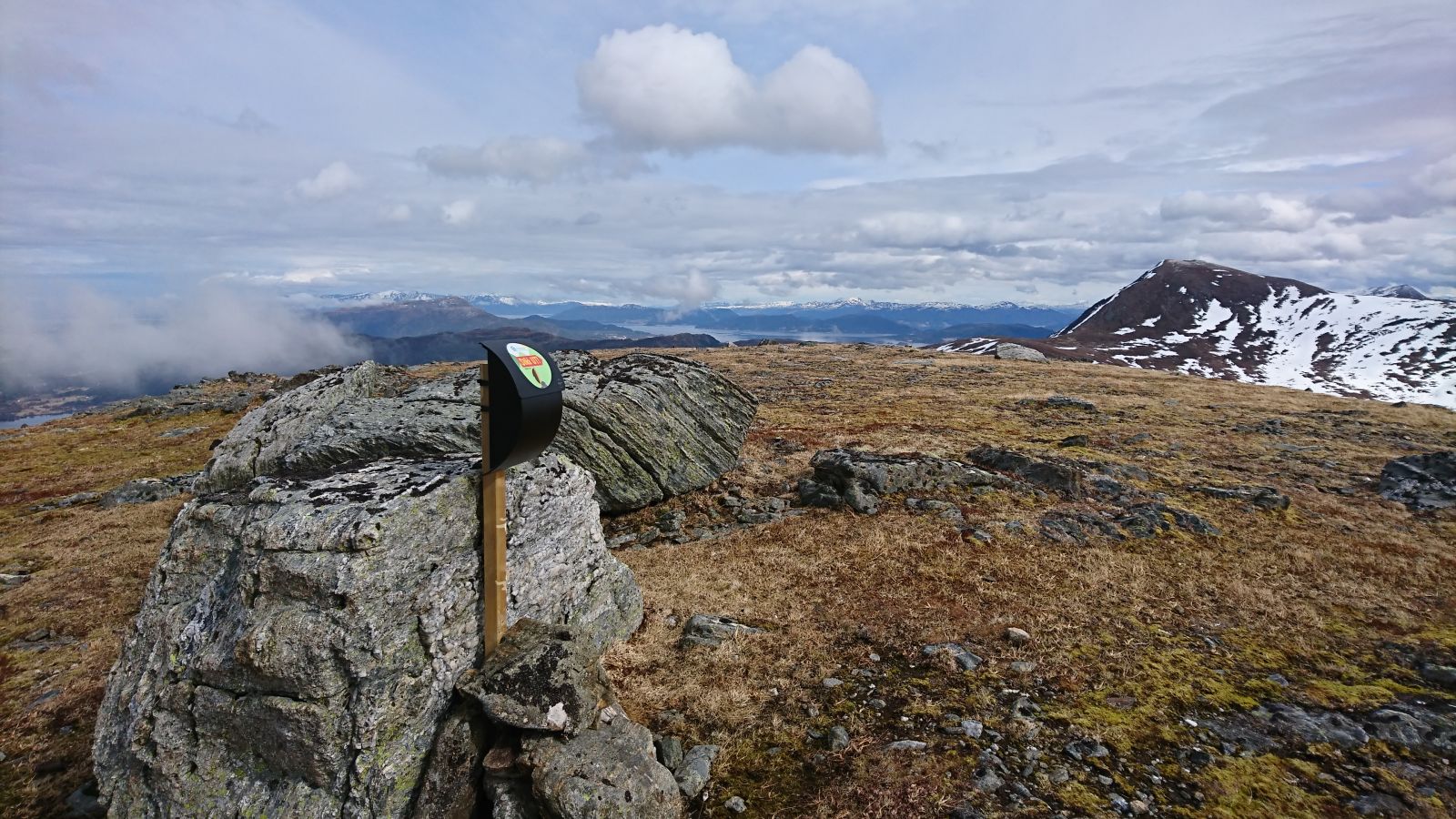
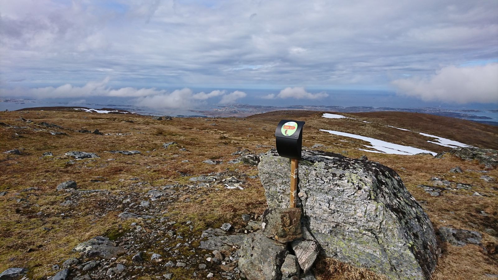
Trail description with the starting point at the car park next to the Follandskaret / Kornstadkleiva road. The length of the trail is measured from that point. You can also start walking from the Folland stadium and follow the way up to Kornstadkleiva for 2.1 km.The path starts at a small car park with a sign for Gulltanna. From here on you can see the ridge you are going to walk up, but not the top of Gulltanna. The path is very well defined throughout the whole trip. There are no sections along the path where you could turn off and walk in the wrong direction.The first part of the trail goes across the marsh. During the most rainy periods of the year it can get a bit damp here. Use the planked footway to avoid getting wet. The path passes through a dark spruce forest, then goes into a broad-leaf forest and finally takes you up above the tree line.Once above the tree line, the path swings up towards Ramsdalsaksla and then goes further in the direction of Gulltanna. Take a moment to enjoy a 360-degree view from up here. The trail postbox at the top is set up by the Kårvåg sports association.Starting from Gulltanna, the trail to Meekknoken coincides with the trail to Fagerfjellet (marked with StikkUT signs), then after about 500 m the path divides into two, and the one to Fagerfjellet follows a ridge stretching along some old mines. Fagerfjellet is a broad massif, and the StikkUT-postbox is attached to some large stones in the central part of the mountain. There is no defined path in the final part of the trail closer to the trail postbox.
Trail description from Follandsskaret.
Regardless of whether you are coming from Eide or Kristiansund: Drive along County Road 64 (FV 64) to Kårvåg. From there on follow County Road 249 (FV249) up the Follandsdalen valley. If you are coming from Eide and the Atlantic Road, the turn to FV249 will be on your right side heading to the mountain. If you are coming from Kristiansund and Bruhagen, the turn will be on your left side heading to the mountain. Follow the asphalt road all the way into the valley and take the turn in the direction of Follandskare and up to Kornstadkleiva.
Parking by the Folland stadium near lake Follandsvatnet. Free parking. From this point on there is a good 2.1-km long gravel road running up to Follandsskaret. It is also possible to follow the path through the forest.
Parking along Follandsskaret / Kornstadkleiva. Follow the way up from Follandsvatnet lake for 2.1 km. No parking fee applies.
Duration
3 t. 5 min.

| Surface type |
Distance |
| Sti |
3,3 |
Bus connection to Kårvåg, Averøy. Please see
http://www.177.no. You have to walk or cycle from Kårvåg to Follandsvatnet lake and then further up Follandsskaret. It is about seven kilometres from Kårvåg to Follandsvatnet.
Gulltanna lies at the heart of a mountain area located centrally in Averøy municipality. It is a bare mountain area extending to around 400 metres. The area is characterised by foothills and valleys stretching over its northern part, while the southern part is gradually (and partly steeply) ascending towards the fjord.
Tree range is quite diverse and includes forest plantations, mixed forest and downy birch forest. Both in winter and summer the area is the most visited tourist destination in Averøy municipality. There is an extensive network of ski trails and snowmobiles are driven here in winter.
Lake Follandsvatnet is considered to be a part of this mountain area. Both Follandsvatnet and Taraldsvatnet offer fishing opportunities.
There are old mining facilities in Dyrsetlia and Vassdalen on the way to Fagerfjellet mountain. A number of summer farmhouses are located in the area. These cultural sights are outside of the ski trail to Gulltanna, but some of the mining facilities can be seen from the top of Gulltanna.
Gulltanna March: Arranged by the Kårvåg sports association every autumn. The march starts at the Folland stadium near lake Follandsvatnet. It usually takes place on the first weekend of September.
Trail description:
Olsen, Kai A. and Pedersen, Bjørnar S. (2008): Trail catalogue for Kristiansund and surrounding areas, p. 75 et seq.
Johansen, Håvard and Gaupset, Dina (2008): 101 trails in Outer Nordmøre, p. 210 et seq.
 Driving directions
 Route data
GeoJSON
Route data
GeoJSON