Norsk

Emblemsfjellet to Heiane

Ålesund

The trail at a glance

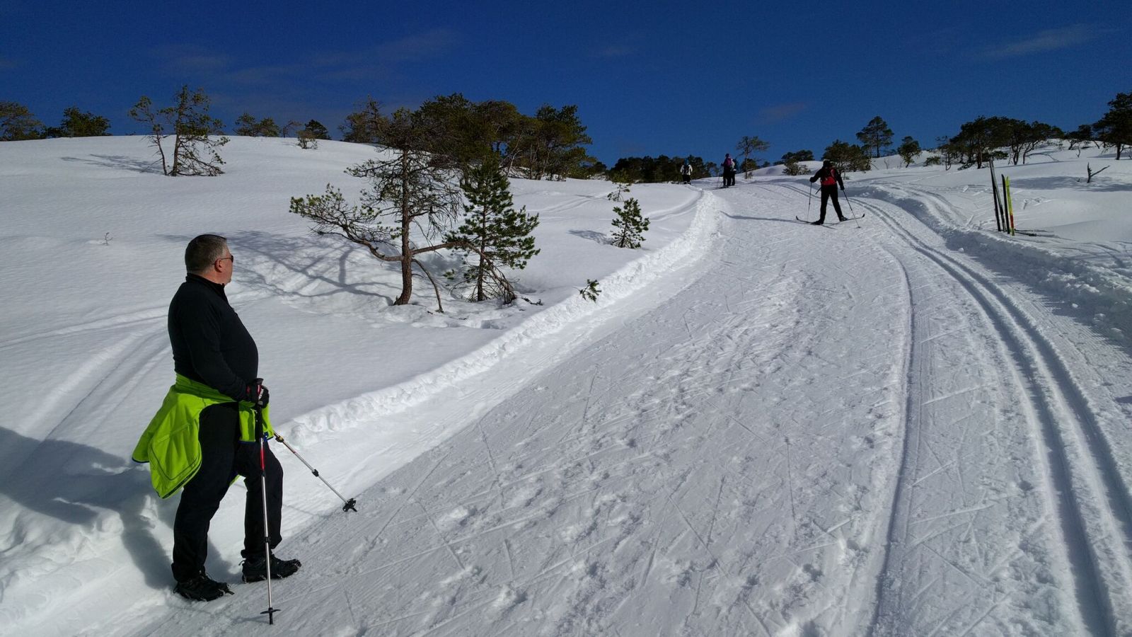
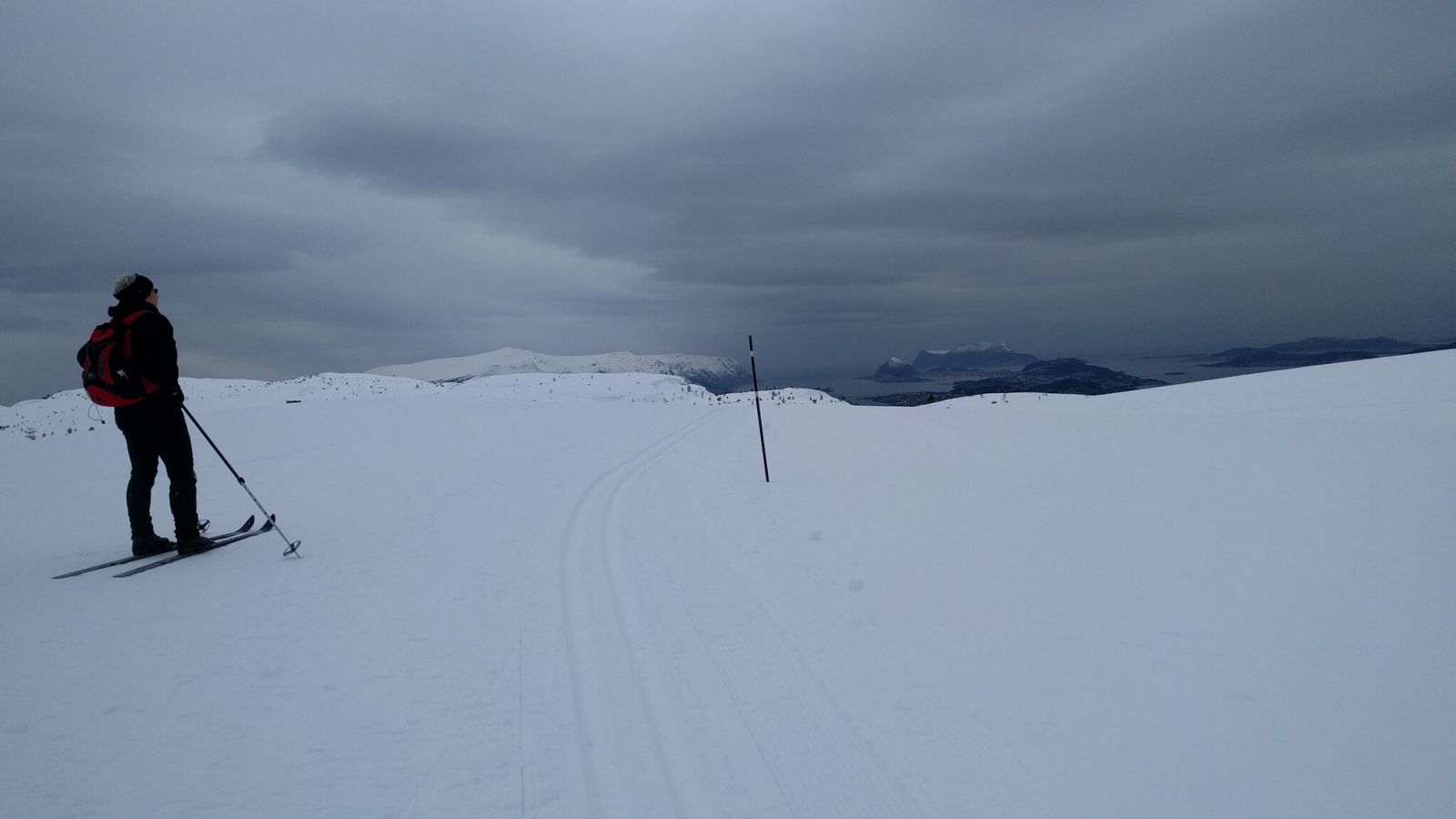
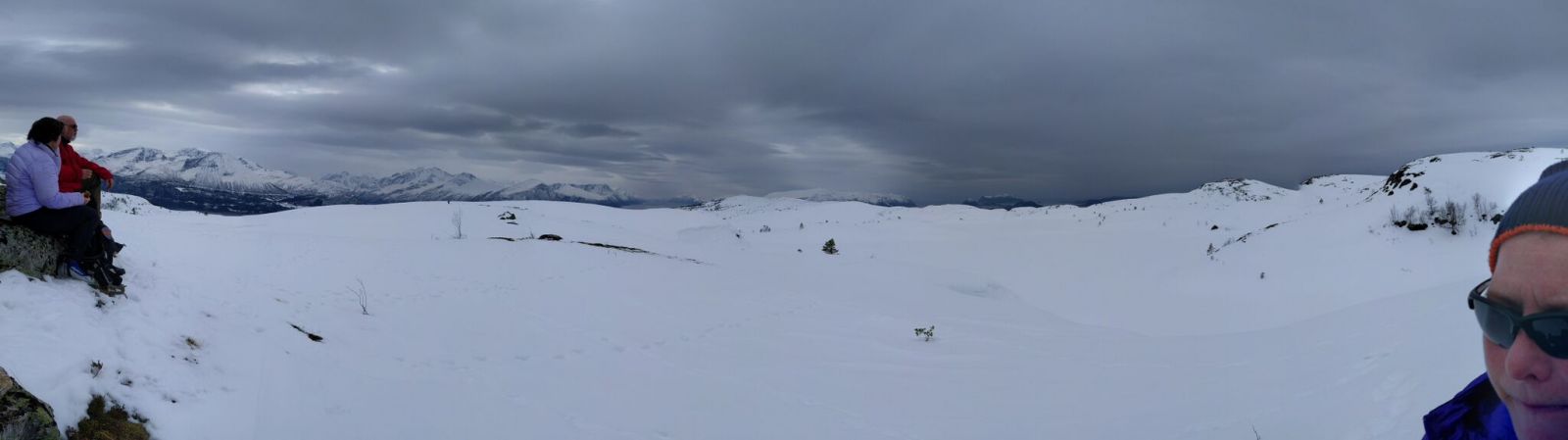
This scenic ski trip is quite special since it can only be done in snowy winters. 2016 was the year when the ski trails in Østrem (Emblem IL) and Spjelkavika (Spjelkavik IL) could be linked together. This relatively easy ski trip offers a spectacular view of fjords and mountains. Challenges may occur only on your return route either when you ski down the slopes Bigtonløypa and “Damenes Skrekk” (Eng. “The Ladies’ Fear”) or if you return to the top of the mountain lift and follow the alpine slope down to the car park. An easier option is to take the chair lift down to the starting point. The price of NOK 50 per person includes the return ticket. Please check when the chair lift stops running in the afternoon and calculate the time you need to return. The two sports clubs are doing an amazing job of grooming ski trails and maintaining the mountain area! https://turheisa.wordpress.com/ This is a loop trail over Mount Emblemsfjellet. The start and the endpoint are the same.

Route description

You will step right into the groomed ski trails when you go out of the chair lift at the top of Høgelia Hill. If you turn right (west), you will end up on the alpine slope that will take you down to the car park.To continue into the mountain area, you need to turn left (east). -------- Cross-country skis are okay for those who will follow this groomed ski trail. However, if you are going to take a detour to, for instance, Høgkubben or Geitnausa, we recommend using alpine skis with steel edges. Skiing downhill will also be easier on skis that have steel edges since the surface can become somewhat hard during the afternoon and evening.-------- There are no intersections of paths on this route with one exception. After about 3.8 kilometres, you will come to a hairpin bend with a ski trail that runs northeast. If you follow this trail, it will take you north towards Geitnausa Hill and the Bigtonløypa trail. Continue moving east for one more kilometre and go up to the mountain area of Heiane. Once you are up on Heiane, you can take a well-deserved break. You will get a fantastic view from here that is only blocked by Geitnausa Hill in the northwest. The section up and down from Heiane is the steepest part of the trail. As you return, follow the same ski track back for the first kilometre until you reach the intersection. This time, turn right and move north following a well-marked ski trail. This trail runs around Lake Høgstølvatnet. After about 1200 metres, you will reach a sign that points to Geitnausa and Bigtonhytta. These waymarks belong to bare ground trails. You are now standing on top of the Bigtonløypa trail, and there are only downhill slopes left for almost the entire way back to the car park, with the exception of two marshy areas. The ski trail is wide and well-maintained, and there are no downhill sections that are more than 11 degrees steep. Note: the entire trail, including the mountain lift, is 11.2 km long. The ski trail itself is 10.2 km long.  

Access and parking

This trail starts at the mountain lift in Spjelkavika. It is saved as a waypoint in the GPX-file. There is a large free car park at the starting point. No parking fee applies as of 2016, but the ticket to the mountain lift costs NOK 50 per person. Return trip included.
Skiing route
Red løype
Distance
11,19 km one way
Elevation
520 m
Duration
2 t. 55 min.
Sesong
Winter
Highest Point
431 masl
Mobile coverage
Unknown

Map route

Surface type Distance
Preparert med tråkkemaskin 11.2

Public transport

There is a bus connection to Spjelkavika. http://www.170mr.no http://www.nettbuss.no

Other

The route with prepared ski trails as described here might not be available every year. The entire ascent from the car park to Heiane is 412 altitude metres, but it is 150 altitude metres from the top of the ski lift.

Map

Ålesund in tourist map series by the Norwegian Mapping Authority No. 2535 and Sykkylven, Sheet 1219 IV in M711 map series

Link to route description

Spjelkavik Turheis på Facebook
Driving directions

API endpoints

Route data GeoJSON